
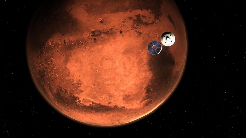
The Mars 2020 mission perseverance rovers, a NASA’s project computed to explore Mars in an additional attempt to investigate astrobiological signatures and prepare human for future exploration on the Planet. High resolution images were collected during the mission by coupling advance engineering, science, and landing imaging cameras in other to compile observations based on visible colour, multispectral, and stereo imaging system with analyses on multiple spatial scales on many targets. A total of twenty-three cameras were installed on different parts of the rovers based on the Mars Science Laboratory spacecraft launched in 2012. The spatial images produced are being processed and analysed based on the geomorphological interference at the edges of the crater on the landing site (Jezero crater). Several remote sensing images collected will be used to investigate the sedimentary characteristics and arrangement of rock layers of the landing site deposits and interpret probable changes at the old lake in Jezero crater.
LIFE ON MARS
Tools used
Remote SensingResearch
Plug-ins used
Remote Sensing
tags
#LifeOnMars#PlanetaryRemoteSensing#RemoteSensing
More by Temidayo Fabiyi

You might also like


Join the community!
We're a place where geospatial professionals showcase their works and discover opportunities.