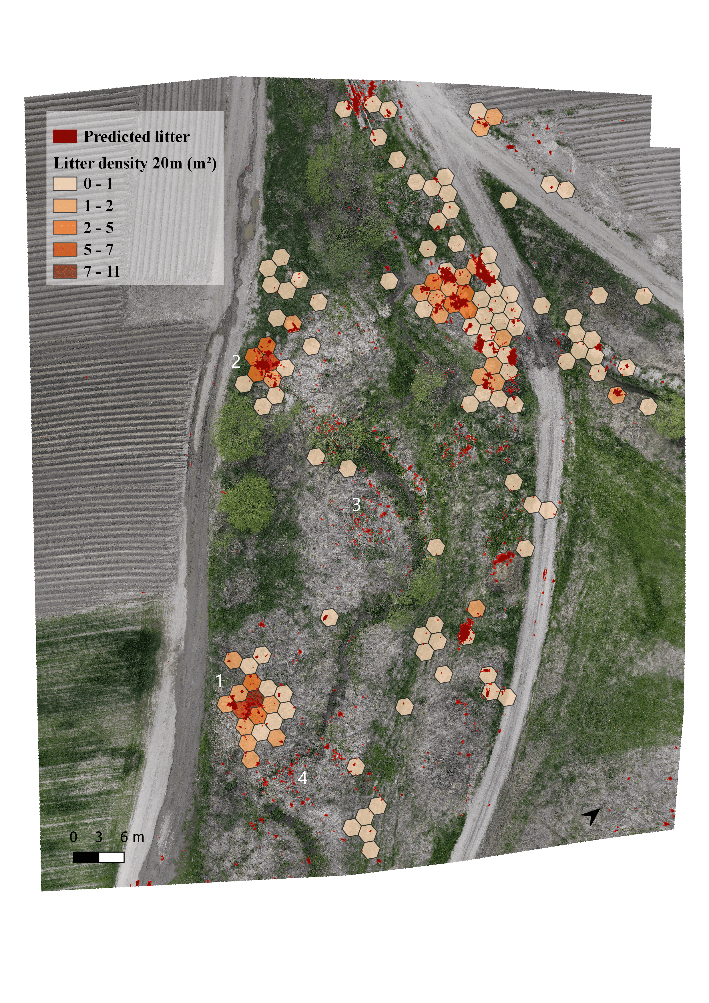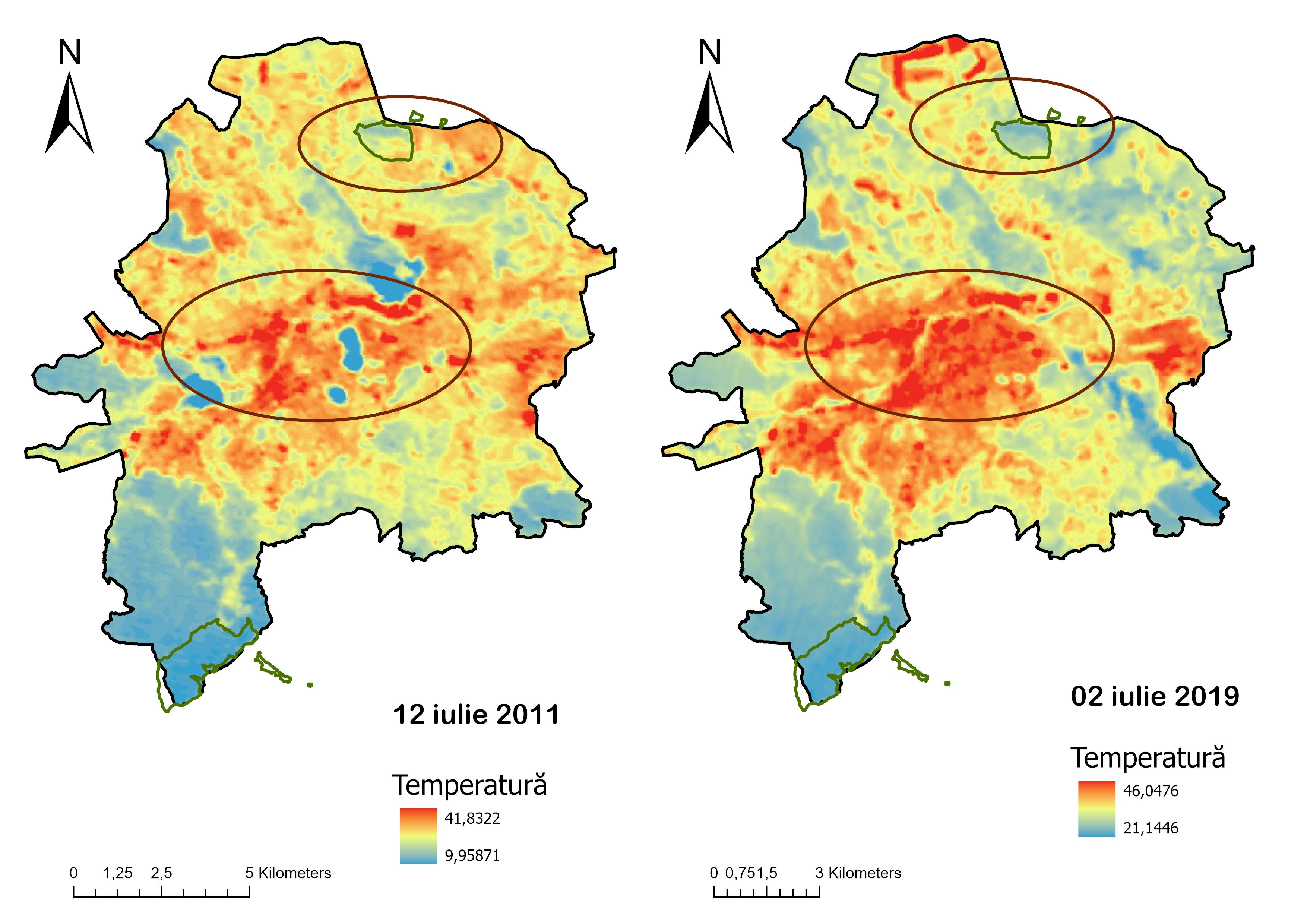
Urbanization effects on Natura2000 lands
For this project I've used satellite imagery (Landsat 5, Landsat 7, Landsat 8, Google Earth imagery) to identify any change in NDVI, NDBI and I've also compared the surface temperature (from the thermal band of satellite imagery) between 2007 and 2020.