Sign up or log in to your Spatialnode account.

Takes less than a few seconds.

Study Area Map - illegal rubbish dumping

Katalin Peter
Katalin Peter•

May 09, 2023

Study Area Map - illegal rubbish dumping

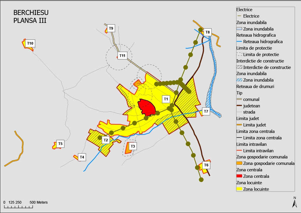
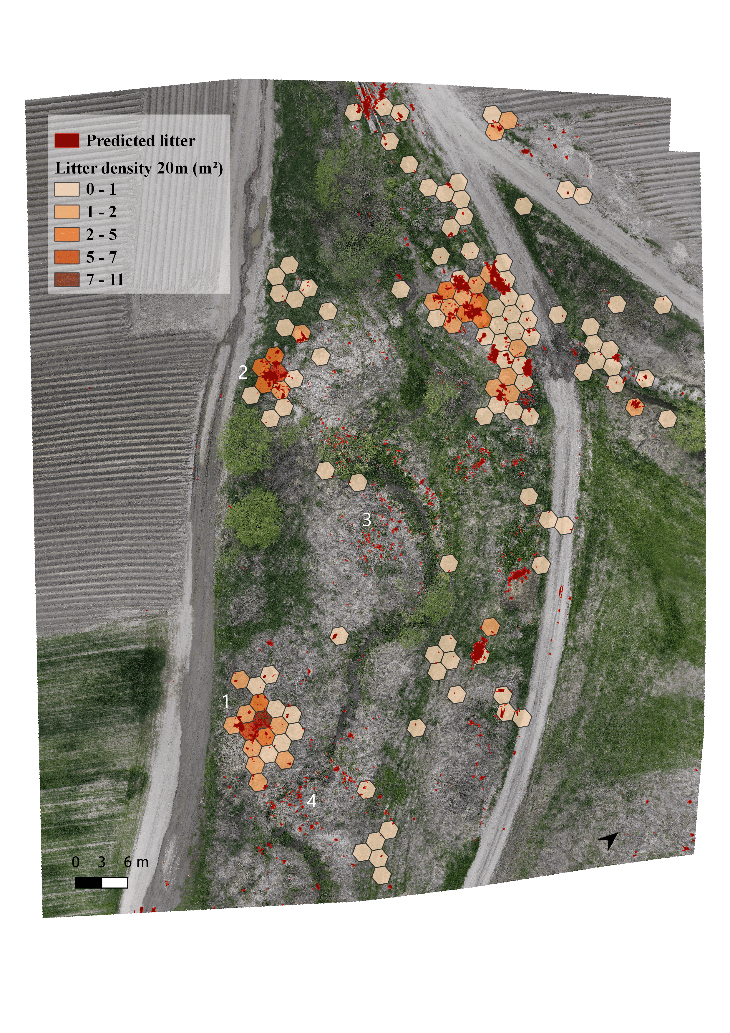
This map is one of my study areas for my dissertation. The aim of my study was to identify illegal rubbish dumpings with UAVs at different flight heights.


Tools used

AgisoftArcGIS ProQGIS

Plug-ins used

-

tags

ArcGIS ProlitterOrtofotoUAV

More by Katalin Peter

Ski slope suitability model
23
Travelling under social influence
24
Density map of illegal waste dump
13
Urban plan of Berchiesu
21
Favorability map for new constructions
8
Human - bear conflicts, Harghita county
8
Land surface temperature
14
Flood hazard map
Flood hazard map
9

You might also like

MAP OF FARM OVERLAID ON CLASSIFIED IMAGE
Edidiong Ekrikpo
MAP OF FARM OVERLAID ON CLASSIFIED IMAGE
Edidiong Ekrikpo
6
Dashboard de Vendas
Henrique Pinheiro de Souza
Dashboard de Vendas
Henrique Pinheiro...
43
Redistricting Plan 2-Collin County
Richard Wierengo
Redistricting Plan 2-Collin County
Richard Wierengo
16
Colorado County Population
Adam O Dolce
Colorado County Population
Adam O Dolce
74
Visualizing Watersheds
Jamaica De Luna
Visualizing Watersheds
Jamaica De LunaPro
15
Digital Elevation Model : Mountain
Noel Png
Digital Elevation Model : Mountain
Noel Png
44
MAPA DE LOCALIZAÇÃO MONTE AZUL-MG
Fenando Paulo Neto Alberto
MAPA DE LOCALIZAÇÃO MONTE AZUL-MG
Fenando Paulo...
495
(Field Work) Insti Maps for Libmanan LGU
Juan Carlos Gabriel Zacarias
(Field Work) Insti Maps for Libmanan LGU
Juan Carlos...
14
DIVISÃO POLITCA DO ZAÍRE
Raduel Fernando da Fonseca
DIVISÃO POLITCA DO ZAÍRE
Raduel Fernando...
25
Manhattan Storm Surges
Ria Rathod
Manhattan Storm Surges
Ria Rathod
11
AGOL - GIS Request Management Solution
Jeffrey Erwin
AGOL - GIS Request Management Solution
Jeffrey Erwin
8
POPULAÇÃO NEGRA E PARDA NO PARANÁ (2010)
Itamar Sateles de Sá
POPULAÇÃO NEGRA E PARDA NO PARANÁ (2010)
Itamar Sateles...
283

Join the community!

We're a place where geospatial professionals showcase their works and discover opportunities.

Sign Up for free