
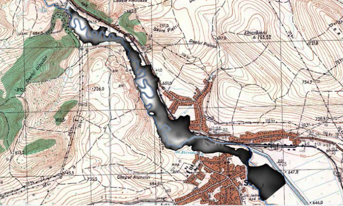
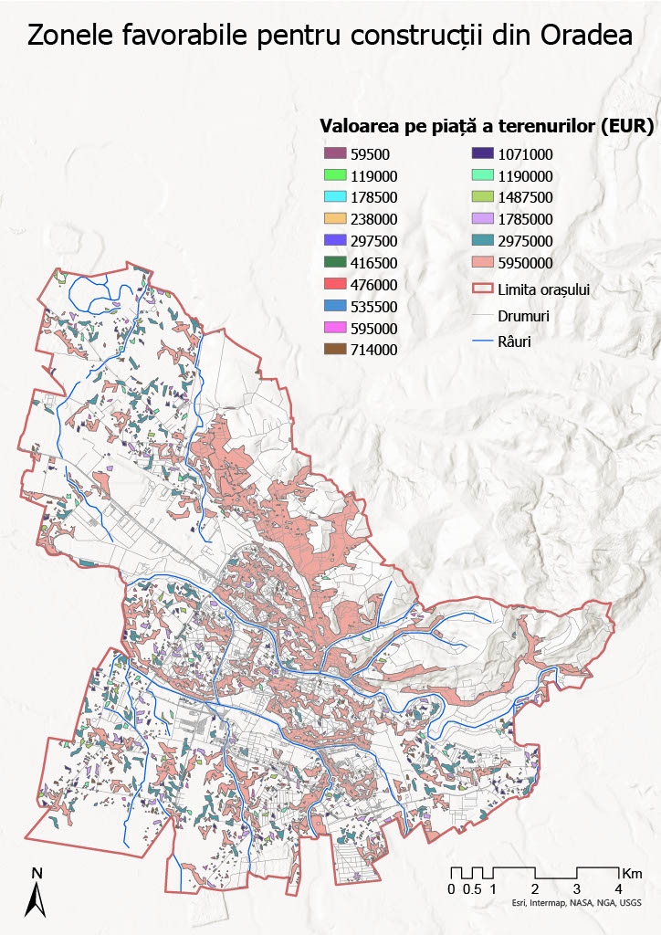
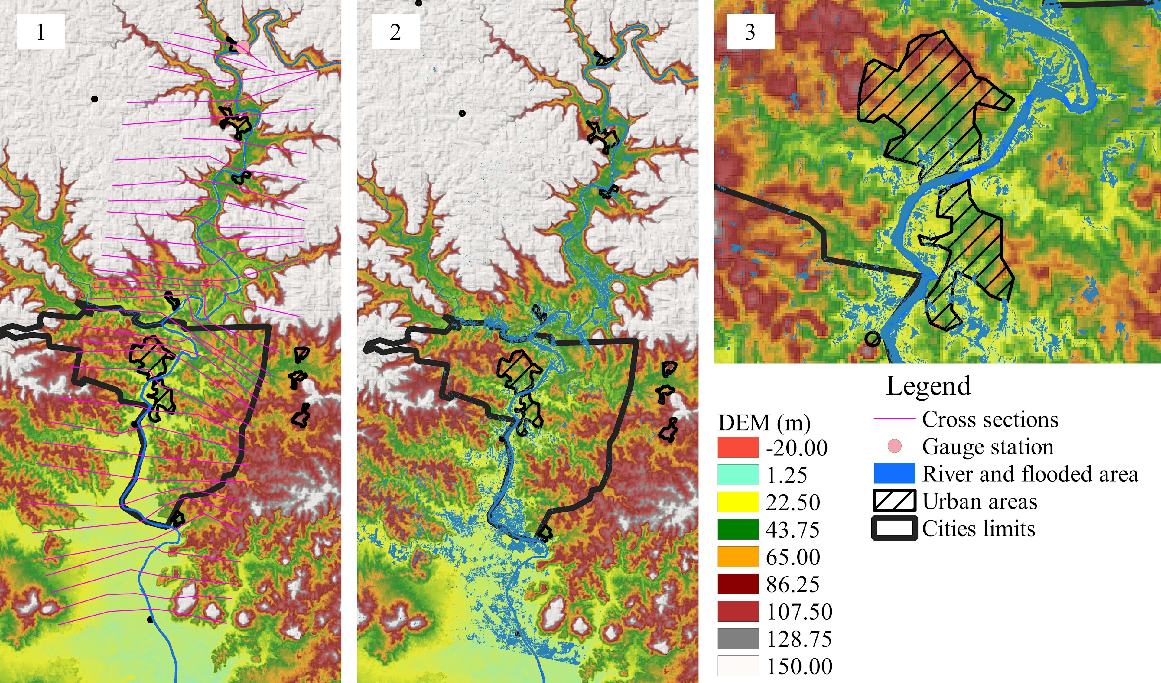
For flood hazard map I've used DEM of the area.
Flood hazard map
Tools used
ArcMapHEC RAS
Plug-ins used
Contour LinesHEC geo RAS
tags
contourDEMFlood Hazardflood risk
More by Katalin Peter


You might also like


.svg "Keran Nkongolo")

Join the community!
We're a place where geospatial professionals showcase their works and discover opportunities.