Sign up or log in to your Spatialnode account.

Takes less than a few seconds.

Urban plan of Berchiesu

Katalin Peter
Katalin Peter•

May 10, 2023

Urban plan of Berchiesu

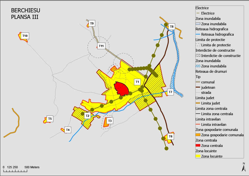
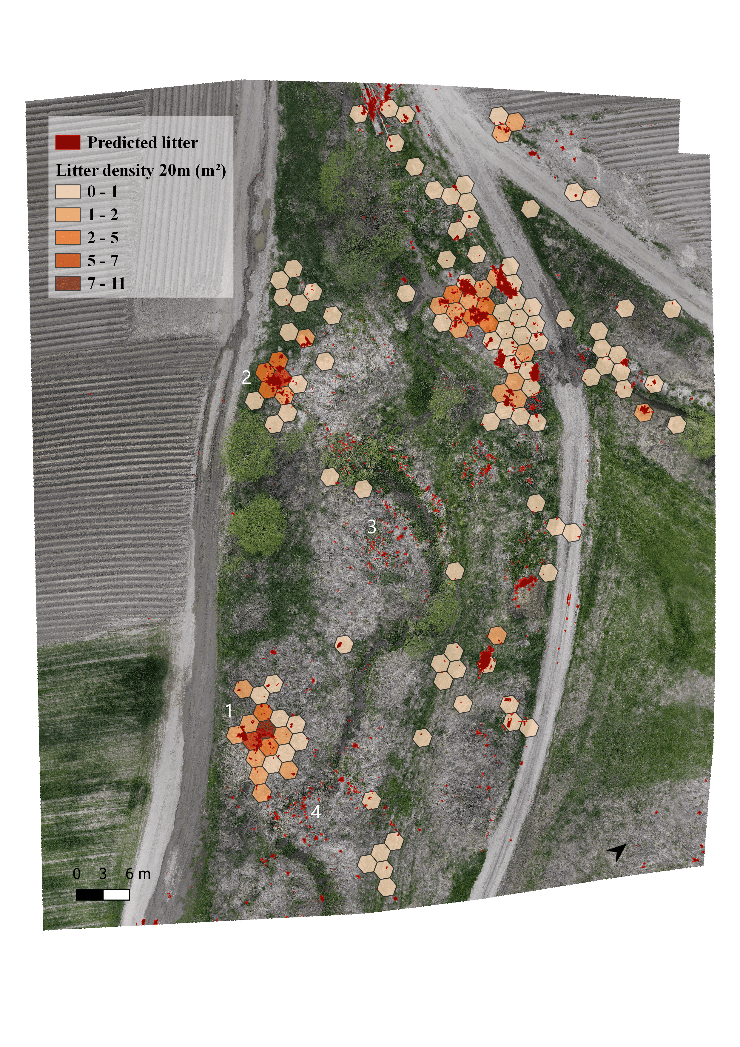
Urban plan of a village, Berchiesu from Cluj, Romania

Demo

Tools used

ArcGIS OnlineArcGIS ProArcMap

Plug-ins used

ArcGIS Online

tags

ArcGIS Onlinedigitising urban planning

More by Katalin Peter

Flood hazard map
Flood hazard map
10
Ski slope suitability model
25
Density map of illegal waste dump
14
Land surface temperature
16
Human - bear conflicts, Harghita county
9
Study Area Map - illegal rubbish dumping
5
Favorability map for new constructions
9
Travelling under social influence
28

You might also like

USO E OCUPAÇÃO DO SOLO
Edvaldo Alves Neto
USO E OCUPAÇÃO DO SOLO
Edvaldo Alves Neto
11
CAR - Cadastro Ambiental Rural
Mauricio Matheus
CAR - Cadastro Ambiental Rural
Mauricio Matheus
37
Planning a GNSS CORS Network for KRI
Peshawa Salih
Planning a GNSS CORS Network for KRI
Peshawa Salih
3
Sazonalidade da Colheita Florestal
Marina Martins de Almeida
Sazonalidade da Colheita Florestal
Marina Martins...
20
Investigate 2021 Fire Season in Tunisia
Moez Labiadh
Investigate 2021 Fire Season in Tunisia
Moez Labiadh
443
Mapa Planimétrico
José Luiz Anjos
Mapa Planimétrico
José Luiz Anjos
144
USO E OCUPAÇÃO DO SOLO
Mapa_Geo
USO E OCUPAÇÃO DO SOLO
Mapa_Geo
61
Mapa de Fluxo de Escoamento Superficial
Luiz Gustavo De Góes Sterle
Mapa de Fluxo de Escoamento Superficial
Luiz Gustavo...
81
Área da Intervenção Pinheiros
Matheus Amaral Prates
Área da Intervenção Pinheiros
Matheus Amaral Prates
7
Shaded relief map of Northeastern Nigeria
Balogun Temitope
Shaded relief map of Northeastern Nigeria
Balogun Temitope
436
West-East Run Curaçao, 2021
Menno ter Bals
West-East Run Curaçao, 2021
Menno ter Bals
6
Montana Impaired Rivers
Keran Nkongolo
Montana Impaired Rivers
Keran NkongoloPro
11

Join the community!

We're a place where geospatial professionals showcase their works and discover opportunities.

Sign Up for free