
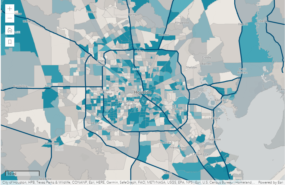
This app shows evacuation routes and demographic data by census tract for Houston, Texas. The darker blue tracts have a higher percentage of households without a vehicle. This pattern helps answer the question: Where in Houston should we provide evacuation assistance during a hurricane?
Use the Layers and Legend tools to learn more about the data shown in the map. Click individual census tracts to see pop-up information, including the percentage of households without a vehicle.
The map in this app contains a Living Atlas layer of Houston evacuation routes and a layer of Houston demographic data. The demographic layer is styled using an Arcade expression that calculates the percentage of households without a vehicle. This information is also provided in pop-ups.


_page-0001.jpg&w=3840&q=100)


")


.svg "Corrine Coakley")

