Sign up or log in to your Spatialnode account.

Takes less than a few seconds.

LANDSAT8 Latest Imagery Auto Updated

Karion Mohamad
Karion Mohamad•

January 14, 2022

LANDSAT8 Latest Imagery Auto Updated

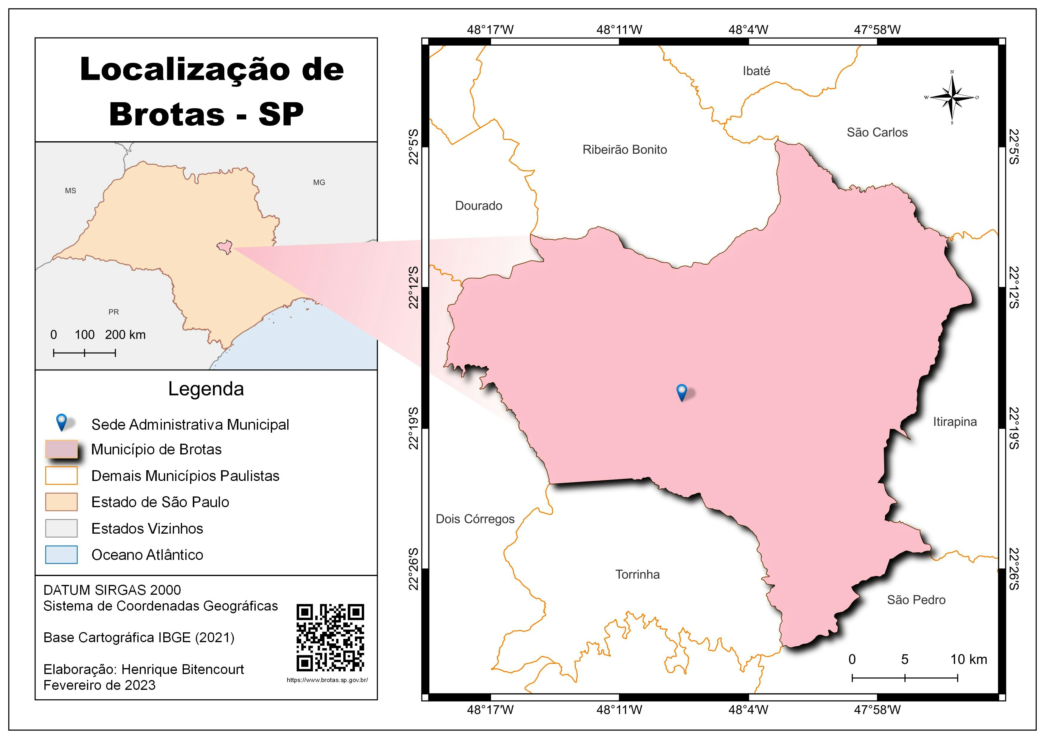
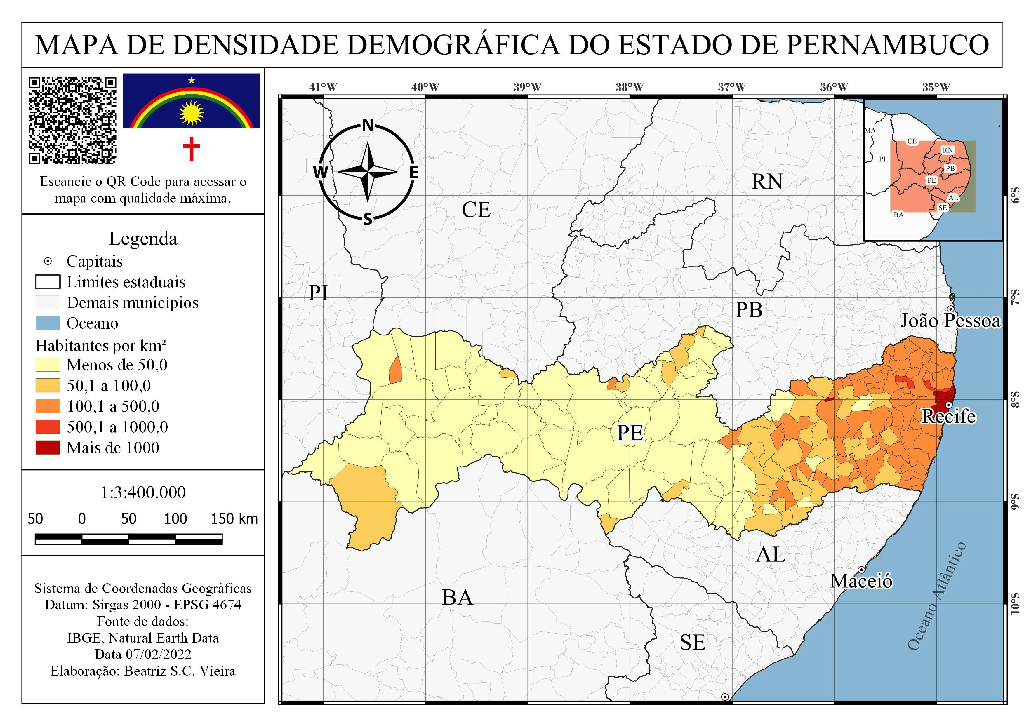
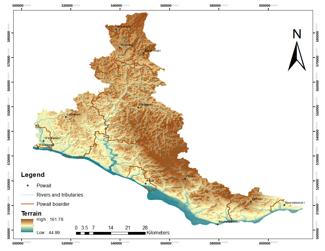
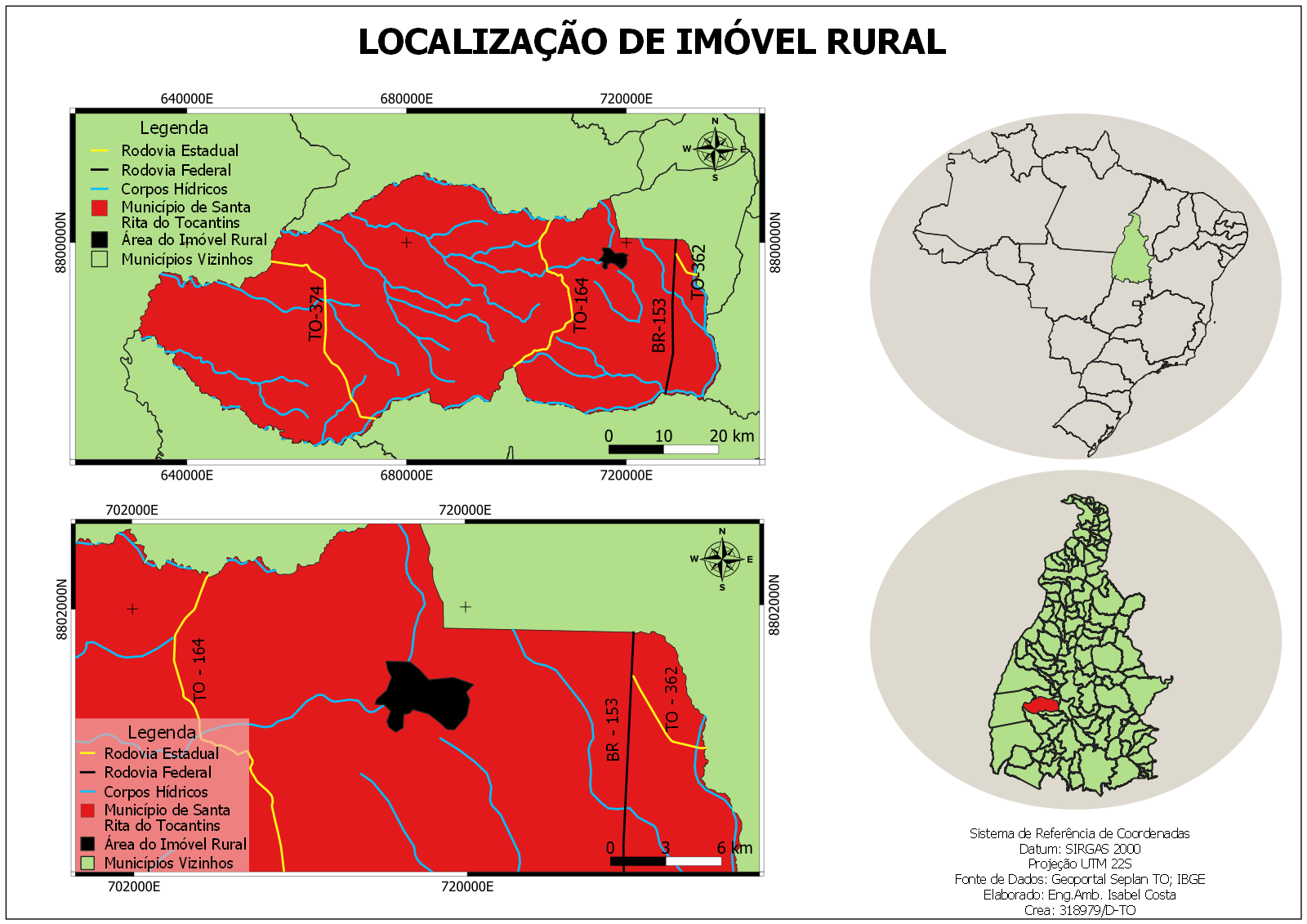
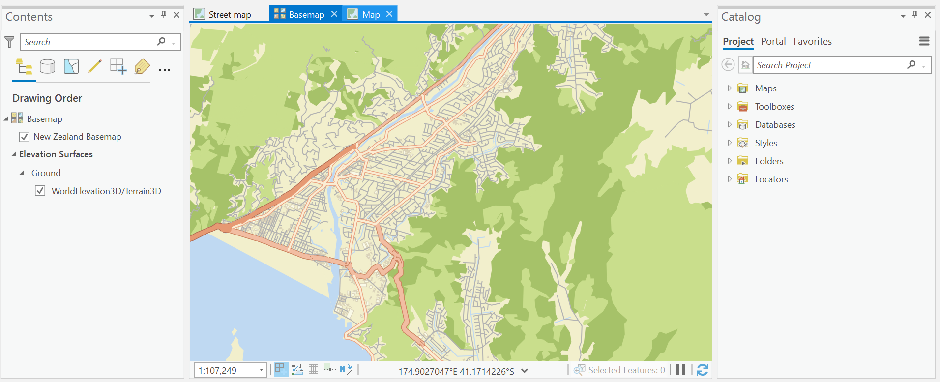
Can Be Found In INPUT apk Under the Name of (LANDSAT)

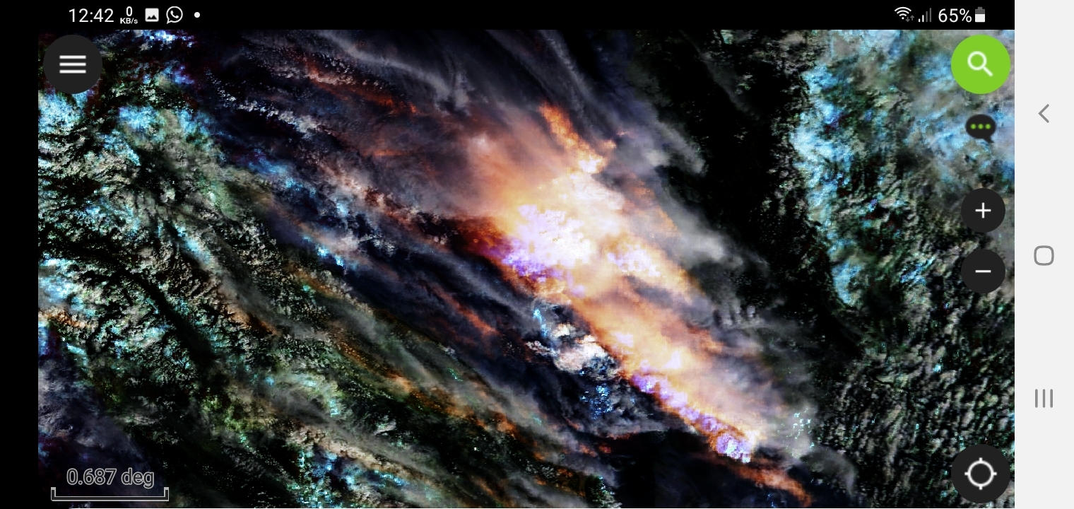
Other projects exist related to (EUMETSAT)(NASA)(NOAA-20)(DESERT2)
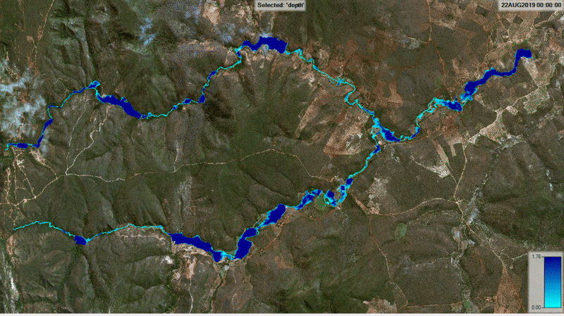


More by Karion Mohamad

EUMETSAT Imagery Updated Every Few Min
257
Modis-Terra With Sentinel3 Satellite
246
SENTINEL2 Satellite AutoUpdate To Recent
5
LANDSAT8 SATELLITE MOST RECENT IMAGERY.
7

You might also like

MN River Flood MitigationforSt.Peter,MN
Dane Lewandowski
MN River Flood MitigationforSt.Peter,MN
Dane Lewandowski
13
Europe Distribution of Forest Land Cover
Krzysztof Boguski
Europe Distribution of Forest Land Cover
Krzysztof Boguski
374
Predicting Sheep Resource Selection
Ryan Shields
Predicting Sheep Resource Selection
Ryan Shields
64
Rio 2016 - Real Estate Market Heat Map
Alexandre Dargains Auricchio de Oliveira
Rio 2016 - Real Estate Market Heat Map
Alexandre Dargains...
316
DEM Data for Virginia farm
Cari Lynn Squibb
DEM Data for Virginia farm
Cari Lynn Squibb
40
Proximity Analysis
Jesse Kato
Proximity Analysis
Jesse Kato
37
Center of Dumai
Muhammad Rifqy
Center of Dumai
Muhammad Rifqy
191
3D Greater Hartford, Connecticut, USA
Ryan O'Neil
3D Greater Hartford, Connecticut, USA
Ryan O'Neil
159
Population of South America - 4000 years
Sebastian Silva
Population of South America - 4000 years
Sebastian Silva
130
Polygyny rate by state in Nigeria.
Bamidele Daniel Ohinoyi
Polygyny rate by state in Nigeria.
Bamidele Daniel Ohinoyi
200
Greek Ombudsman Published Maps
Konstantinos Gouzias
Greek Ombudsman Published Maps
Konstantinos Gouzias
19
Precipitação de Junho do Recife-PE
Carlos Alberto
Precipitação de Junho do Recife-PE
Carlos Alberto
30

Join the community!

We're a place where geospatial professionals showcase their works and discover opportunities.

Sign Up for free