
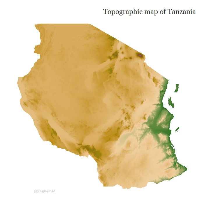
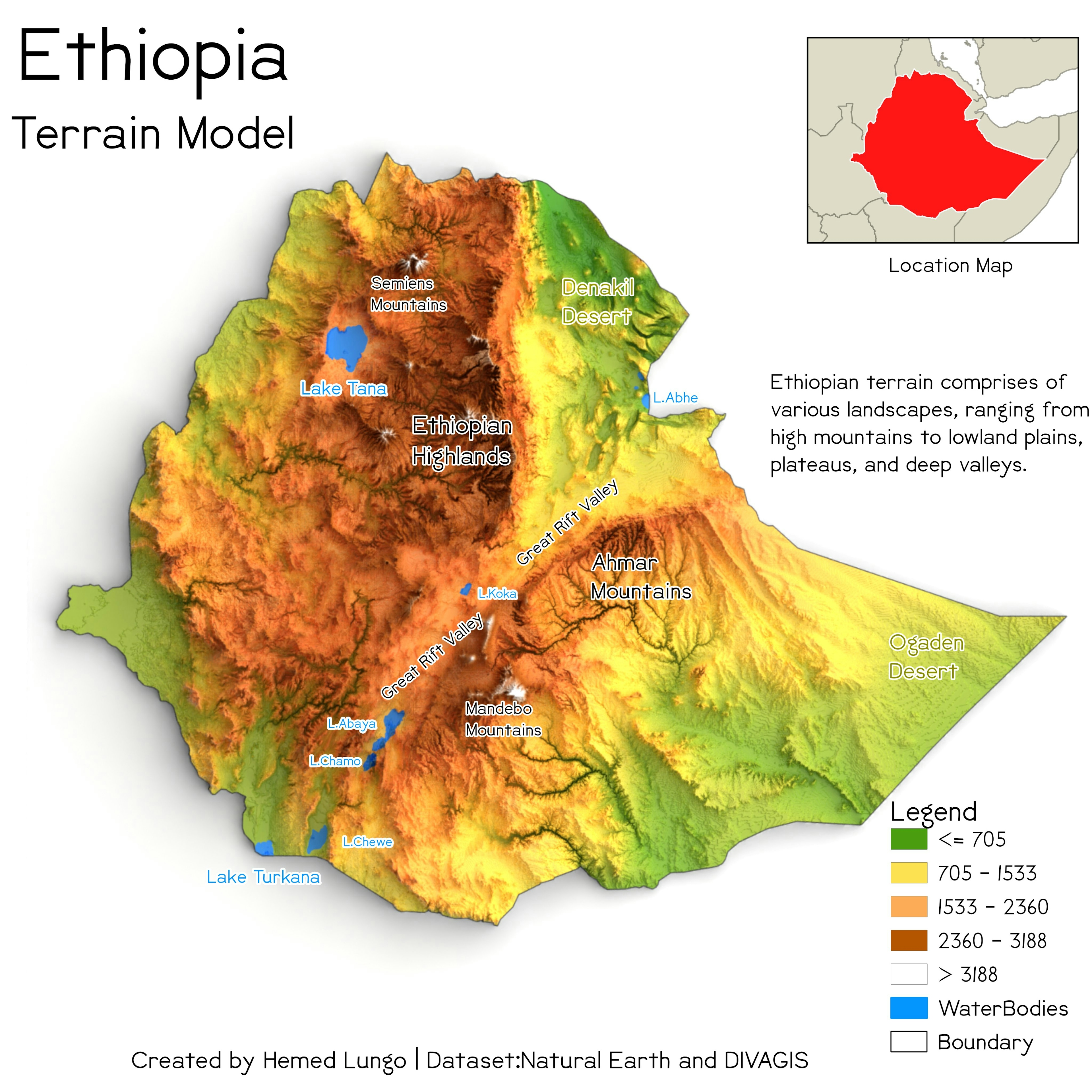
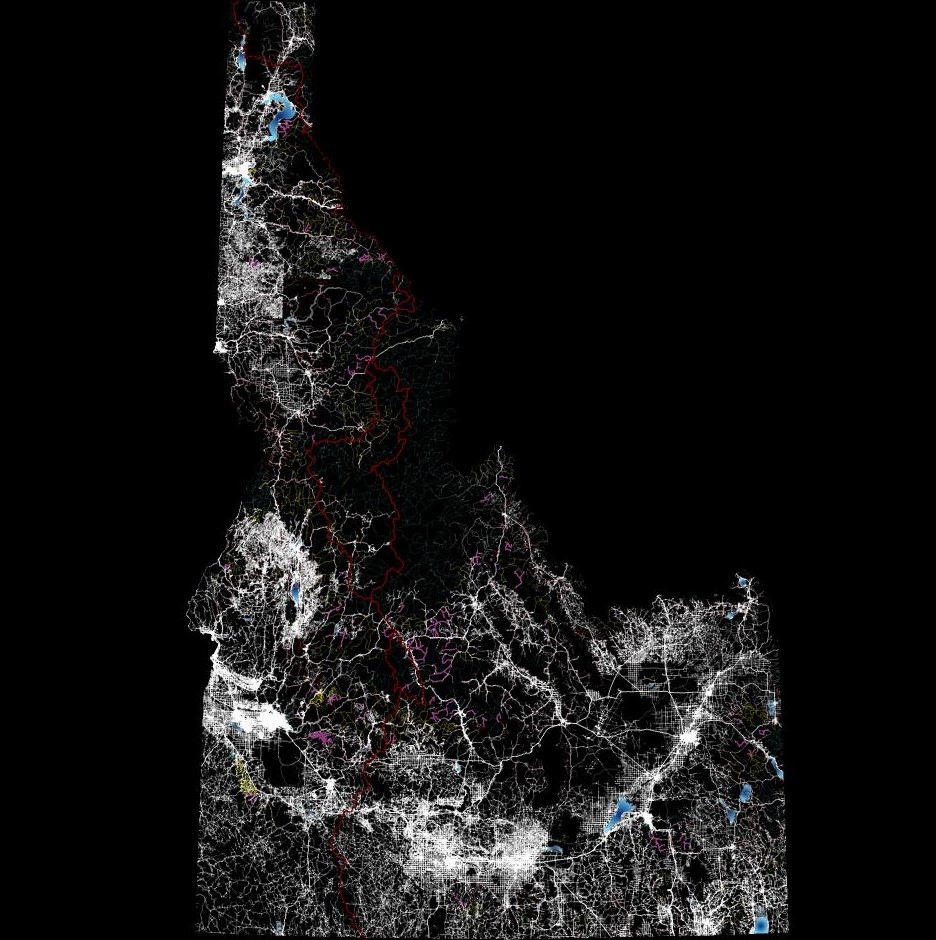
Using @milos_agathon tutorial (https://t.co/Weo0NcwpBX) I was able to Make that Topographic Map of Tanzania Using R Programing skills.
Topography Map of Tanzania
Tools used
R Studio
Plug-ins used
Raster
tags
RR MapR Studio
More by Hemed Lungo


You might also like


Join the community!
We're a place where geospatial professionals showcase their works and discover opportunities.