
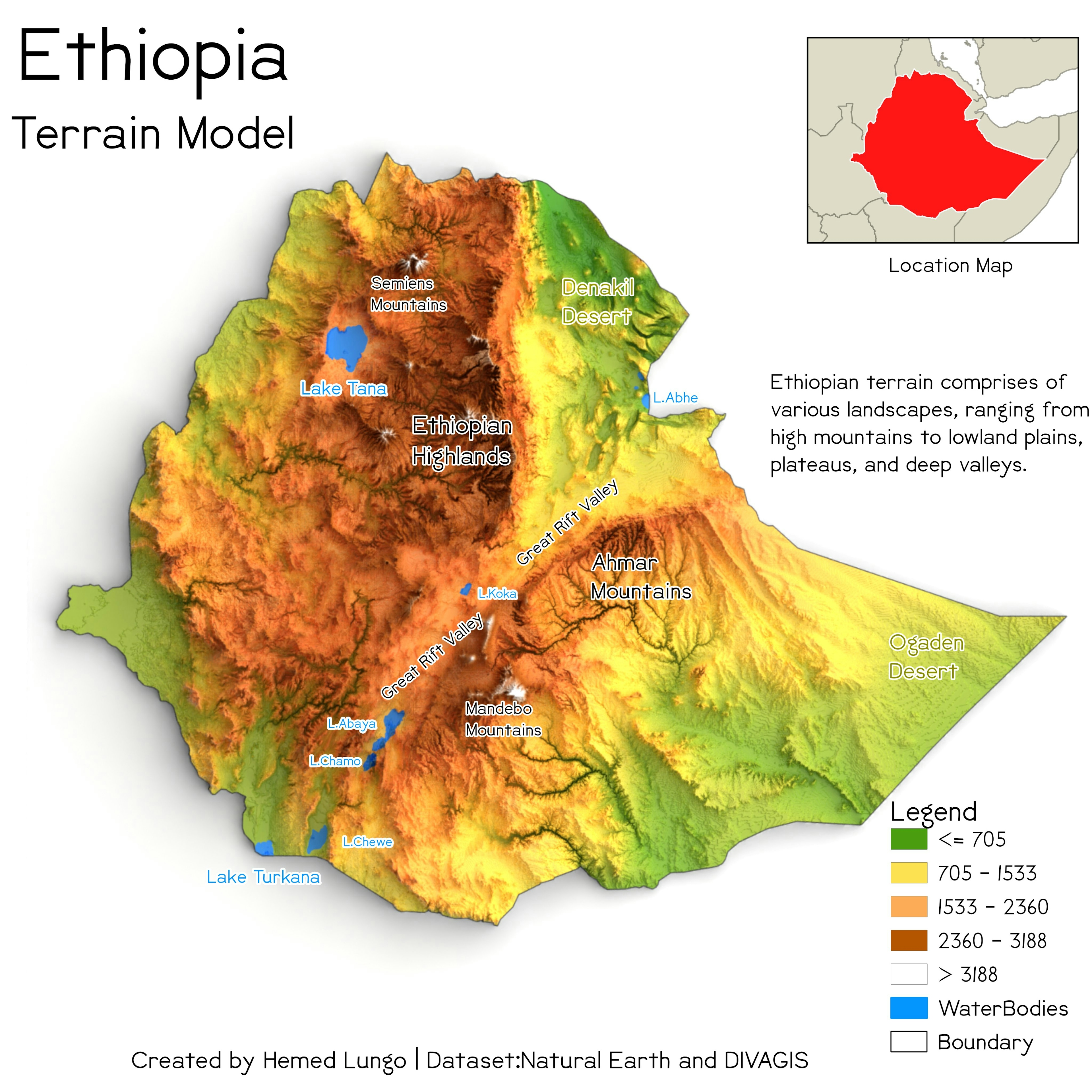
Made by using R
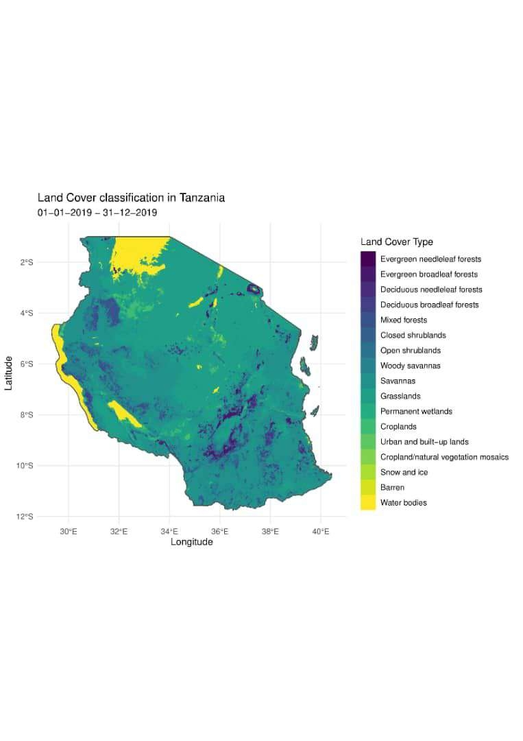
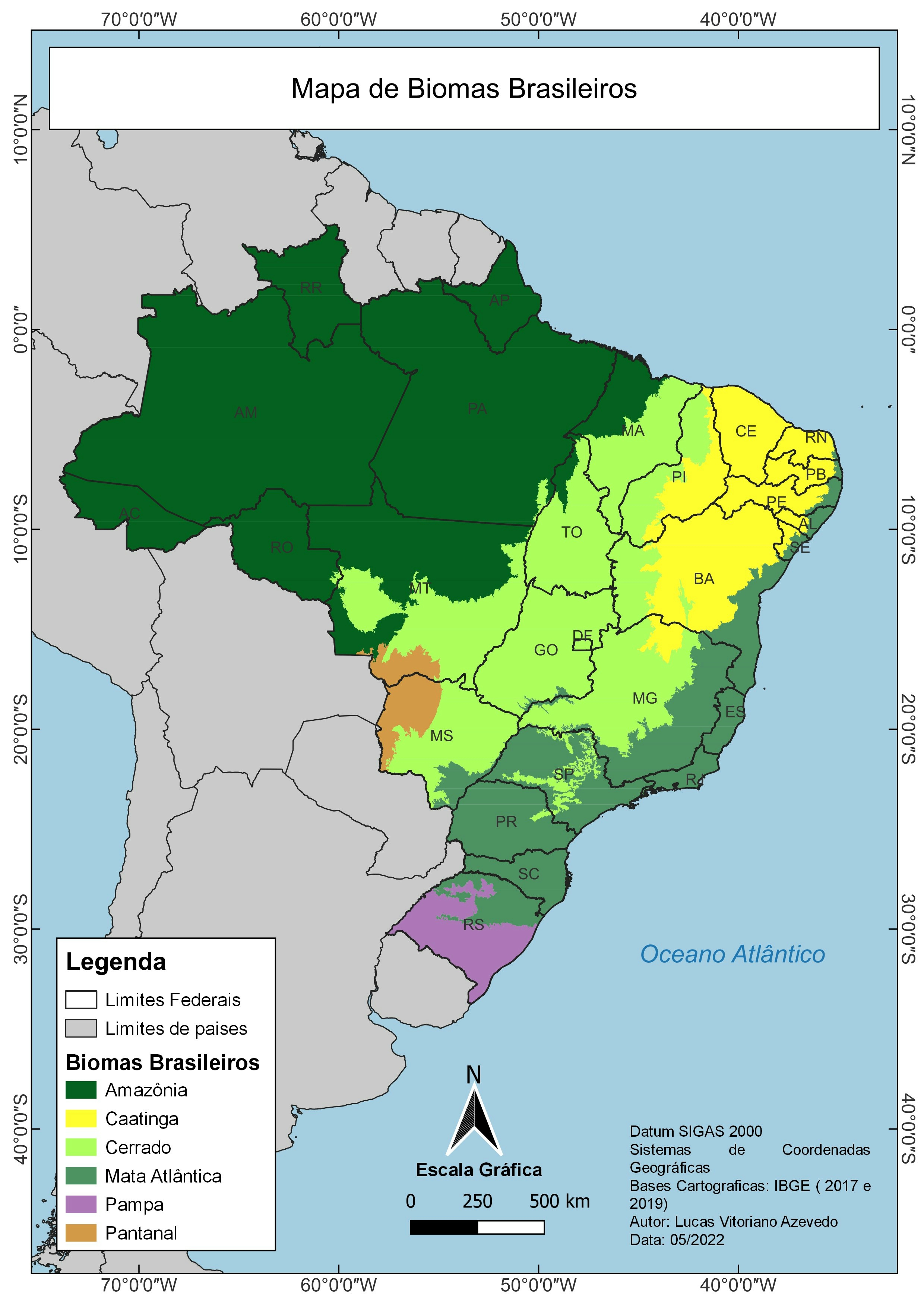
Landcover map of Tanzania
Tools used
R
Plug-ins used
R
tags
R
More by Hemed Lungo


You might also like


.png&w=3840&q=100)
 He")


.gif&w=3840&q=100)


Join the community!
We're a place where geospatial professionals showcase their works and discover opportunities.
Landcover map of Tanzania
Made by using R
More by Hemed Lungo
You might also like
We're a place where geospatial professionals showcase their works and discover opportunities.