.gif&w=3840&q=100)
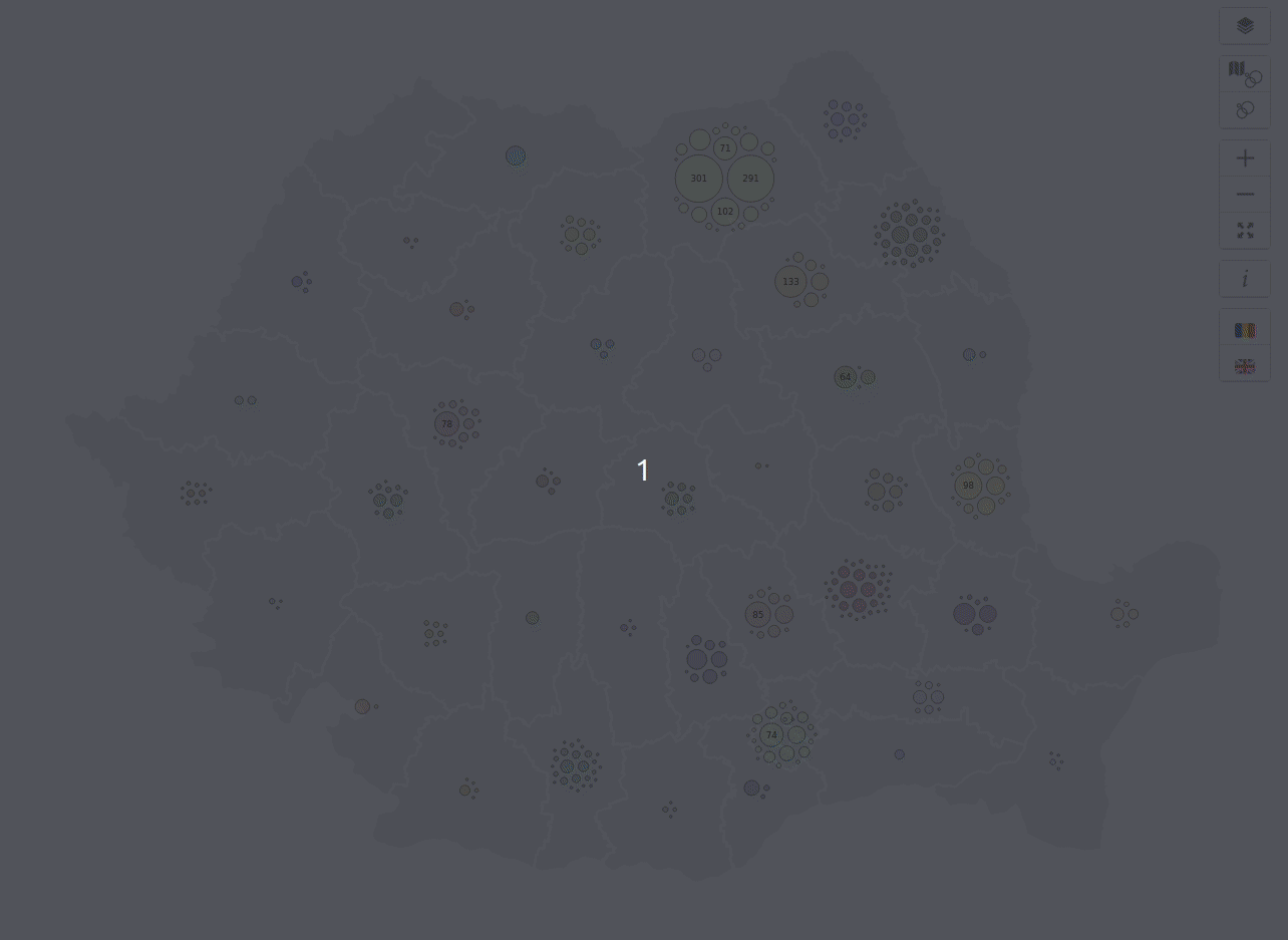
Romania Presidential Elections 2019
“ Eu pentru cine votez? ” (“ I'm not drunk... but I, for whom shall I vote? ”) *
Those are the results from the Romania's Presidential Elections 2019, round 1 and round 2, held on the 10th of November and the 24th of November, with a focus on the first two candidates.
The cartograms show the size of each county distorted by population (the total number of valid expressed votes). Eg. Bucharest(B1-B6), the country capital, is small on the geographic map, but much bigger on the cartograms. The color ranges show the votes each candidate has received per electoral district, in percentages. SR represents the voters from abroad.
Data: Geoportalul Agenției Naționale de Cadastru și Publicitate Imobiliară, Biroul Electoral Central and Alegeri Prezidentiale 10 și 24 Noiembrie 2019.


.gif&w=3840&q=100)