Sign up or log in to your Spatialnode account.

Takes less than a few seconds.

Terrain Model of Ethiopia

Hemed Lungo
Hemed Lungo•

July 01, 2023

Terrain Model of Ethiopia

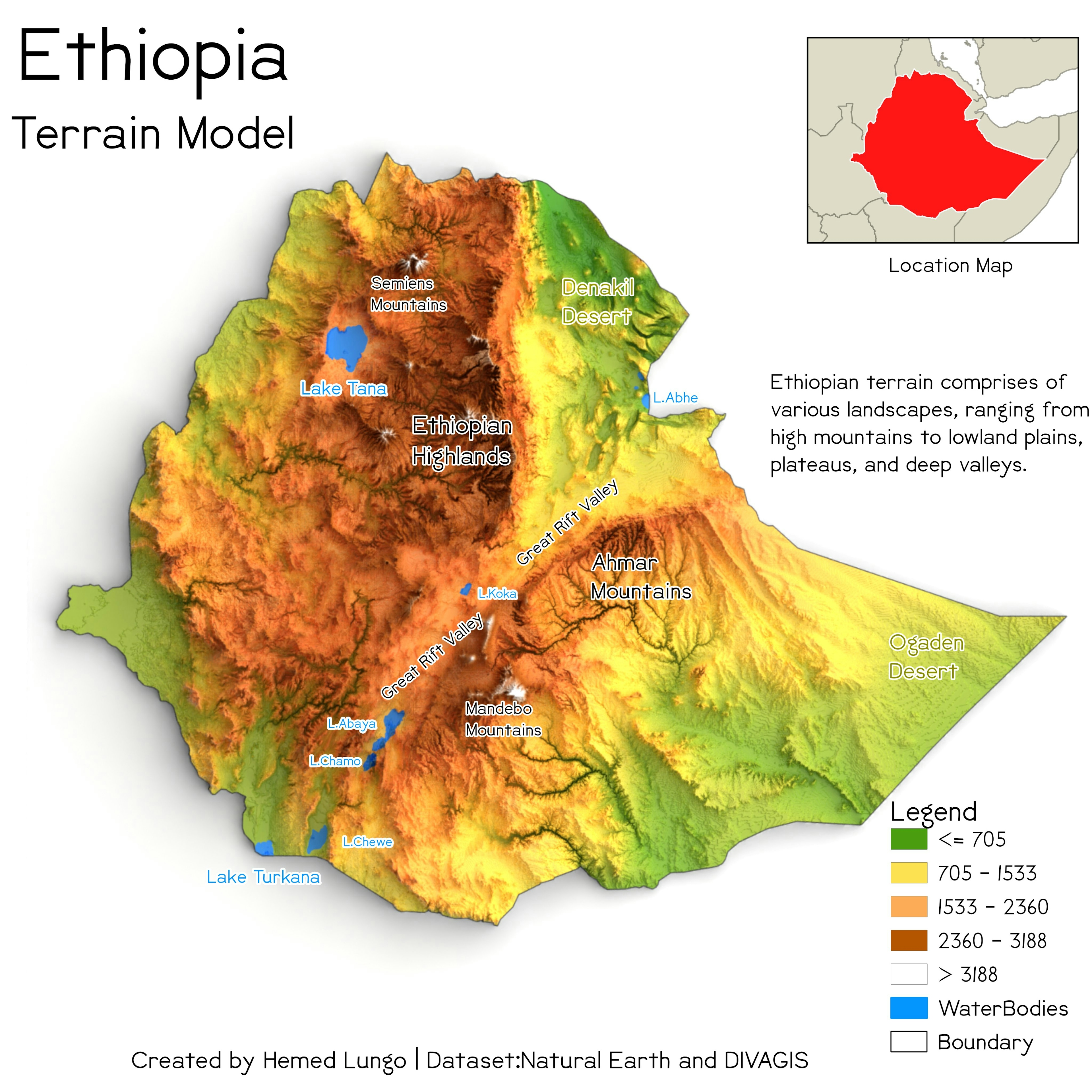
I used blender and QGIS in making this one.


Tools used

BlenderQGIS

Plug-ins used

QGIS

tags

modern map

More by Hemed Lungo

Landcover map of Tanzania
20
Topography Map of Tanzania
112
SRTM of Tanga Region (Tanzania)
171
Land cover Map of Kenya(2020)
91
Nigeria Terrain Model
194
PrettyMap of Dar-es-salaam
40

You might also like

Drive Times for Fire and Rescue Services
Jacob Jones
Drive Times for Fire and Rescue Services
Jacob Jones
16
test
Shahzaib Saleem
test
Shahzaib Saleem
215
Teresina - 1ª cidade planejada do Brasil
Felipe Dantas
Teresina - 1ª cidade planejada do Brasil
Felipe Dantas
50
Mapa de Localização
Lucas de Siqueira Cardinelli
Mapa de Localização
Lucas de...
70
Land Trust Housing in Gentrifying Areas
Henry Paddock
Land Trust Housing in Gentrifying Areas
Henry Paddock
48
Landuse Landcover Map of LOKOJA
Enoch Oluwaferanmi Babayemi
Landuse Landcover Map of LOKOJA
Enoch Oluwaferanmi Babayemi
39
Mapping changes in employment patterns
Stewart Berry
Mapping changes in employment patterns
Stewart Berry
36
APA de Murici
Jardel Estevam Barbosa dos Santos
APA de Murici
Jardel Estevam...
37
Flood Hazard Mapping in QGIS
Peter Kimani
Flood Hazard Mapping in QGIS
Peter Kimani
188
Web map
Paula Megumi Kawahara
Web map
Paula Megumi Kawahara
335
Mapa de localização com Drone
Eduardo Nardez
Mapa de localização com Drone
Eduardo Nardez
20
FUTA Layout
Eguagie-suyi Precious
FUTA Layout
Eguagie-suyi Precious
191

Join the community!

We're a place where geospatial professionals showcase their works and discover opportunities.

Sign Up for free