
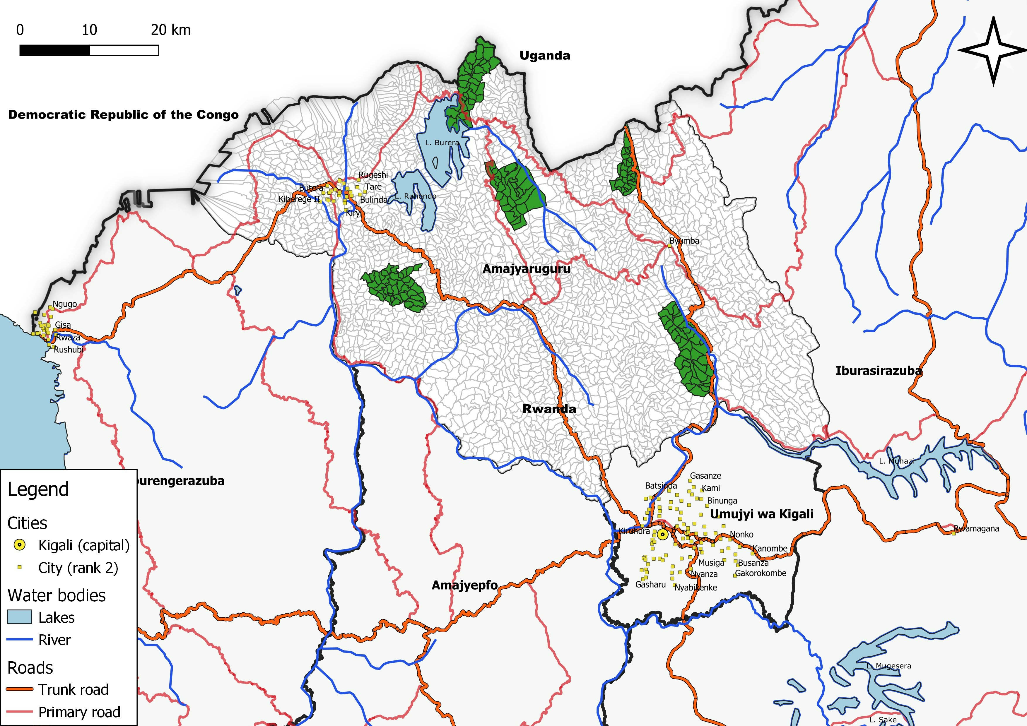
Map describing the area of study of the Northern province of Rwanda, using layers from pro version of World cities database and OSM for roads and other sources for water bodies.
Rwanda - Northern Province by village
Tools used
QGIS
tags
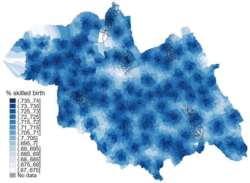
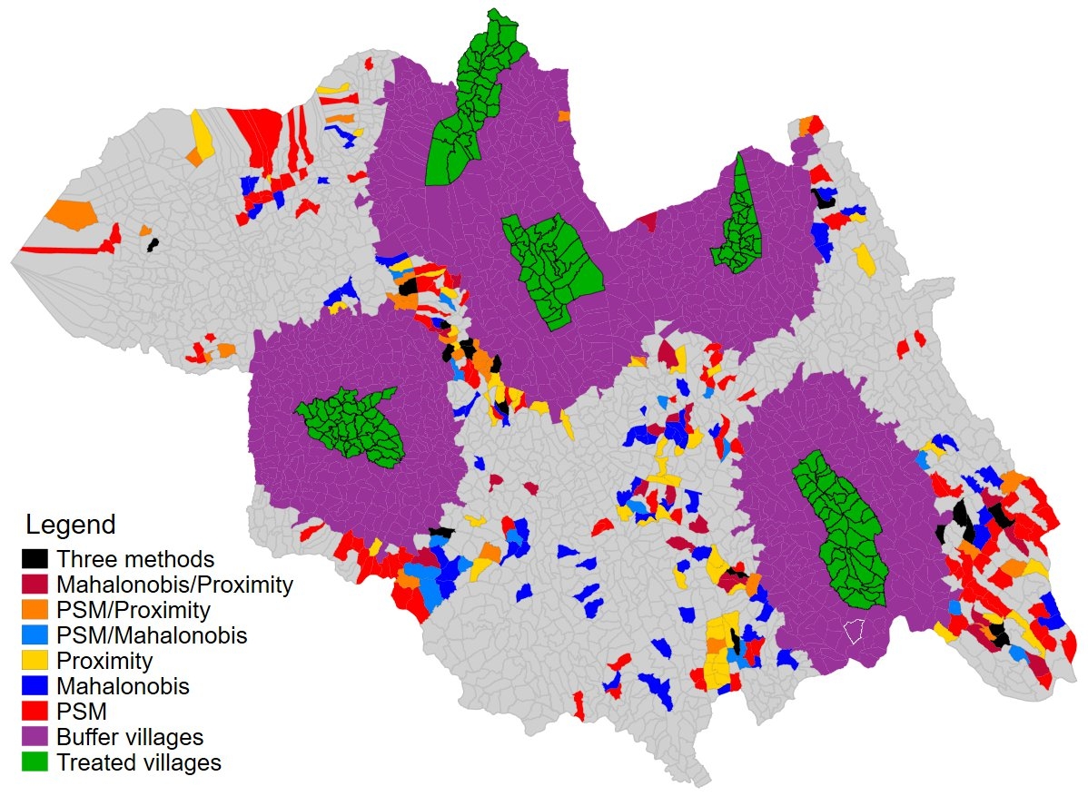
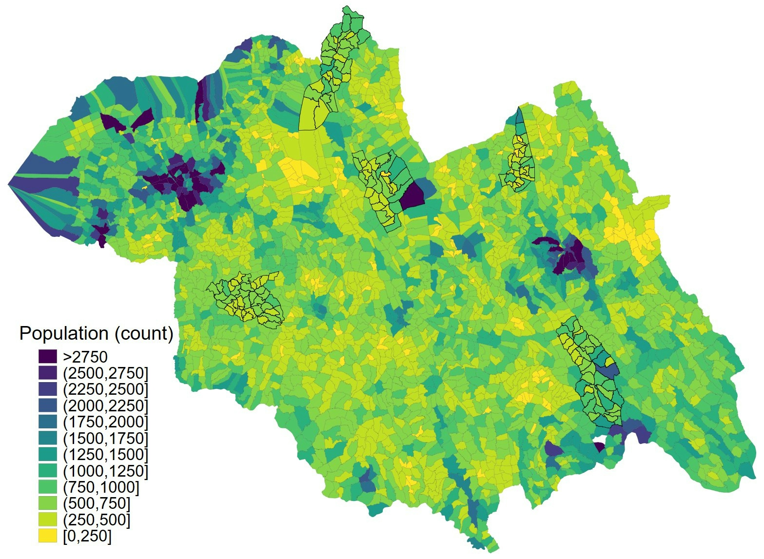
Demographicsdistancetopographic map
More by Jose Rubio-Valverde
You might also like


_645201.jpg&w=48&q=40 "Eguagie-suyi Precious")


.svg "Keran Nkongolo")
Join the community!
We're a place where geospatial professionals showcase their works and discover opportunities.