

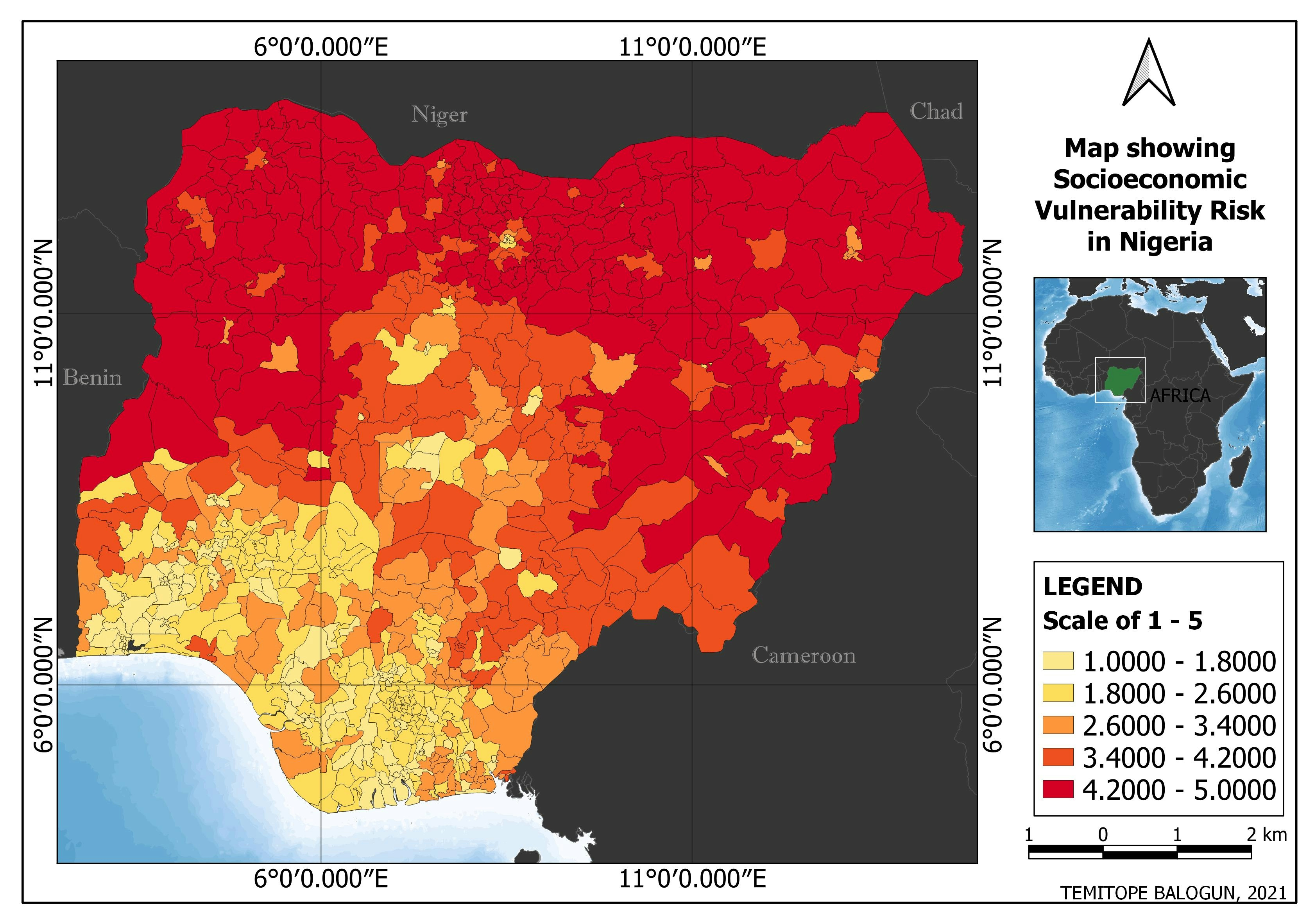
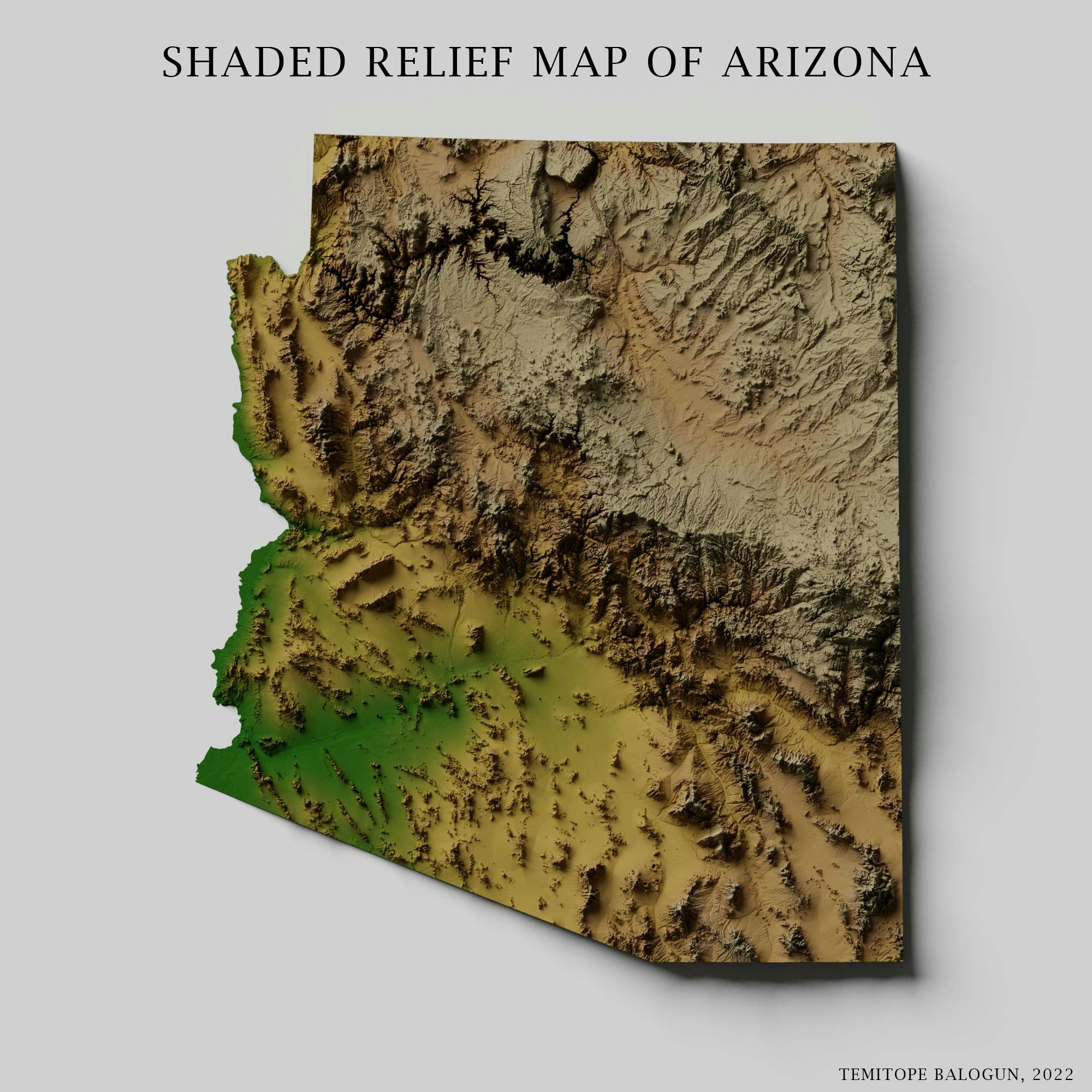
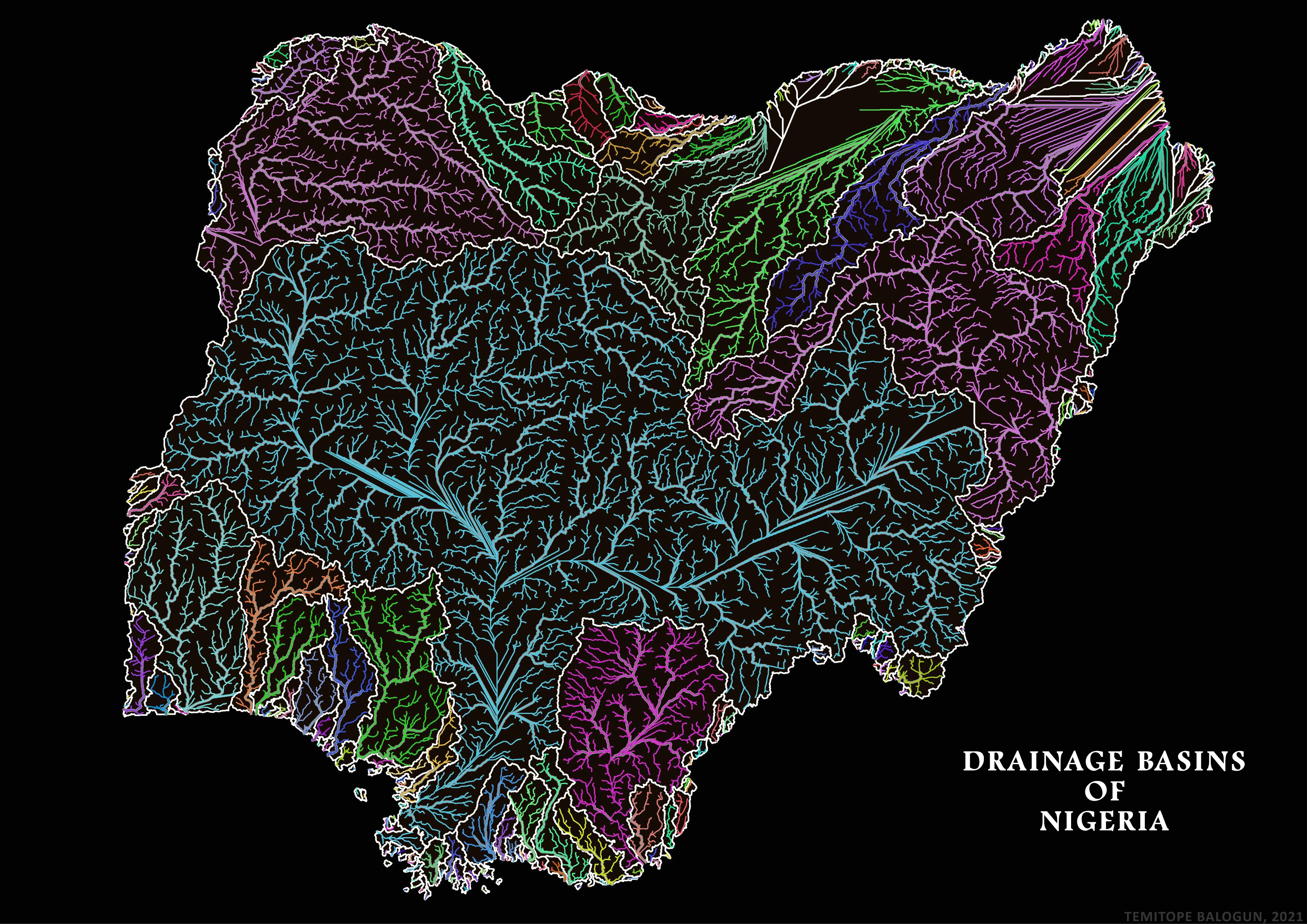
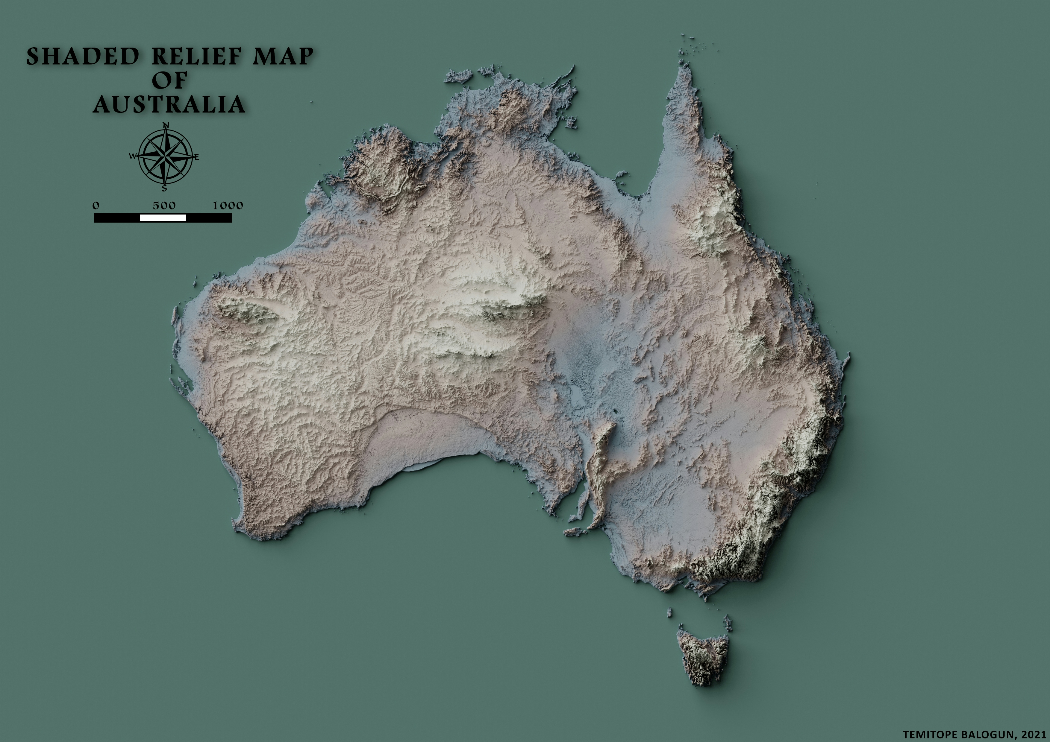
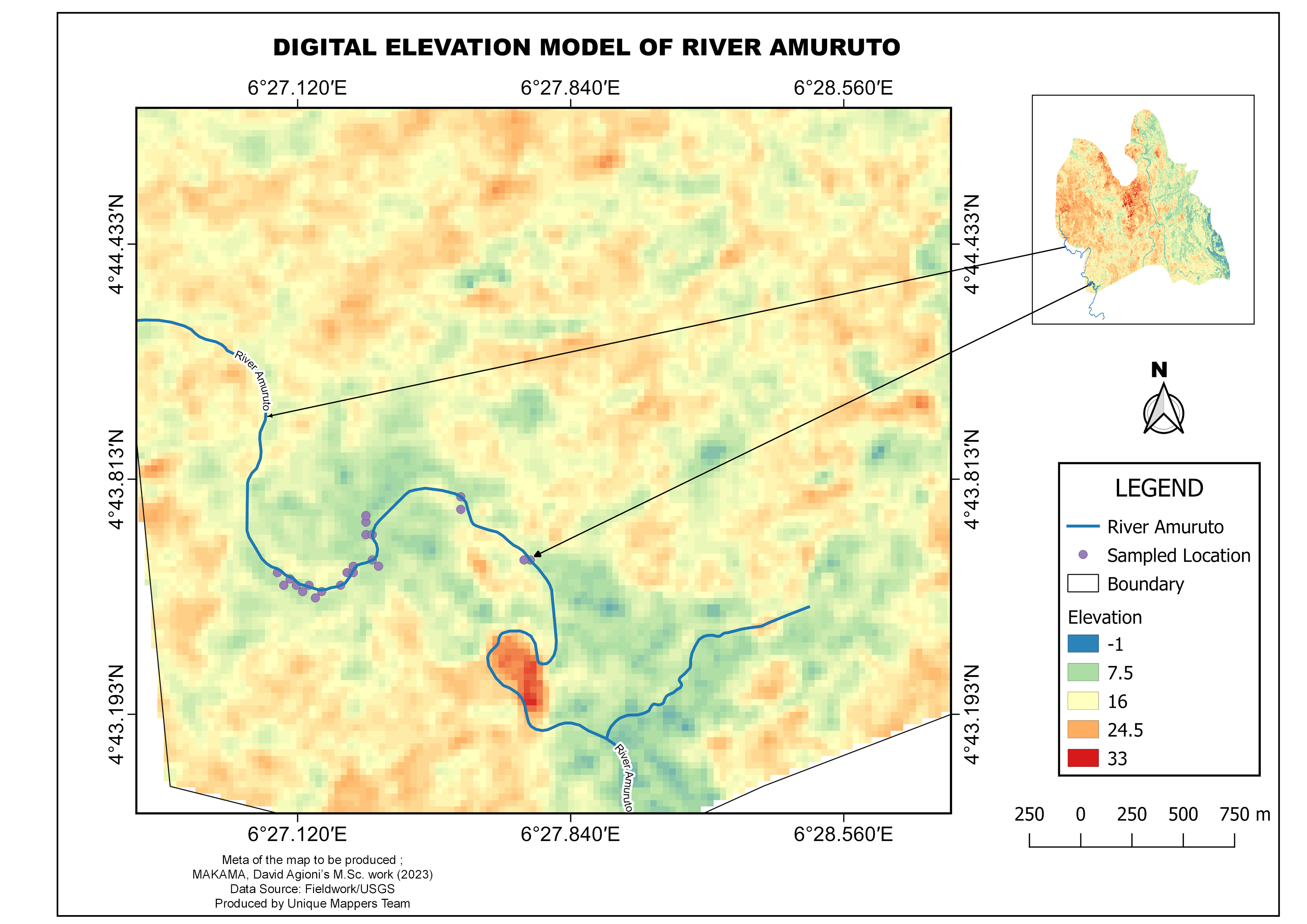
Nigeria's most extensive geological locale is that of the Niger and Benue River valleys, which converge into one another and structure a "y" shaped confluence at Lokoja. Plain ascend toward the north of the valleys. Toward the southwest of the Niger there is "rough" highland. The Northeastern part of the terrain consists of a terrain almost entirely of extensive flat or very gently undulating plains which runs down to the shores of Lake Chad.
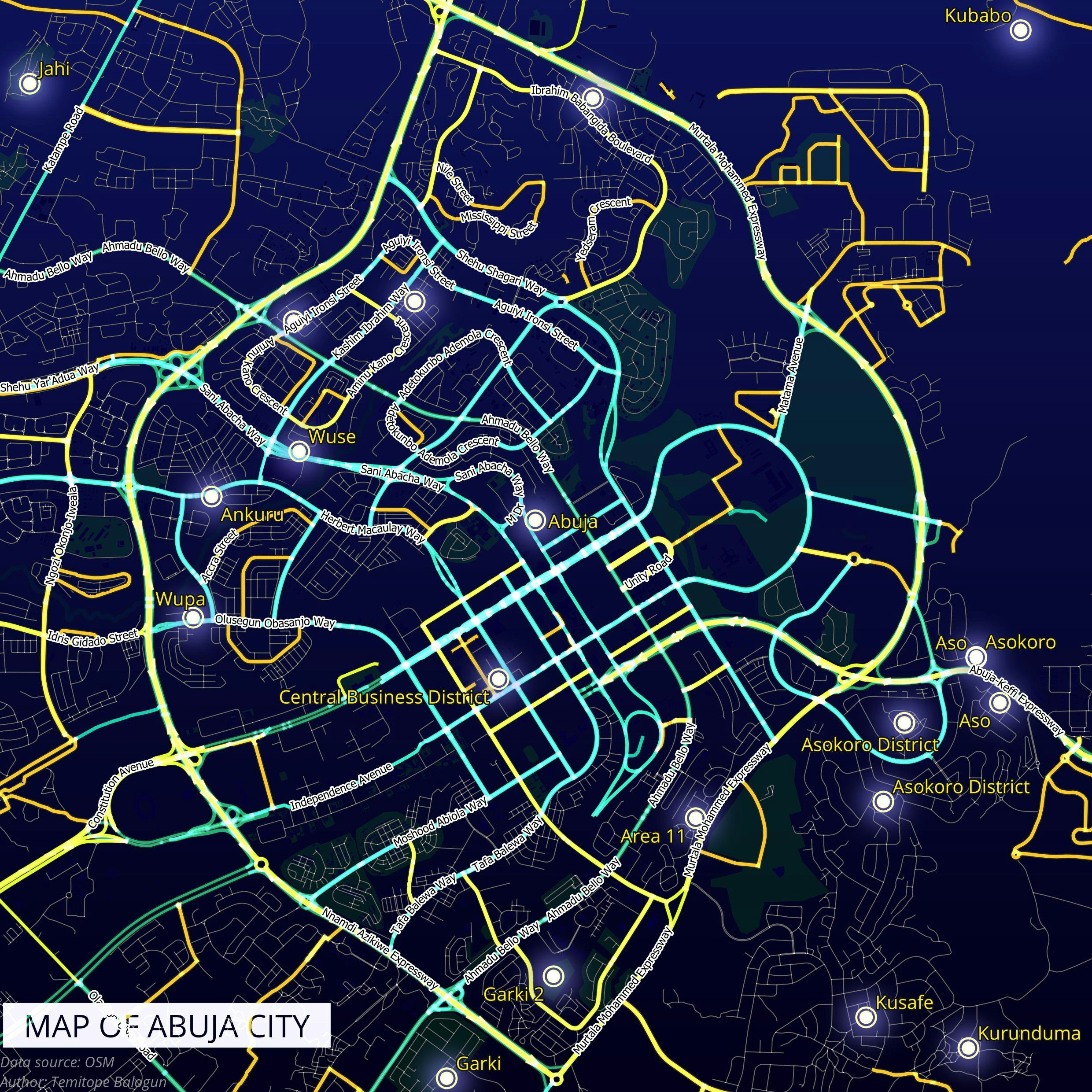
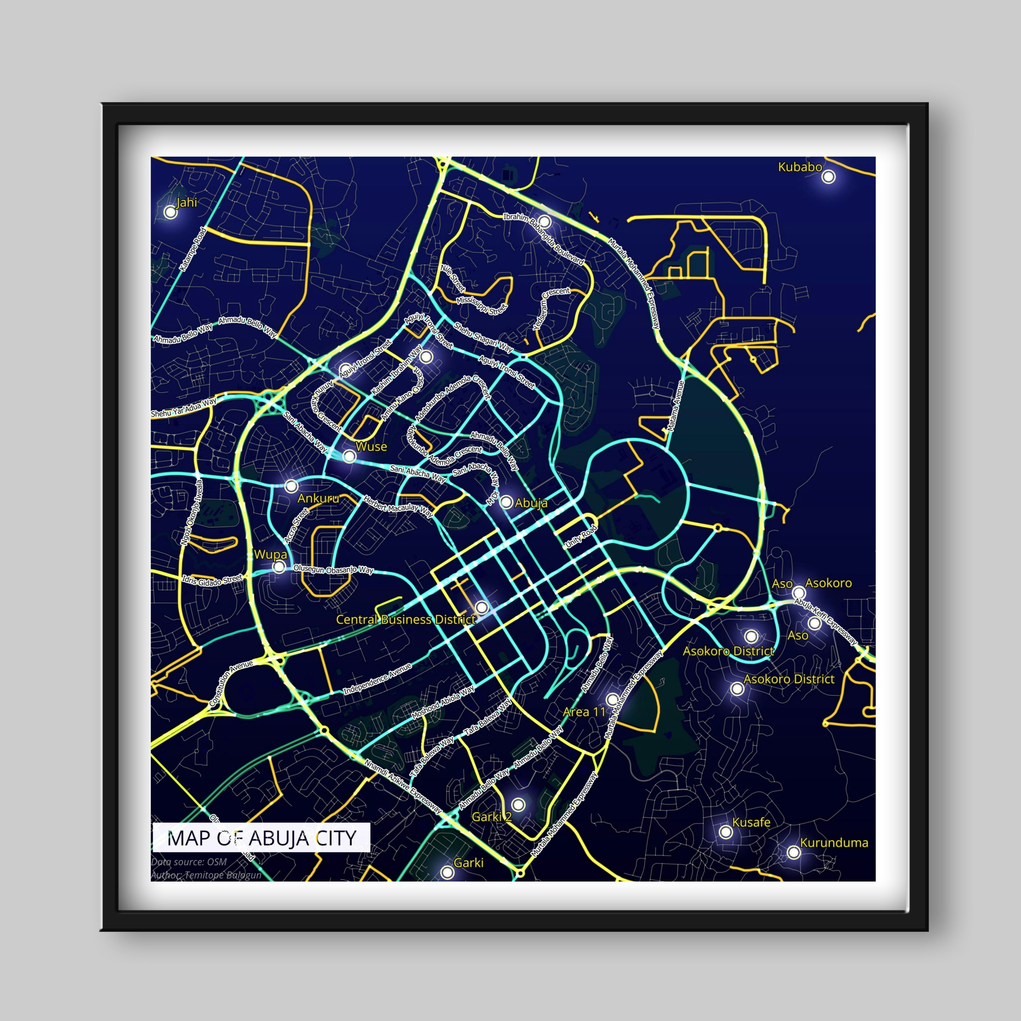
Shaded relief map of Nigeria
Tools used
ArcMapBlender
Plug-ins used
Spatial analyst
tags
ArcMapBlenderData Visualization
More by Balogun Temitope

You might also like


Join the community!
We're a place where geospatial professionals showcase their works and discover opportunities.