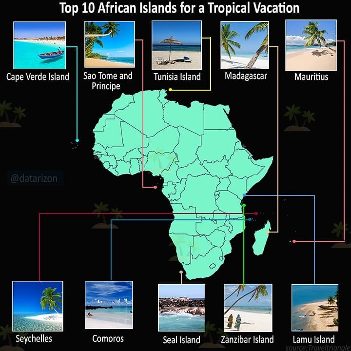
Top 10 islands for a tropical vacation

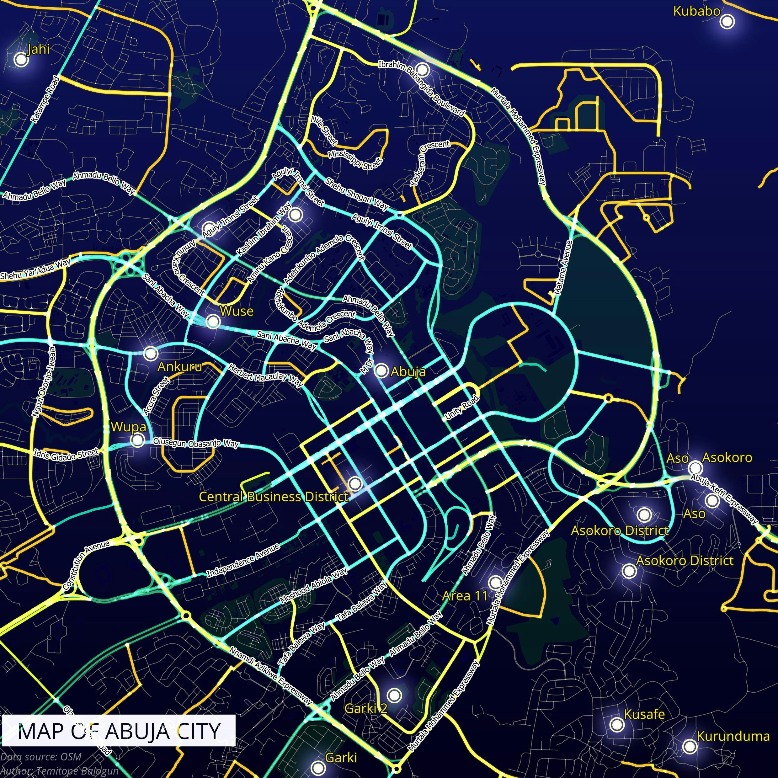
Tools used
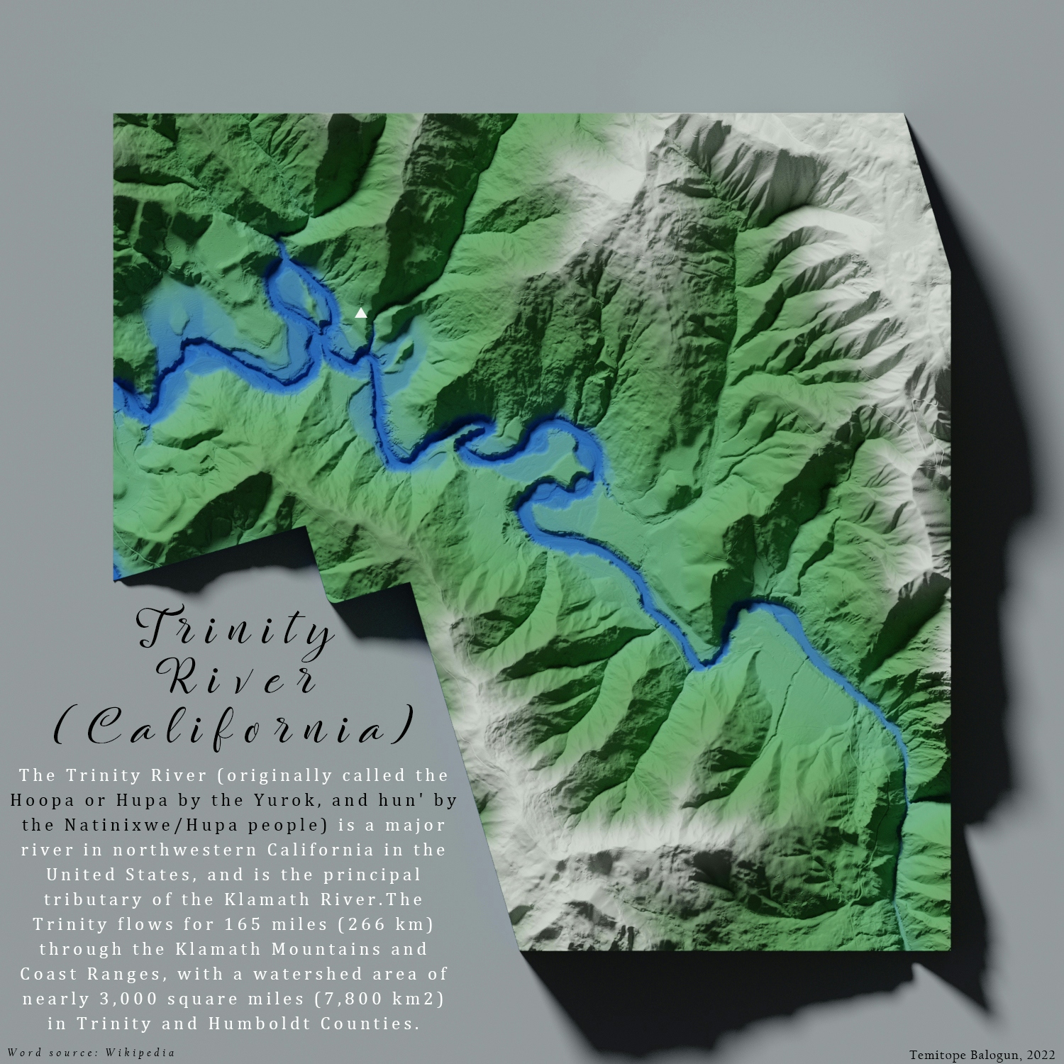
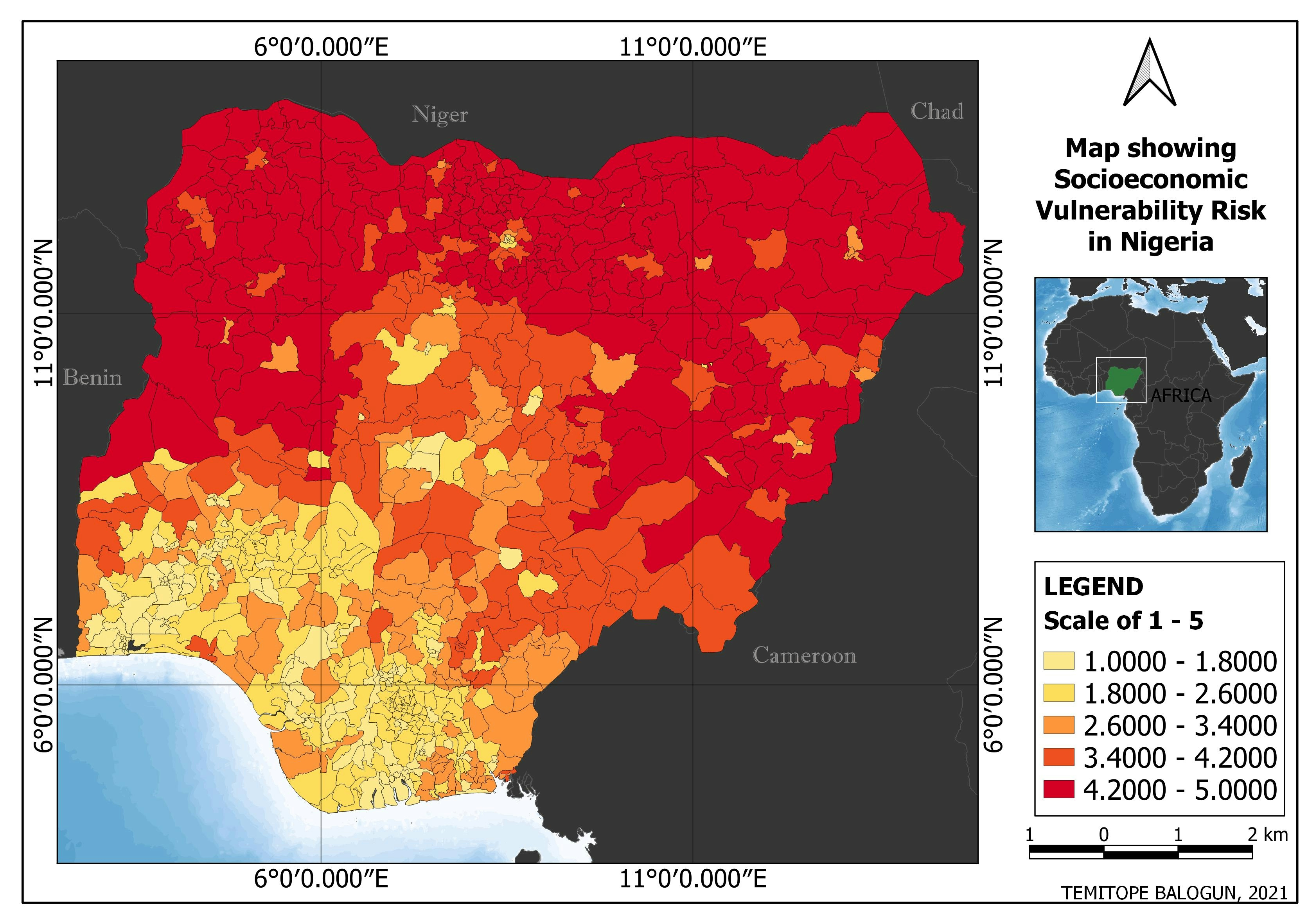
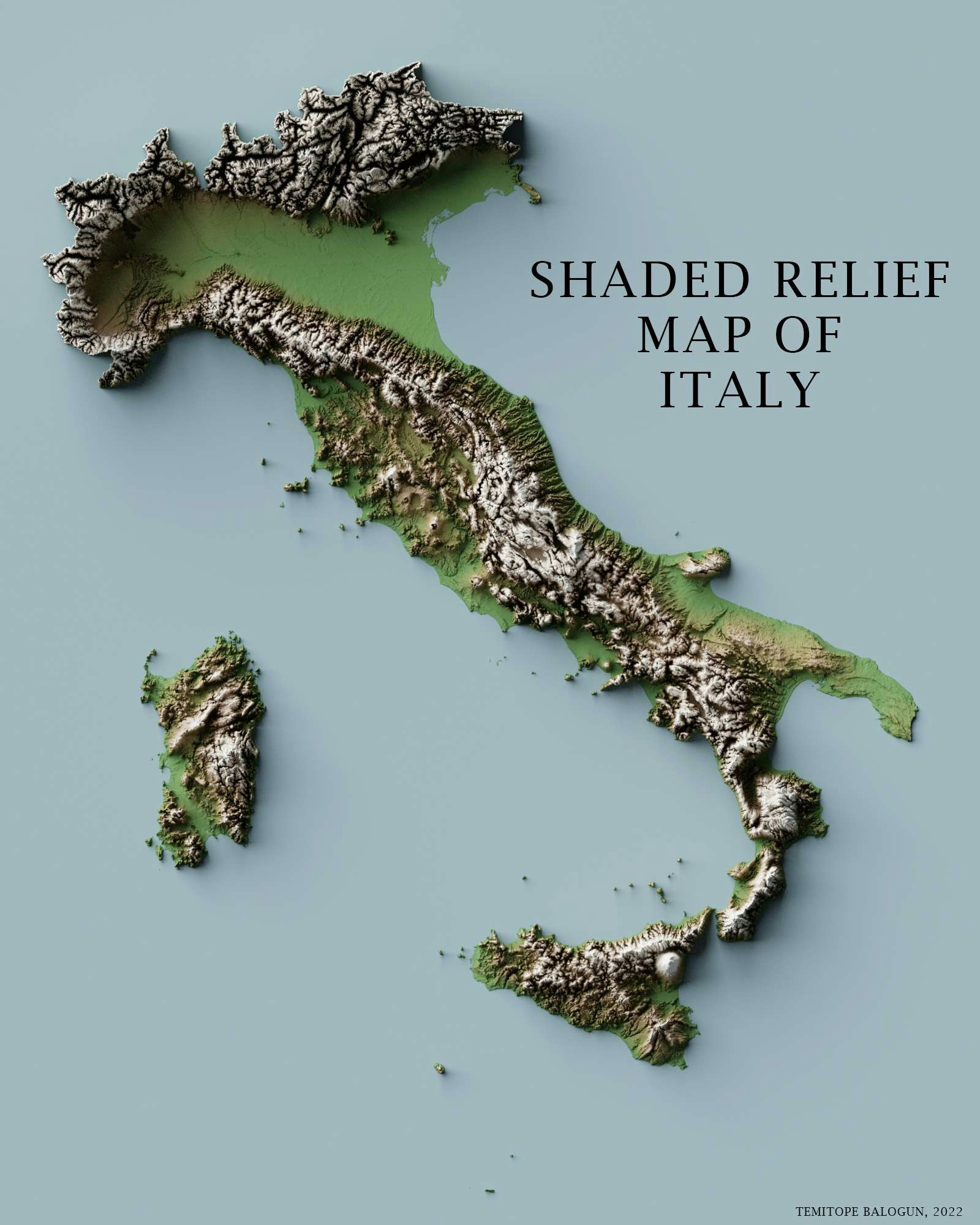
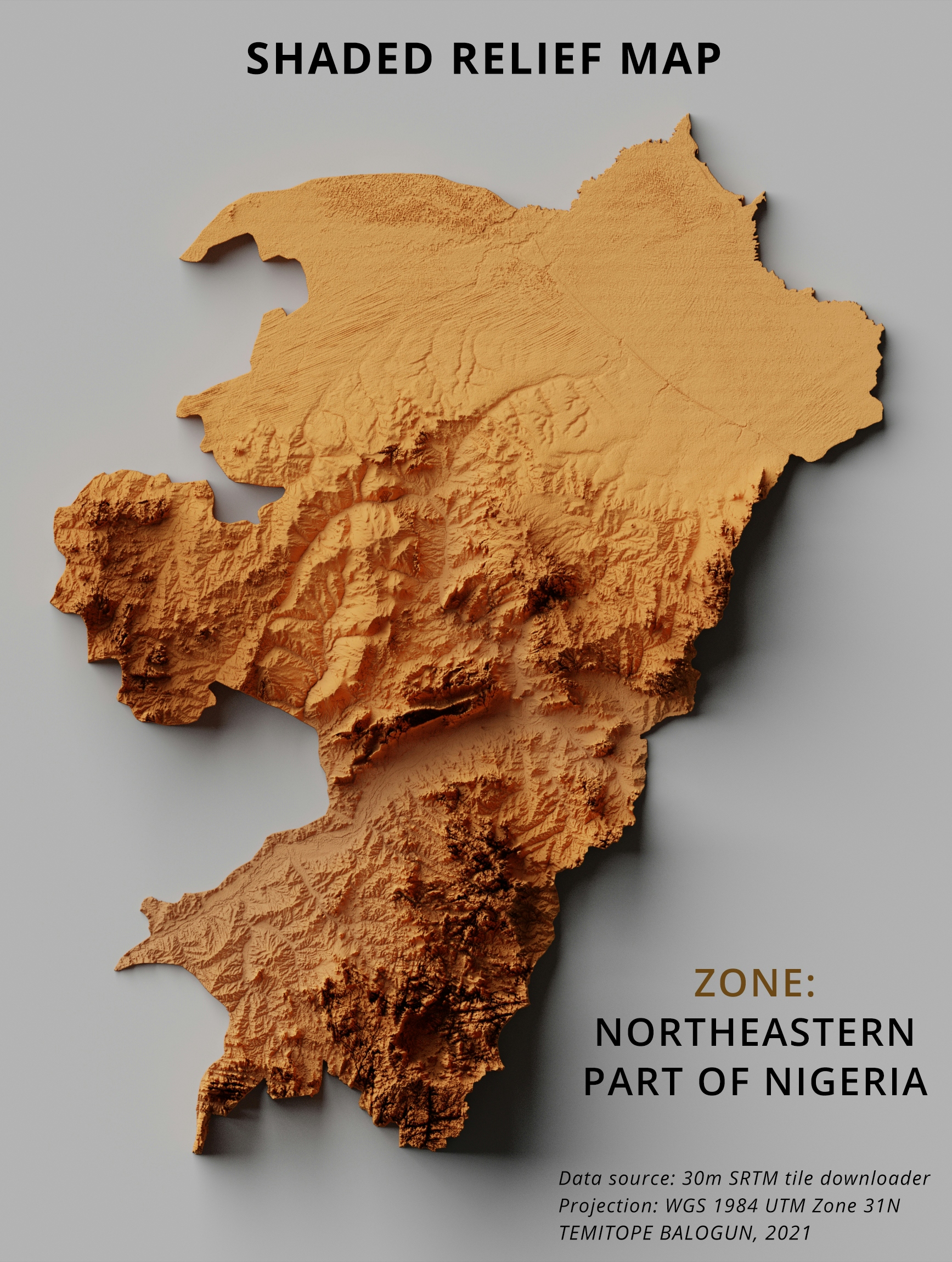
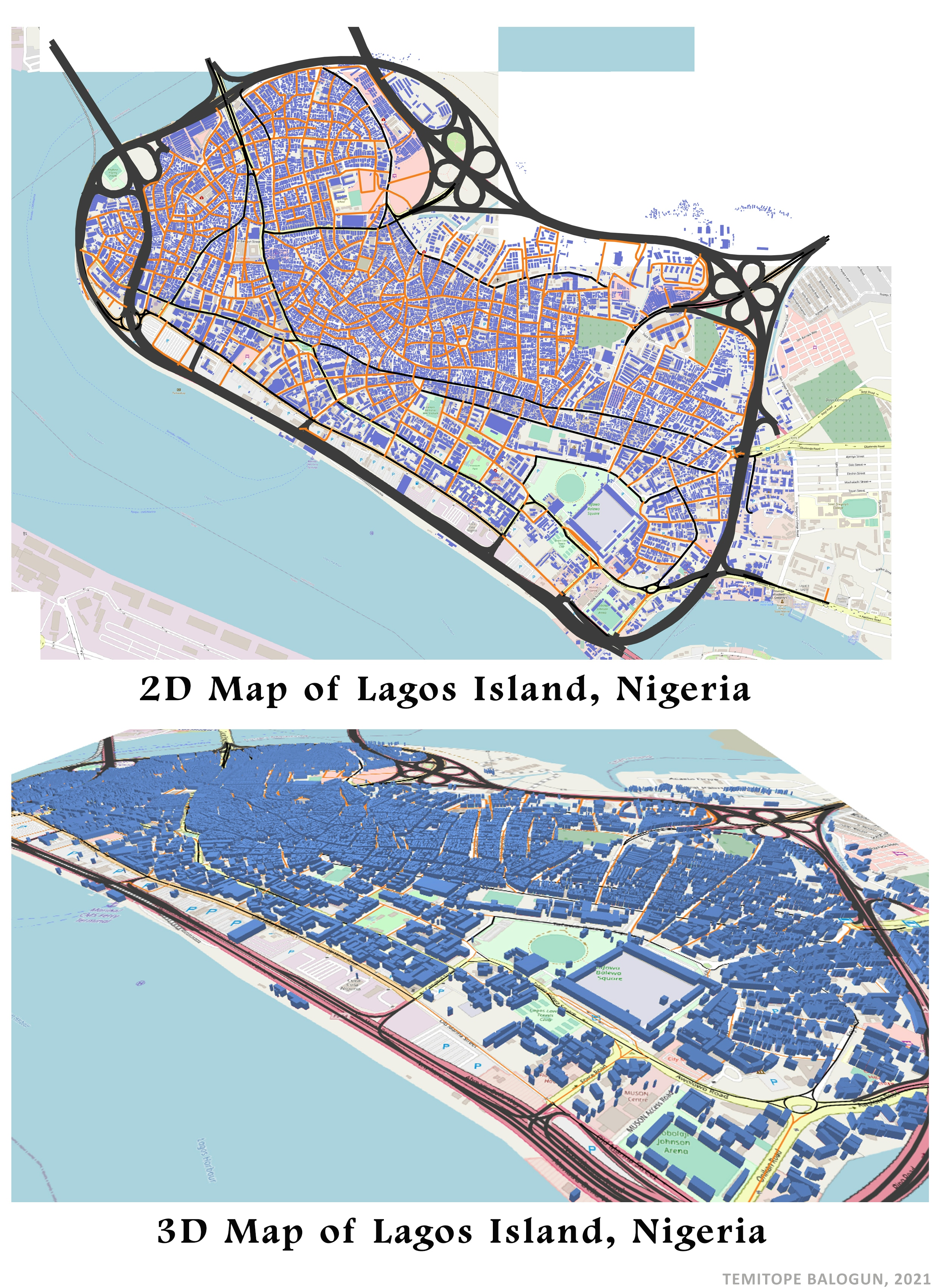
ArcMap
Plug-ins used
Openlayers
tags
ArcMap
More by Balogun Temitope
You might also like


_2239484.png&w=3840&q=100)


.png&w=3840&q=100)


Join the community!
We're a place where geospatial professionals showcase their works and discover opportunities.