I have come to realize that Design and aesthetics are fundamental to cartographic practice and design is also one of the most difficult part of the cartographic process. it can be challenging finding a good color combination for cartographic map but the beauty is Cartography helps us understand our place in the world, analyze positional relationships, and reflect on geography's effect on our daily lives.
“In cartography, as in medicine, art and science are inseparable. The perfect map blends art and science into an effective tool of visual communication.” ~ Dr. Keith Harries
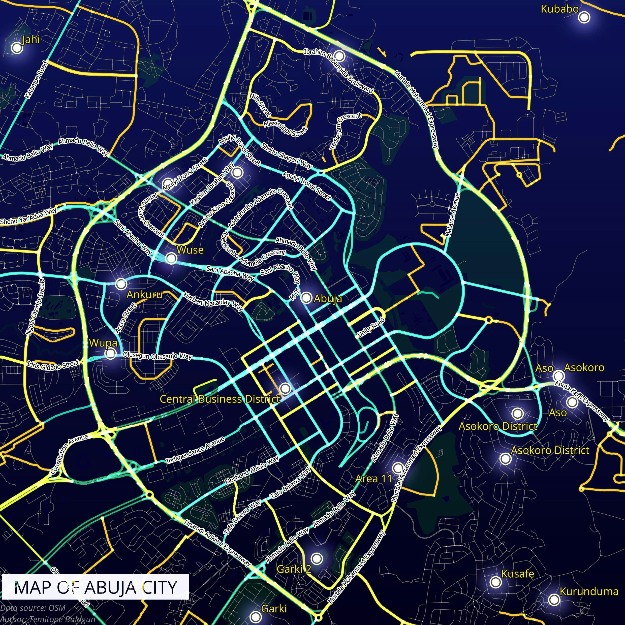
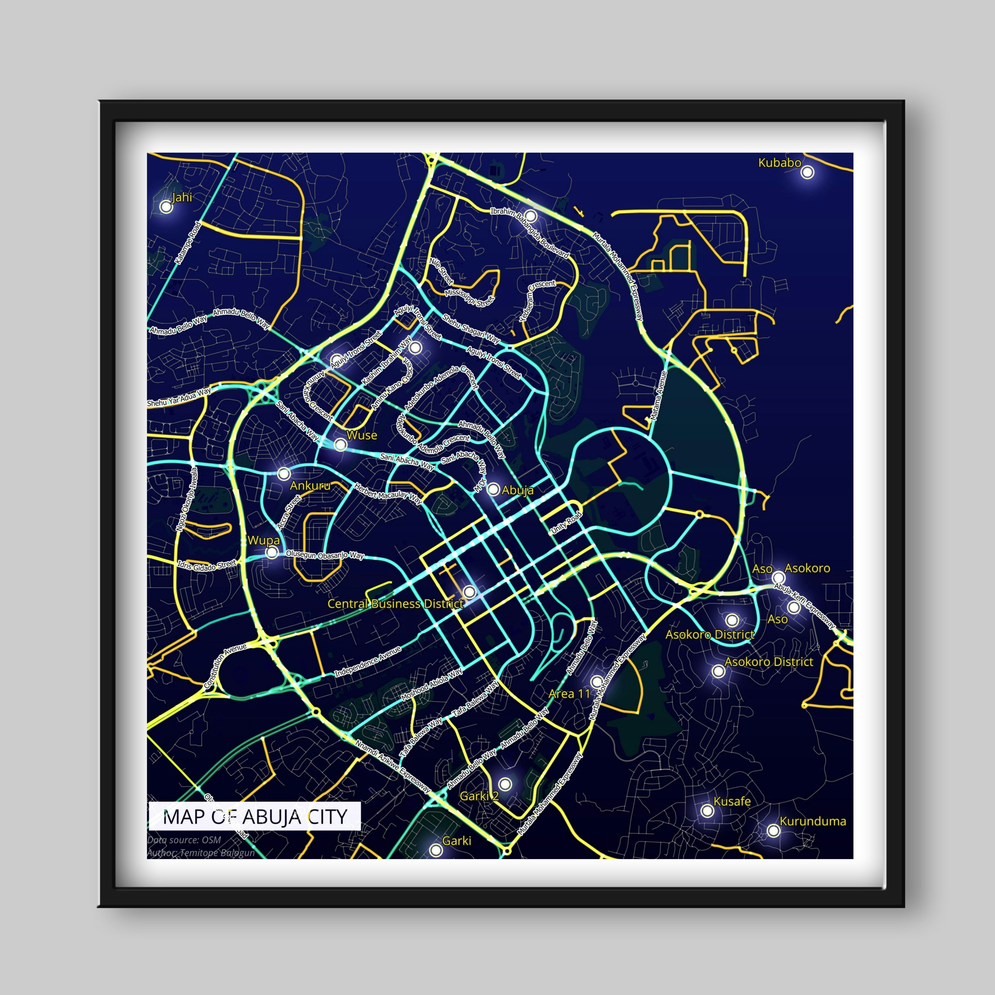
About Abuja
Abuja is the capital and eighth most populous city of Nigeria. Located in the centre of the country within the Federal Capital Territory, it is a planned city built mainly in the 1980s based on a master plan by Japanese architect Kenzo Tange. It replaced Lagos, the country's most populous city, as the capital on 12 December 1991.
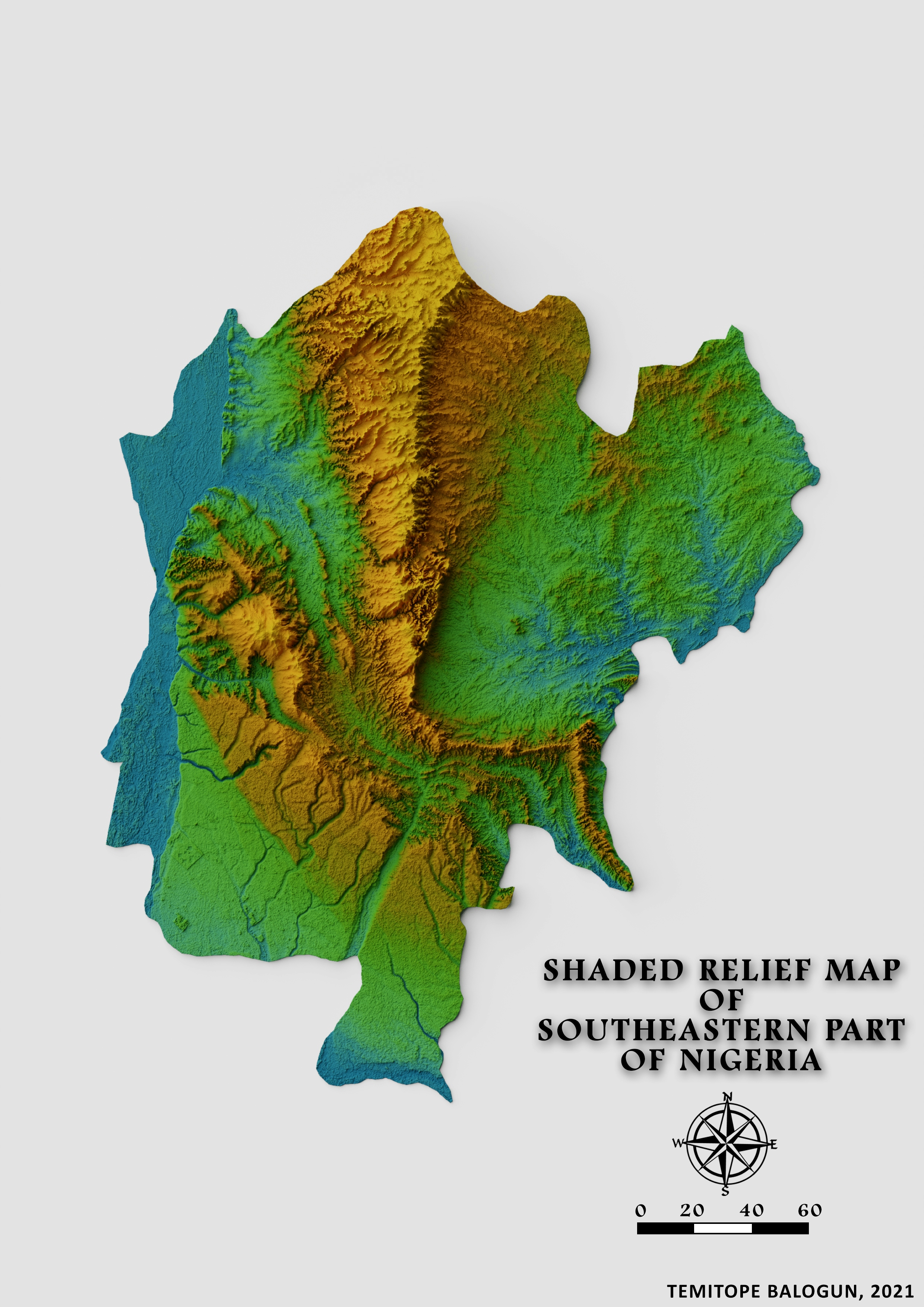
Abuja's geography is defined by Aso Rock, a 400-metre (1,300 ft) monolith left by water erosion. The Presidential Complex, National Assembly, Supreme Court and much of the city extend to the south of the rock. Zuma Rock, a 792-metre (2,598 ft) monolith, lies just north of the city on the expressway to Kaduna. (Wikipedia).
Methodology
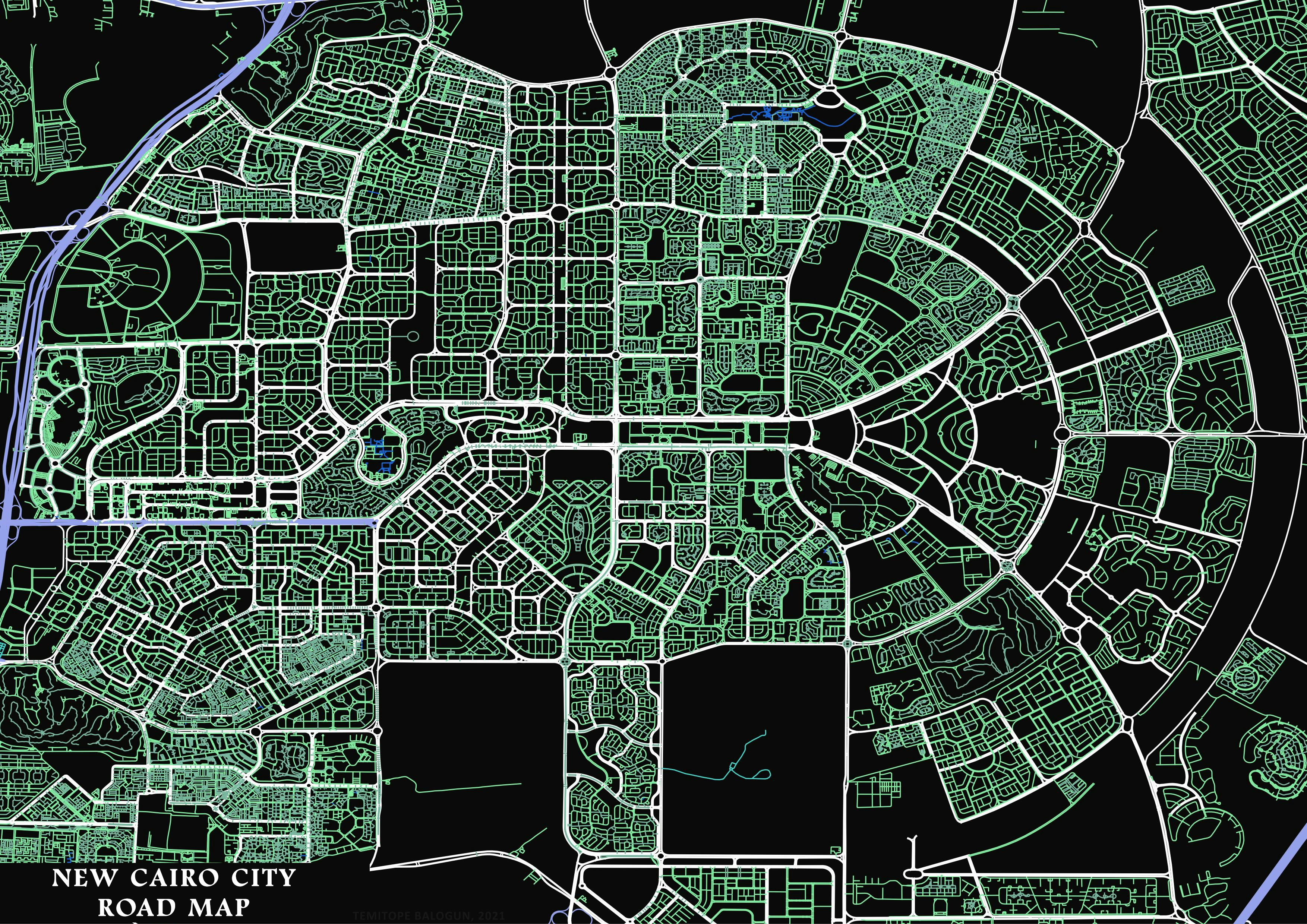
Road and location shapefile of Nigeria were downloaded from Geofabrik and imported into the QGIS environment , the shapefile of Nigeria road and location were changed from geographic coordinate system to a Projected coordinate system. After conversion from GCS to PCS, Abuja city was clipped out from the entire Nigeria Road shapefile and the location shapefile using Abuja polygon shapefile.
After clipping, the symbology of the road shapefile and the location shapefile was modified(change of color, increase of road width, increase of point size and so on). After the modification, it was visualized in Layout view.