Sign up or log in to your Spatialnode account.

Takes less than a few seconds.

Africa Fabric map

Atieno Owino
Atieno Owino•

November 16, 2022

Africa Fabric map

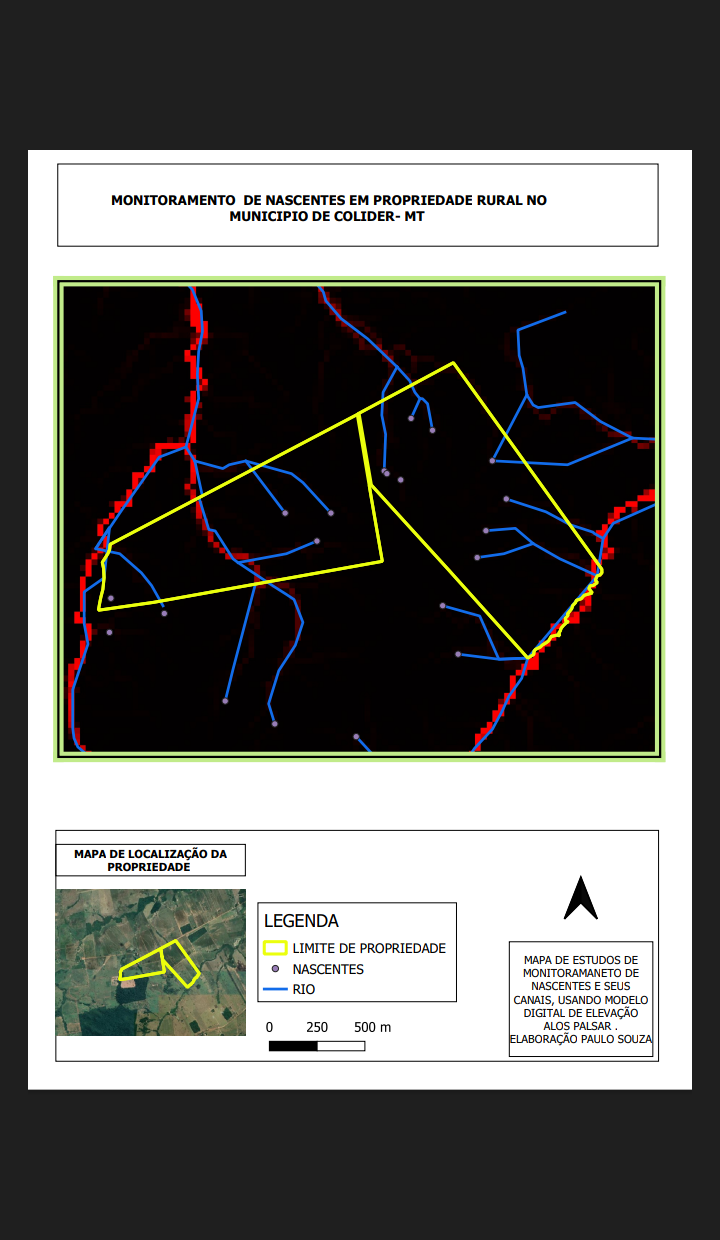
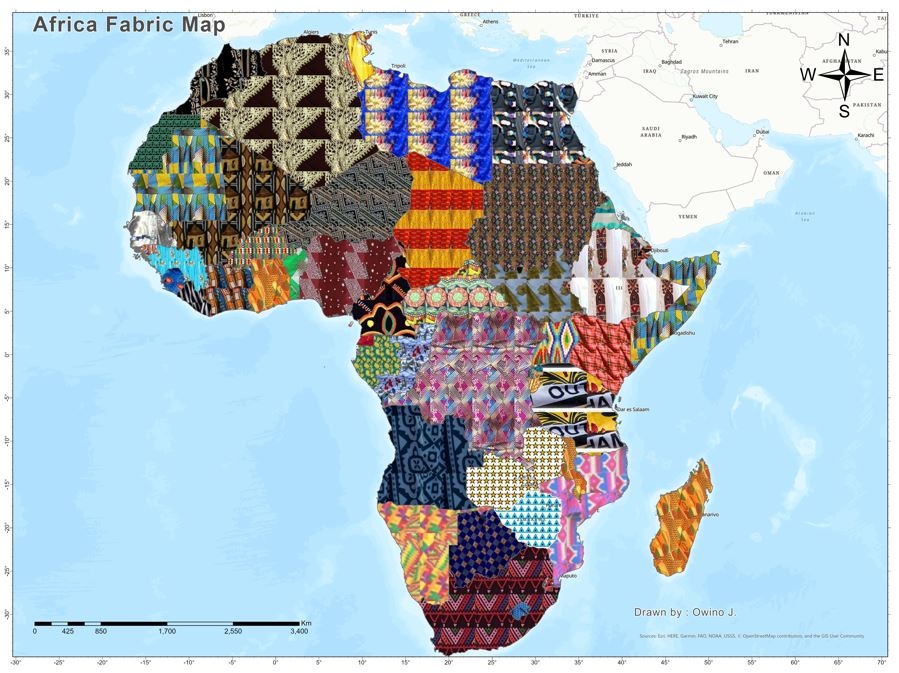
Ankara symbology to represent African wear per country

Africa shapefile boundary data


Tools used

ArcGIS ProSpatial analyst

Plug-ins used

Photofiltre Studio XQGIS

tags

Data PreparationData Visualization

More by Atieno Owino

Kenya Shaded Relief Map
43
Kenya Population Density 2020
50
3D Population Density
93
Child Marriage Cases
39
Nzoia River Relative Elevation Model
72

You might also like

California and its Major Urban Areas
Hugo He
California and its Major Urban Areas
Hugo He
14
Air Quality Bike Dashboard
Mohammad Younes
Air Quality Bike Dashboard
Mohammad Younes
282
COMUNIDADES SIN ENERGÍA ELÉCTRICA
GUSTAVO ABEL CACERES MARTINEZ
COMUNIDADES SIN ENERGÍA ELÉCTRICA
GUSTAVO ABEL...
16
Tectonic & Lithological Map - CTFB & IBR
Niroj Shrestha
Tectonic & Lithological Map - CTFB & IBR
Niroj Shrestha
12
Digital Elevation Model of Oyo State.
Olawuyi Abolade Pelumi
Digital Elevation Model of Oyo State.
Olawuyi Abolade Pelumi
31
Map of UK Rainfall by Weather Sation
Cameron
Map of UK Rainfall by Weather Sation
Cameron
101
Mapping Historic vs Modeled SST
Ria Rathod
Mapping Historic vs Modeled SST
Ria Rathod
10
Ramais em comunidades
ANDRE NOBREGA DE ARRUDA
Ramais em comunidades
ANDRE NOBREGA...
5
Mapping Wetland and Swampy Topography
Desmond Twum
Mapping Wetland and Swampy Topography
Desmond Twum
5
ESRI GIS for Climate Action MOOC Sample
Martijn Dieleman
ESRI GIS for Climate Action MOOC Sample
Martijn Dieleman
31
Species Distribution Model (Part 1)
Ali Mulla
Species Distribution Model (Part 1)
Ali Mulla
20
PrettyMap of Dar-es-salaam
Hemed Lungo
PrettyMap of Dar-es-salaam
Hemed Lungo
37

Join the community!

We're a place where geospatial professionals showcase their works and discover opportunities.

Sign Up for free