Sign up or log in to your Spatialnode account.
Takes less than a few seconds.
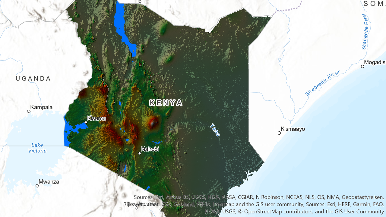
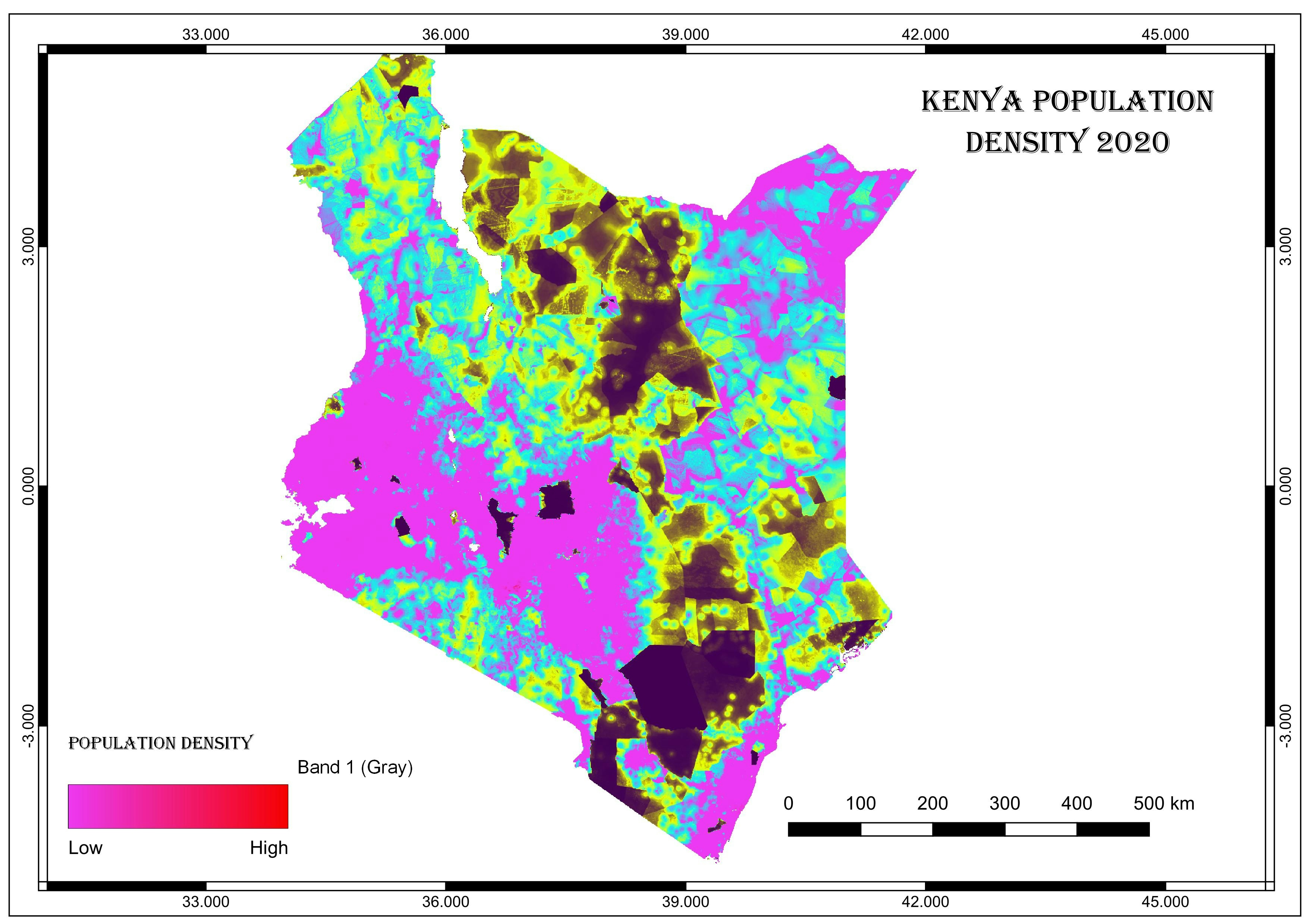
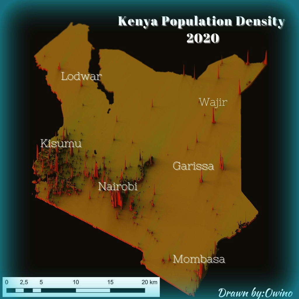
Kenya Shaded Relief Map
November 21, 2022
DEM
Kenya Boundary
More by Atieno Owino
You might also like
We're a place where geospatial professionals showcase their works and discover opportunities.


.svg "Maggie Zou")