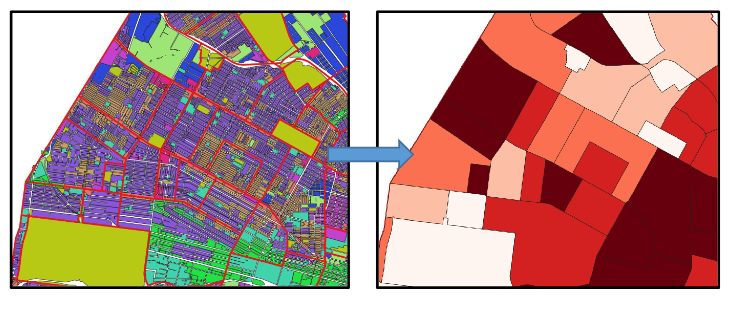
A Python application and a QGIS plugin for spatial analysis of Land Use and Land Cover data! This project aims to fill in the gap on automatic implementations of some important LULC operations that are not found on most popular GIS software. Specifically, the core part of the application aims to implement indices of Land Use Mix with commonly found literature methods (mainly Entropy Index and Herfindahl–Hirschman Index). This is supplemented by other useful tools, such as extracting statistics and reports about the LULC landscape of an area.
Land Use mix is an important aspect of Urban Planning and Spatial Planning. For example, policy of mixed land use is considered an important component for promoting walkability in an urban area (Mavoa et. al., 2018) and it is considered to be energy-eficient (Zhang & Zhao, 2017). However, it was observed that no tool has been developed so far on the field of land use mix calculations, neither as standalone, nor as part of existing GIS software. Land Use Analyzer aims to fill that gap as a simple python script.
More info on the demo link!