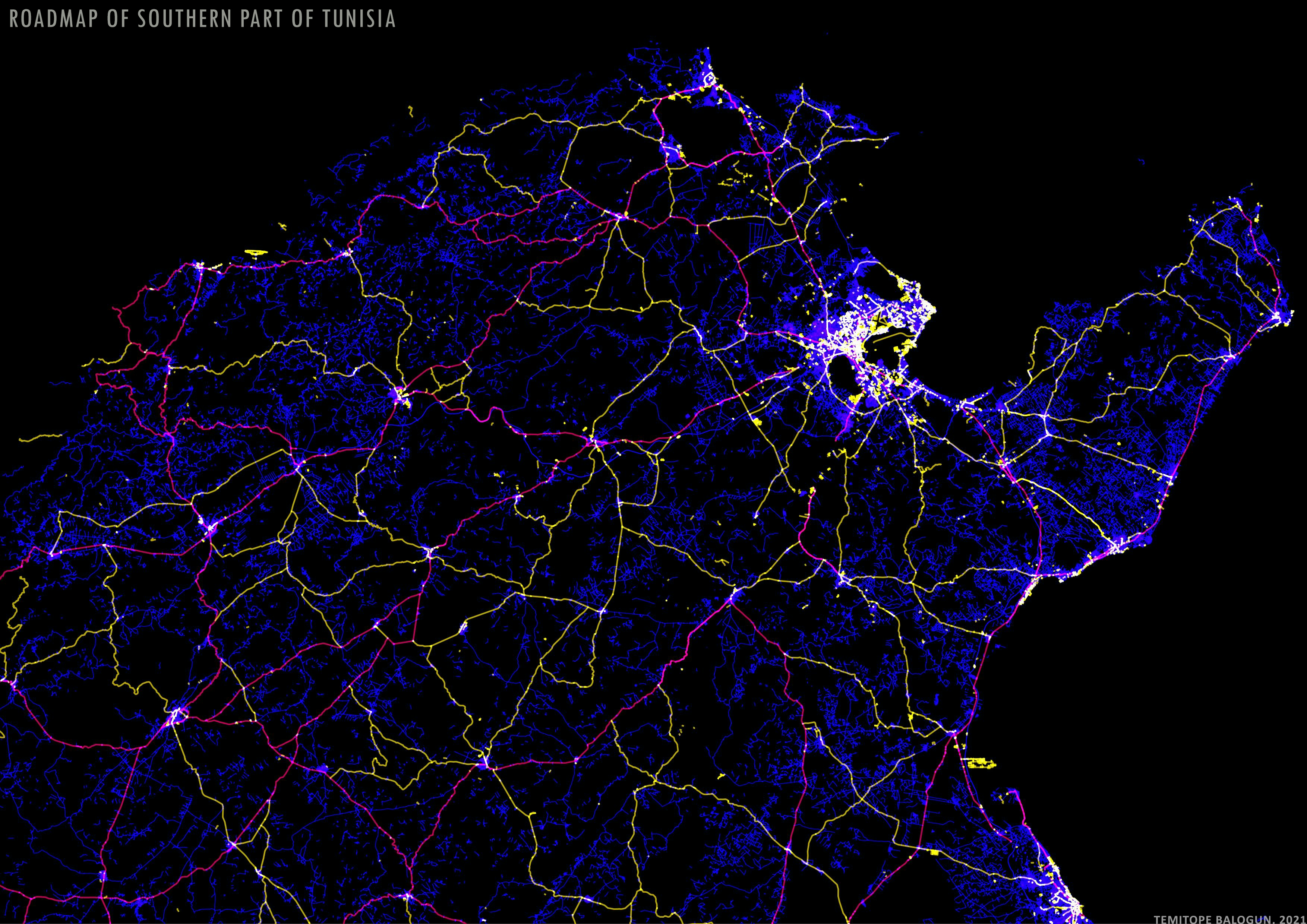
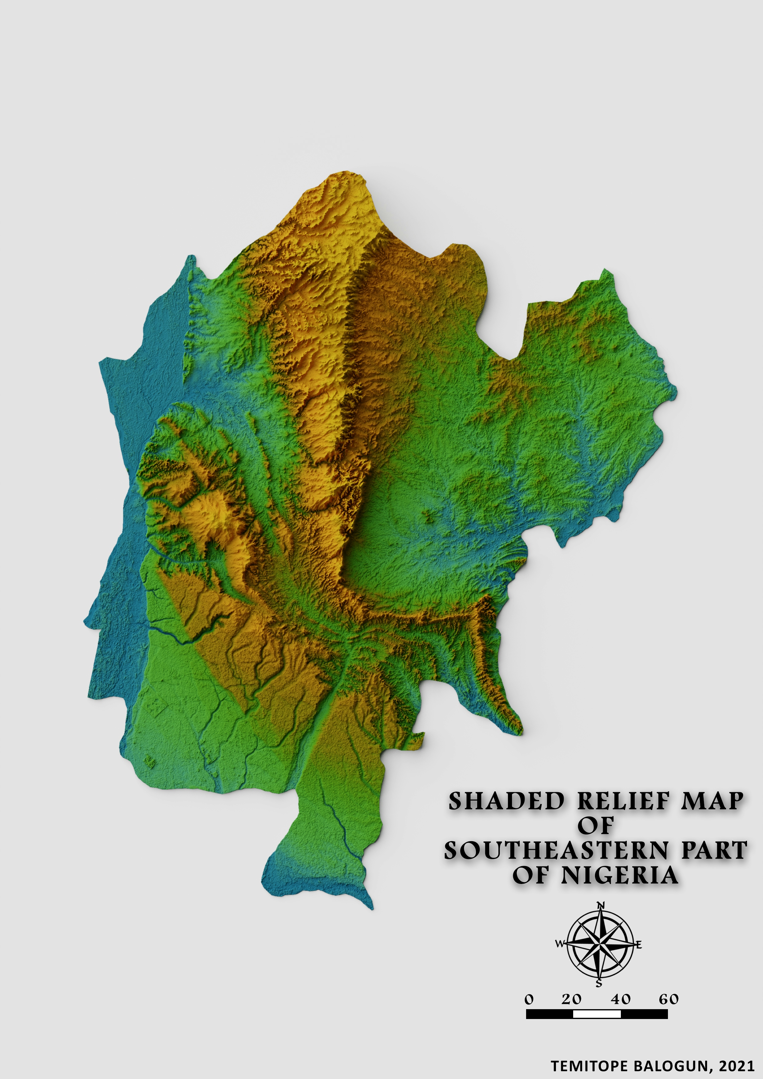
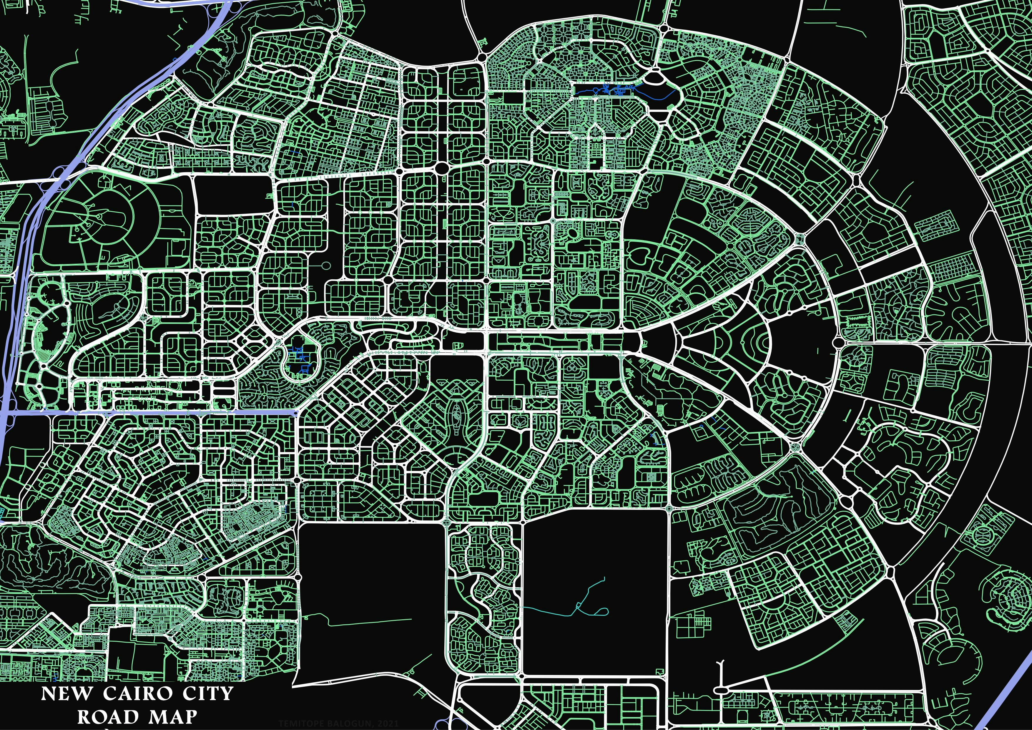
Roadmap of Southern part of Tunisia

Tools used
QGIS
Plug-ins used
OpenStreetMap
tags
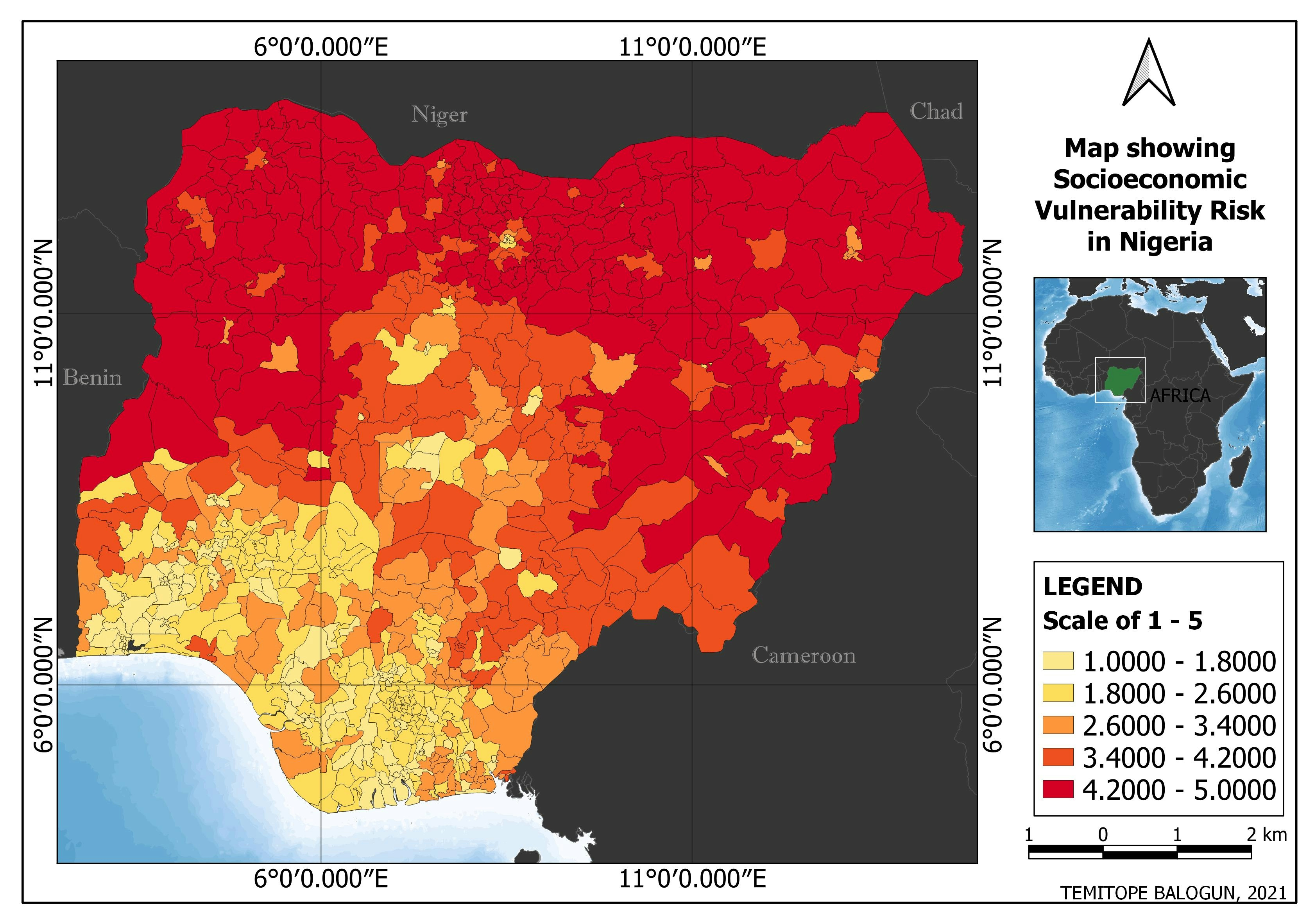
Data VisualizationQGIS
More by Balogun Temitope
You might also like


_1639877.jpg&w=48&q=40 "Guilherme Herculano de Oliveira")
Join the community!
We're a place where geospatial professionals showcase their works and discover opportunities.