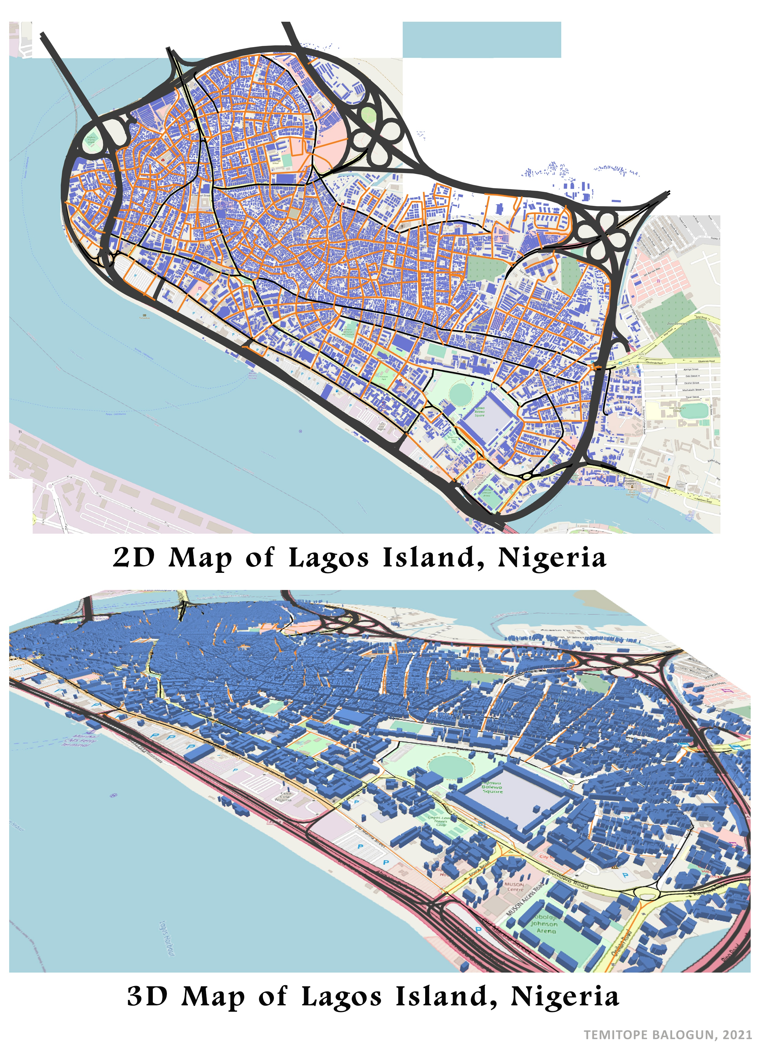
ABOUT THE ISLAND
Many people hear about Lagos Island but do you know Lagos Island?
This Island is surrounded by water, and a populated city with low land mass.Most Nigerian banks' head offices are located on Lagos Island. First Bank of Nigeria is one of the Nigerian banks with its head office in Marina, Lagos Island.
This island has contributed and still contributing economically to the development of the country.
ABOUT THE 3D MAP
Mapping and visualization is a huge area of work and is of interest to many people. We're working on reinventing a new kind of 3D cartography to make it easier to tell stories with 3D maps. — Jack Dangermond
Whenever I see a 3D map, I always feel I am inside an aircraft having an aerial view of a location. An advantage of these 3D maps is 3D maps provides a realistic view of a location that can be utilised by local authorities and planners. Another advantage is 3D Maps lets you discover insights you might not see in traditional two-dimensional (2D) maps. Infact, layman finds 3D easier to understand than 2D.
ANALYSIS
OpenStreetMap(OSM) serves as source of data(building shapefile). This building shapefile was downloaded from geofabrik.de and imported into QGIS environment. Since OSM basemap uses Pseudo Mercator projection, the shapefile was reprojected to pseudo Mercator projection.
A tool called View 3D Map was used to display the 2D building shapefile in 3D using OSM standard as basemap.


_645201.jpg&w=48&q=40 "Eguagie-suyi Precious")