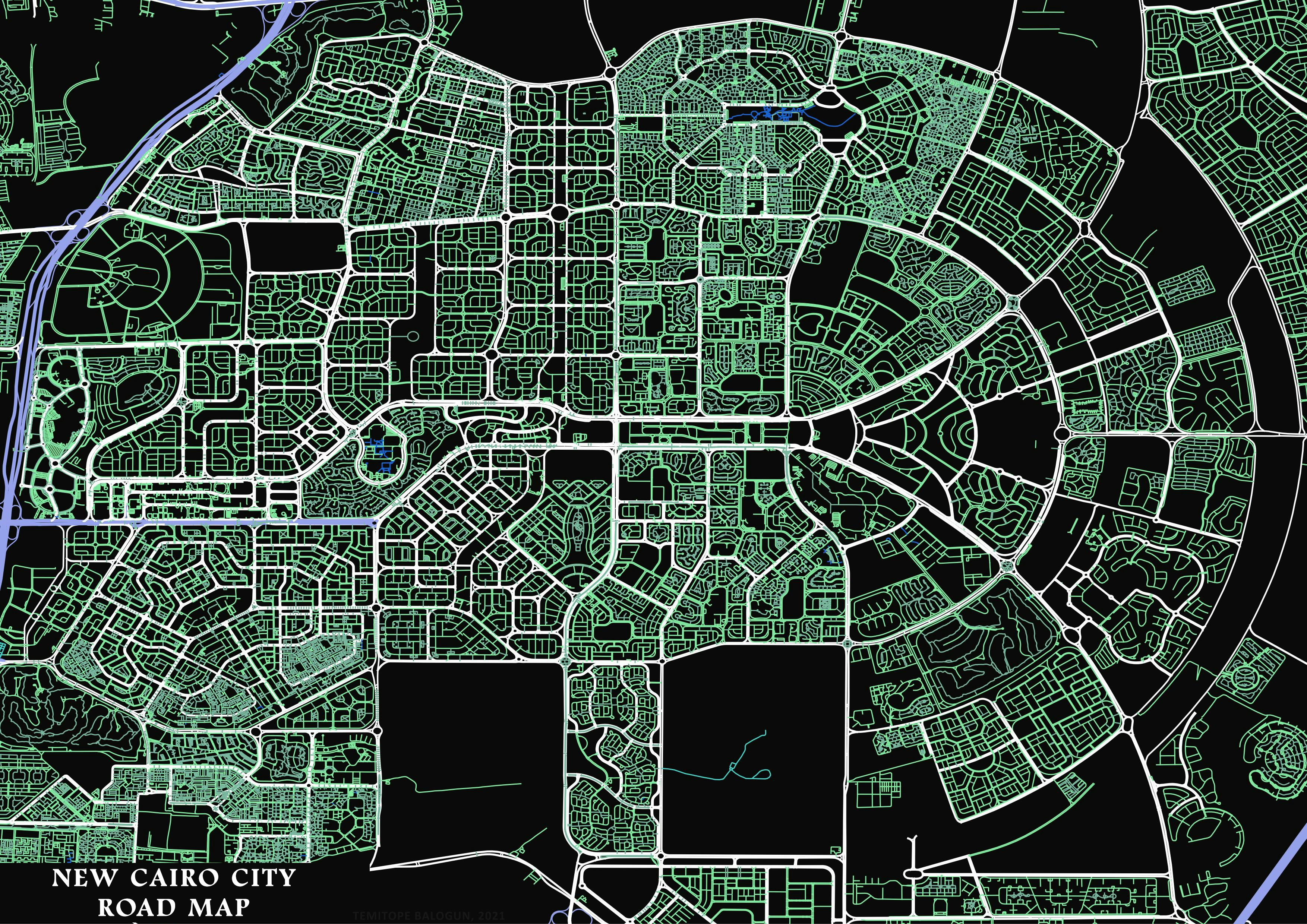
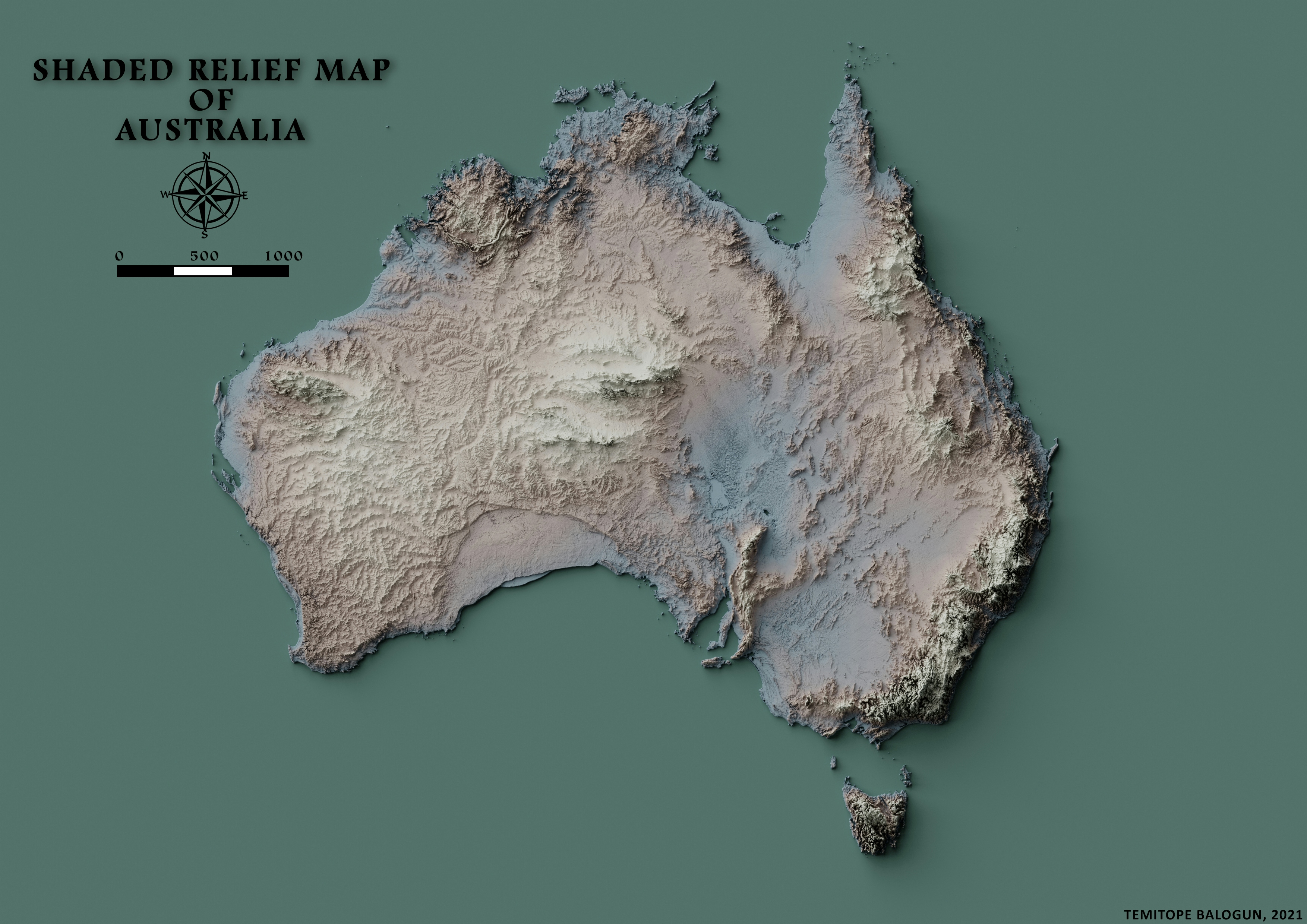
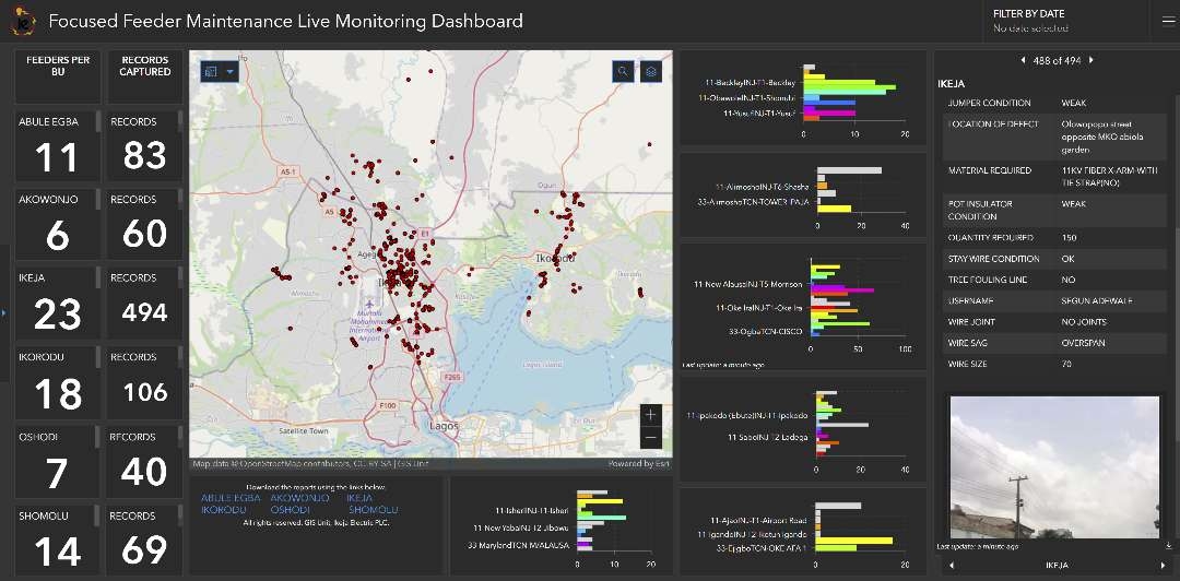
Road map of New Cairo City, Egypt

Tools used
QGIS
Plug-ins used
OpenStreetMap
tags
OpenStreetMapQGIS
More by Balogun Temitope

You might also like


.svg "Keran Nkongolo")


Join the community!
We're a place where geospatial professionals showcase their works and discover opportunities.