
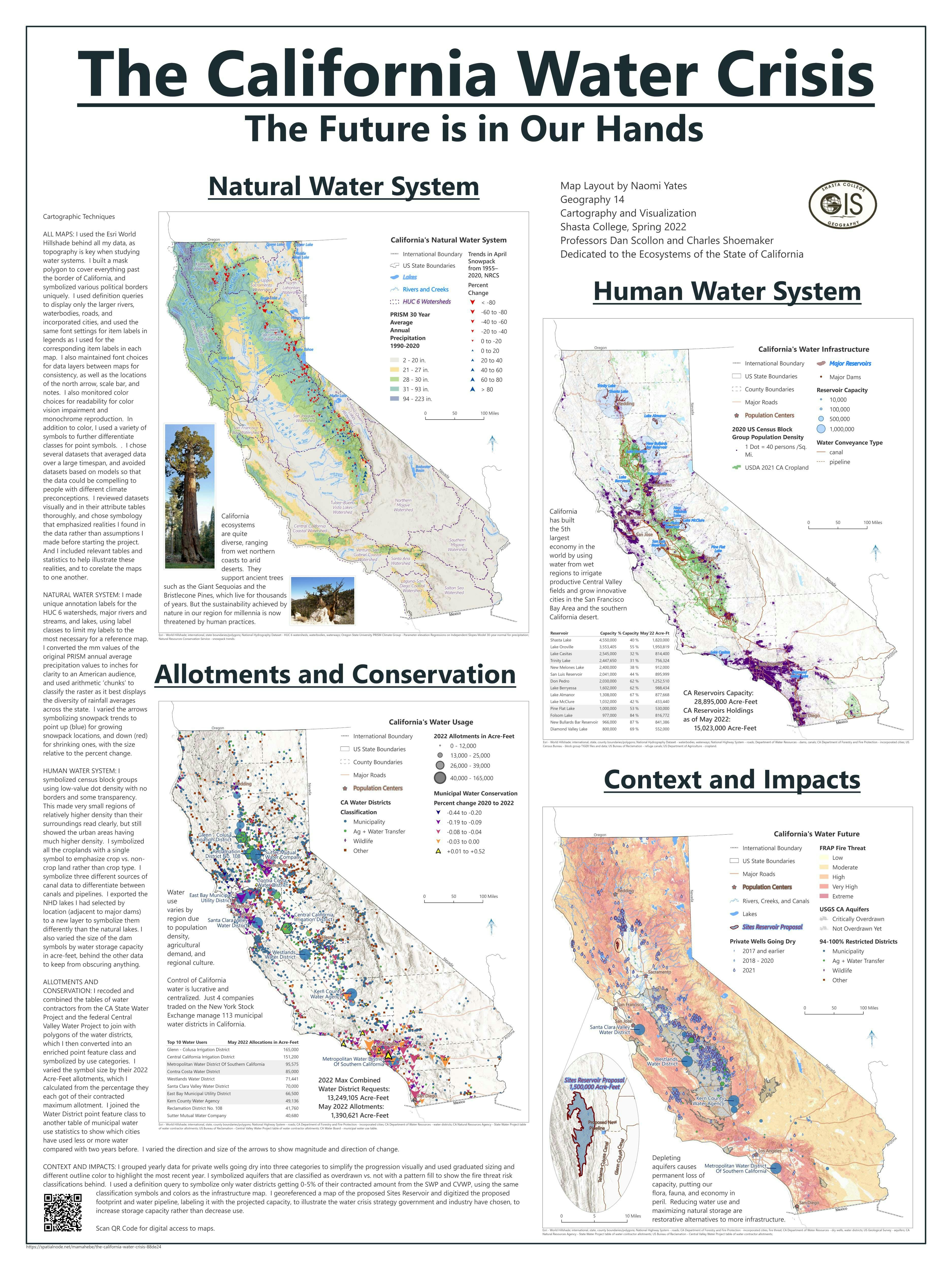
This linked static map layout and storymap consists of four maps of California hydrology. The purpose of the project is to demonstrate cartographic excellence, to inform Californians about the breadth of our current water crisis, and to gently point toward better solutions.
This project won awards this year from CGIA and URISA, and Naomi was sponsored to present the work at the 2022 URISA GIS-Pro Conference.
The first map illustrates the natural hydrological system of the state of California, including precipitation, snow-packs, watersheds, rivers, and lakes.
The second map focuses on the things human activity has added to that natural system, such as population density and agriculture, and the reservoirs and canals that bring water to them.
The third map quantifies the uses of surface water in the state of California leading up to the production date of the map in May 2022.
The final map highlights significant impacts made to the natural and human ecosystems of the state through over-drafting of aquifers. These include dry private wells, water districts under severe shortage, and extreme risk of fire.
Taken together, the four maps bring to light the incompatibility of California water infrastructure and use with the health of its natural ecological systems, and thus the healthy future of the state’s economy and ecology.


.jpg&w=3840&q=100)


