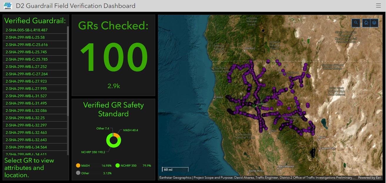
Guardrail Inventory Project
Responsibilities
- Preprocessed, geolocated, and recoded and refined excel data of existing guardrail beginnings and ends collected from Caltrans records.
- Designed and built guardrail geodatabase for updating locations and attributes of Caltrans District 2 guardrails in ArcGIS Pro and ArcGIS Enterprise.
- Performed editing and QA/QC on guardrail data to prepare it for publishing.
- Published data layers, maps, and designed apps for field verification of guardrails for safety standard compliance.
Key Achievements
- Project won first place in the URISA 2023 Digital Competition.
- Independently discovered and corrected data inconsistencies and errors during data preprocessing.
- Innovated process of geolocating data using Caltrans linear referencing Postmile resources within ArcGIS Pro.
- Found solution for hosting offline data collection imagery, shared it with other districts in Caltrans facing same hurdles.
- Documented project for presentation to all of Caltrans as potential cost-saving alternative to third-party data collection.


.svg "Keran Nkongolo")