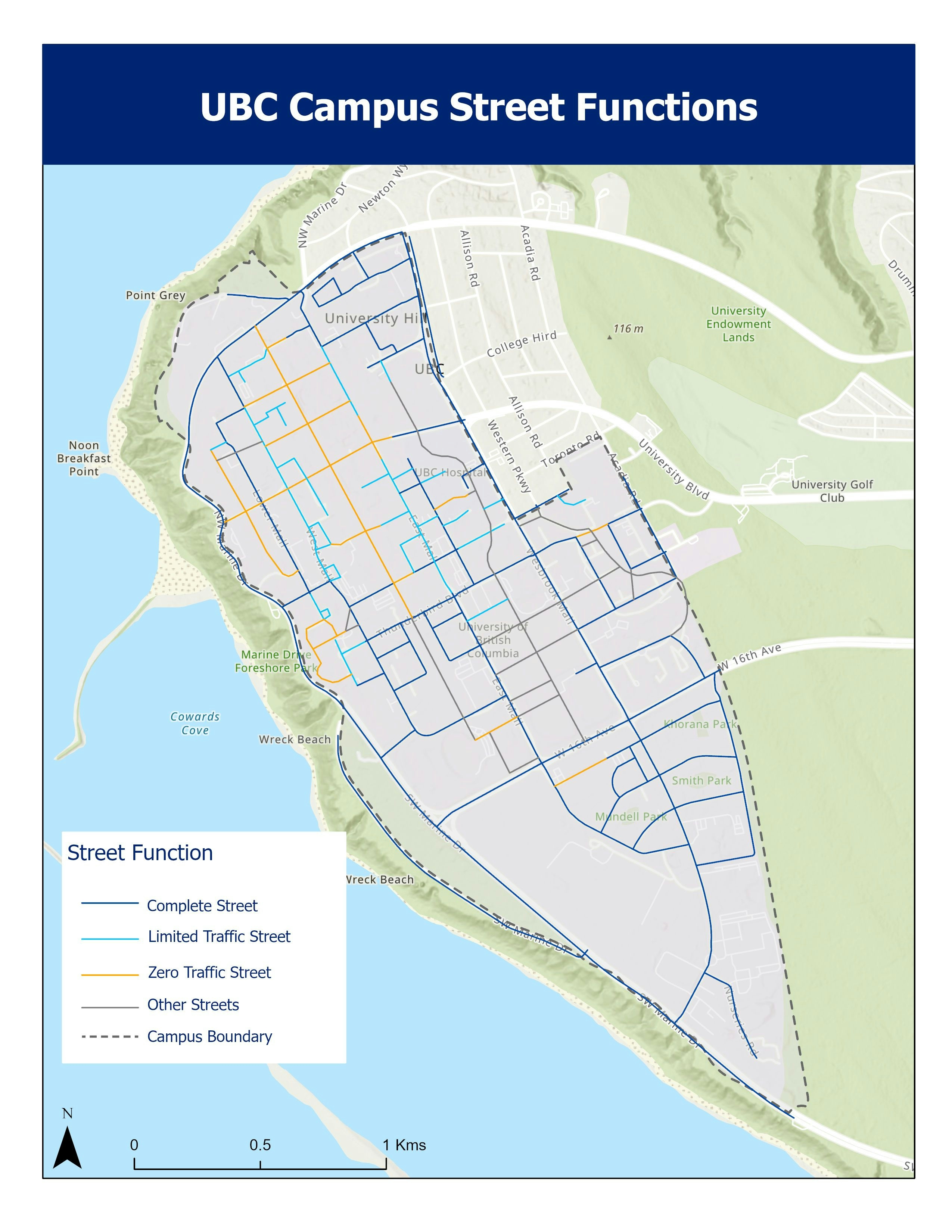
Data Preparation: To finalize the maps for the UBC Future Land Use Plan, a crucial step involved creating a clean roads layer classified to match the updated map used by campus planners. This required careful editing of the UBC Street functions layer, using the Street Network map as a base.
Road Classification: The existing categories of road classification needed significant updates to accurately reflect the evolving campus infrastructure and transportation requirements. This involved reclassifying various streets to better align with the campus's future land use goals. Categories of Street Functions (Source NACTO Guide):
a) Complete Street - Designed to accommodate all users, including pedestrians, cyclists, public transit riders, and motorists of all ages and abilities.
b) Limited Traffic Street - Restricted access or low-traffic street, designed to limit vehicular traffic to special or few vehicles only.
c) Zero Traffic Street - Car-free and pedestrian-only street, vehicular traffic entirely prohibited.
Road Network Refinement: In order to achieve seamless integration of the road network on the land-use plan, certain streets had to be deleted and newly created to symbolize traffic flow and accessibility on the UBC campus.