Sign up or log in to your Spatialnode account.

Takes less than a few seconds.

Vancouver 100 Hectare Site Analysis

Satyam Soni
Satyam Soni•

March 27, 2023

Vancouver 100 Hectare Site Analysis

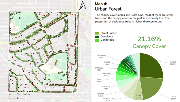
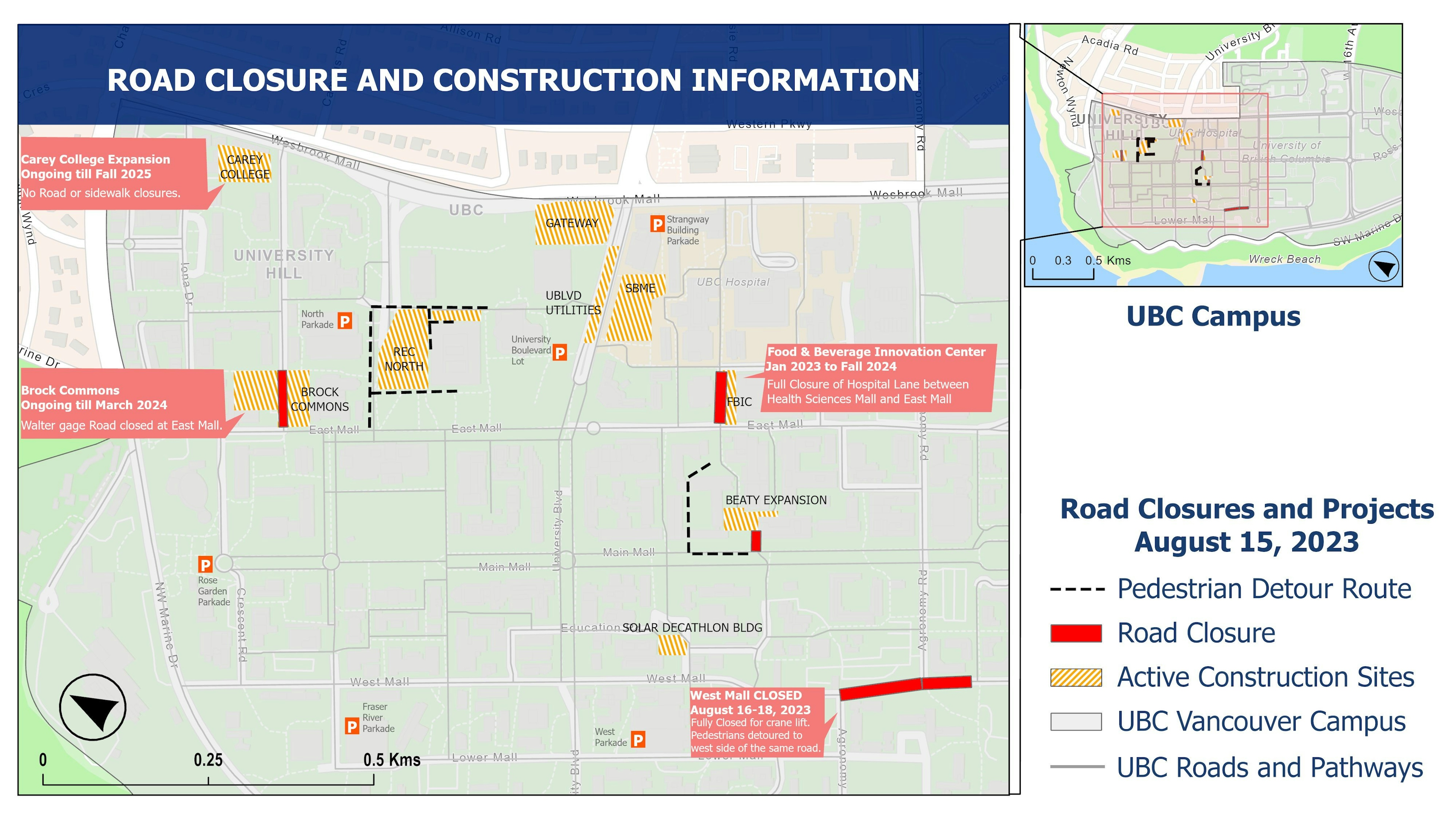
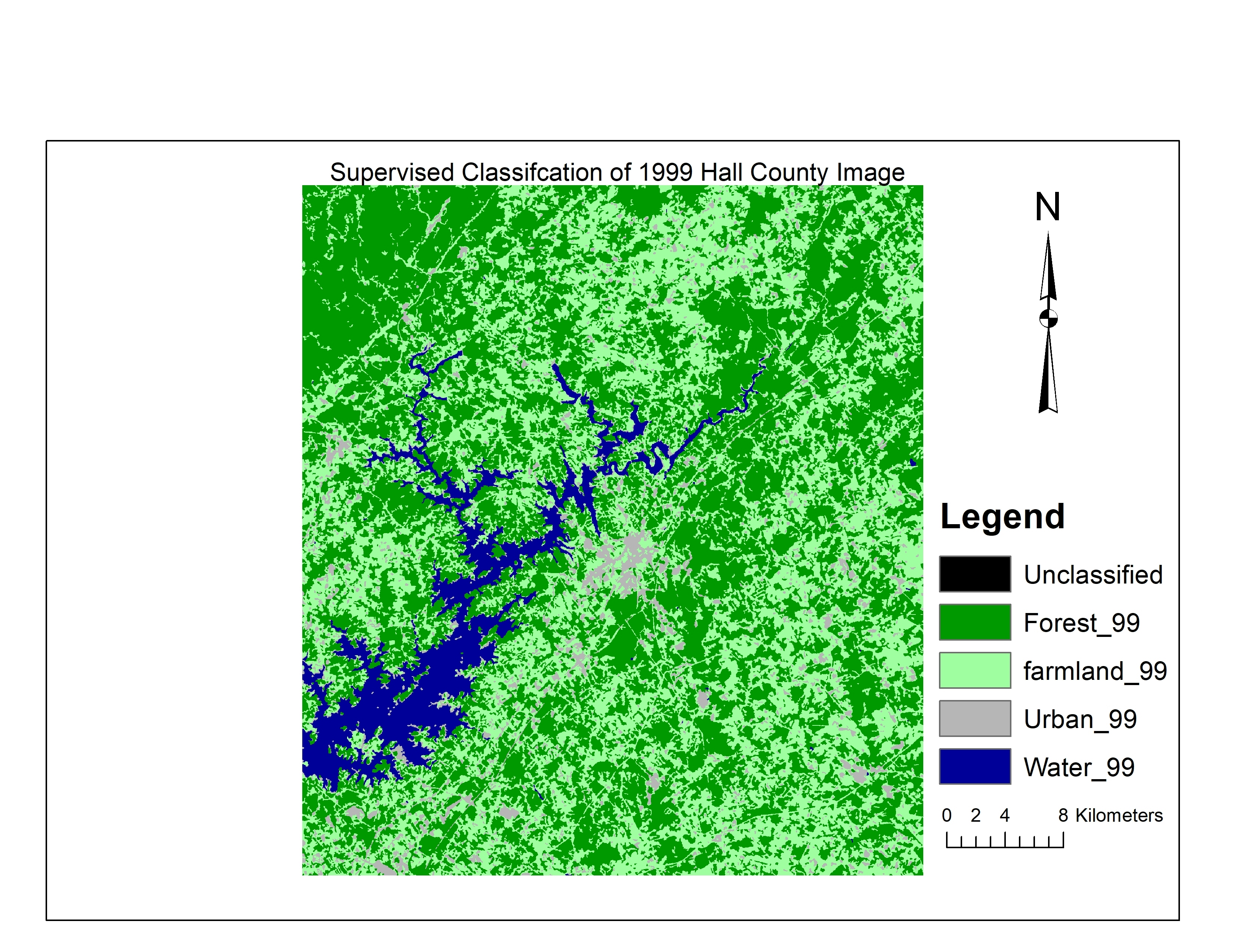
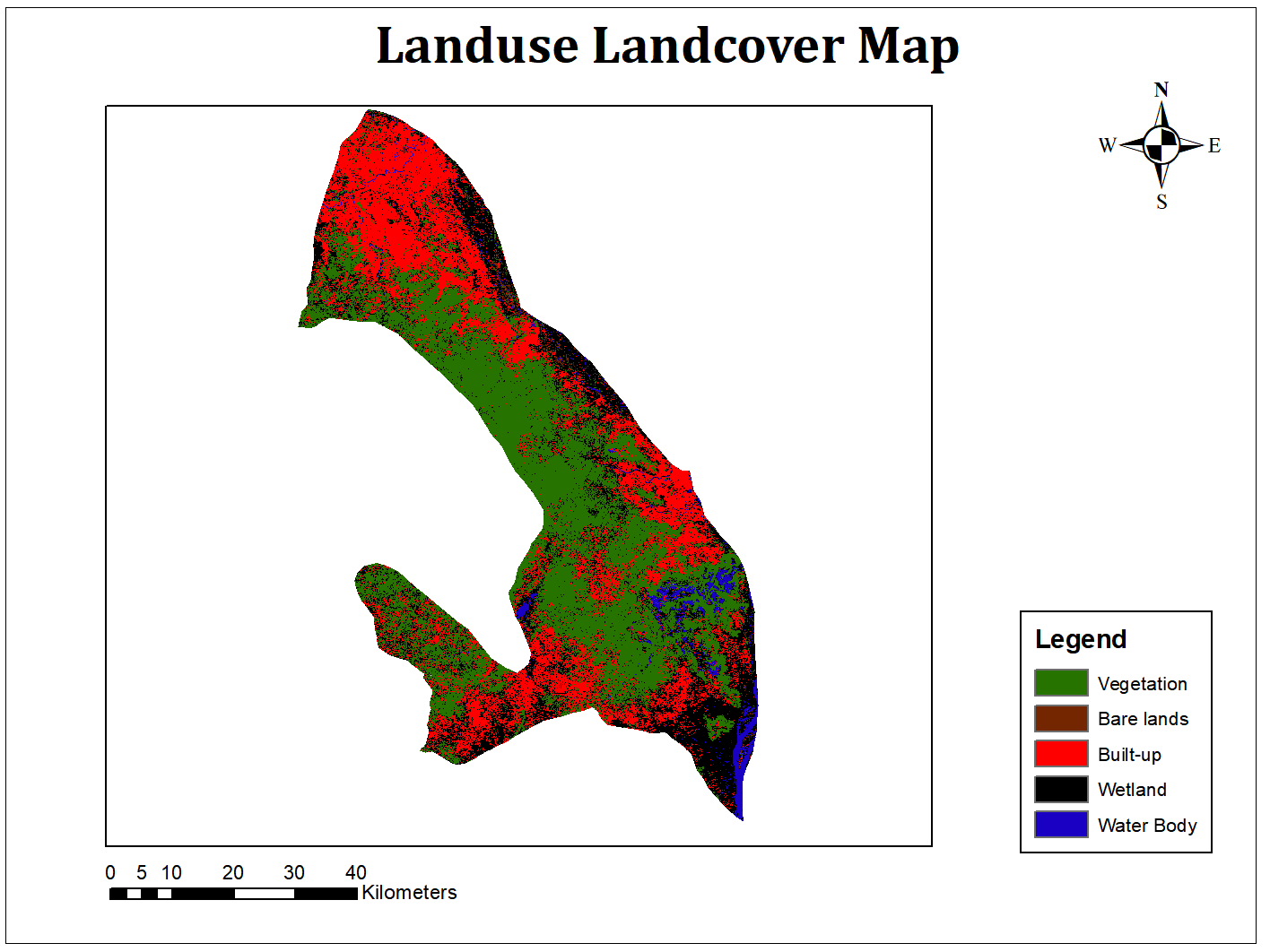
Map showcasing an analysis of a 100-hectare site of Vancouver focusing on land use, urban forest etc. characteristics


Tools used

ArcGIS ProArcMapGoogle Earth Engine(GEE)MS OfficeQGIS

Plug-ins used

City of Vancouver VanMap

tags

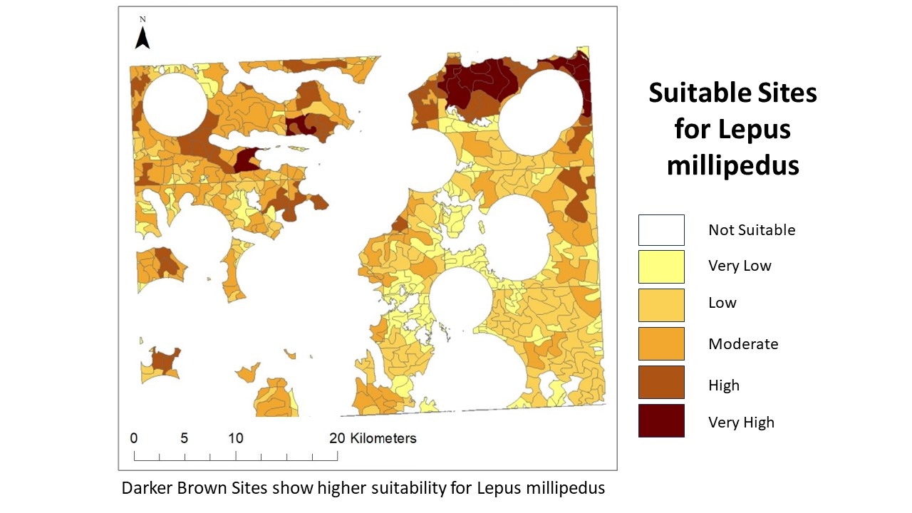
Cartography#Habitat Suitabilityland coverland useModelbuilder

More by Satyam Soni

41st Avenue Vancouver Imperviousness
32
UBC Vancouver Streets Function Map
116
Habitat Suitability for Species
77
UBC Road Closure and Construction Map
49
Kerrisdale Park Walkshed Analysis
41
Residents' Proximity to Greenspace
25
Tree Species Distribution
47
Land Use Map of a Block of Vancouver
25
Interactive UBC Buildings Time Slider
47

You might also like

NDVI da Microrregião ParaibunaParaitinga
Lucas de Siqueira Cardinelli
NDVI da Microrregião ParaibunaParaitinga
Lucas de...
26
Strawberry fields of Europe
Ayeisha Sheldon
Strawberry fields of Europe
Ayeisha Sheldon
389
Sistema Viário RMBH
Emanuel Sanches
Sistema Viário RMBH
Emanuel Sanches
45
Mapa temporal das enchentes no RS (1/2)
Rodrigo Chemite Barbosa
Mapa temporal das enchentes no RS (1/2)
Rodrigo Chemite Barbosa
9
MAPA DE LOCALIZAÇÃO EMPREENDIMENTO
Edvaldo Alves Neto
MAPA DE LOCALIZAÇÃO EMPREENDIMENTO
Edvaldo Alves Neto
131
Percentage of tree canopy cover (PCA)
Matheus Medici
Percentage of tree canopy cover (PCA)
Matheus Medici
22
4b: Snapping Waterlines
carson allen
4b: Snapping Waterlines
carson allen
13
Mapa de intervenção em APP
Carla Américo
Mapa de intervenção em APP
Carla Américo
12
Áreas de influência do empreendimento
Leví Carneiro Oliveira
Áreas de influência do empreendimento
Leví Carneiro Oliveira
15
Mapeamento do BR Canopy Insight
Augusto Fernandes
Mapeamento do BR Canopy Insight
Augusto Fernandes
42
Avalahalli Cadastral Map- L3
Stefy Abraham
Avalahalli Cadastral Map- L3
Stefy Abraham
10
NAIROBI COUNTY 2021 NDVI/NDBI
Mary Muthee
NAIROBI COUNTY 2021 NDVI/NDBI
Mary Muthee
56

Join the community!

We're a place where geospatial professionals showcase their works and discover opportunities.

Sign Up for free