Sign up or log in to your Spatialnode account.

Takes less than a few seconds.

Car Collisions in Los Angeles 2014-2019

Harrison Hyatt
Harrison Hyatt•

May 16, 2022

Car Collisions in Los Angeles 2014-2019

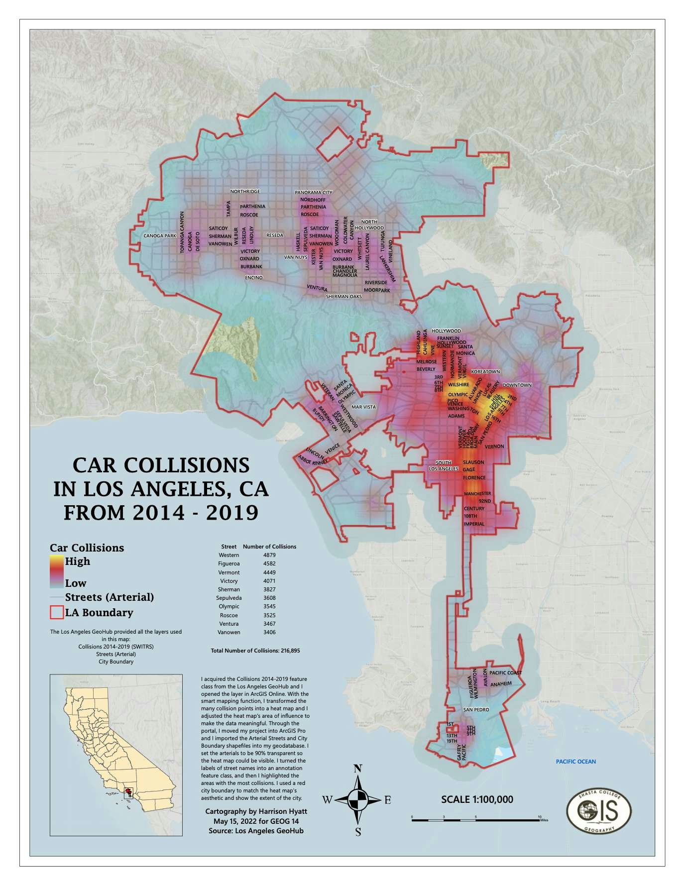
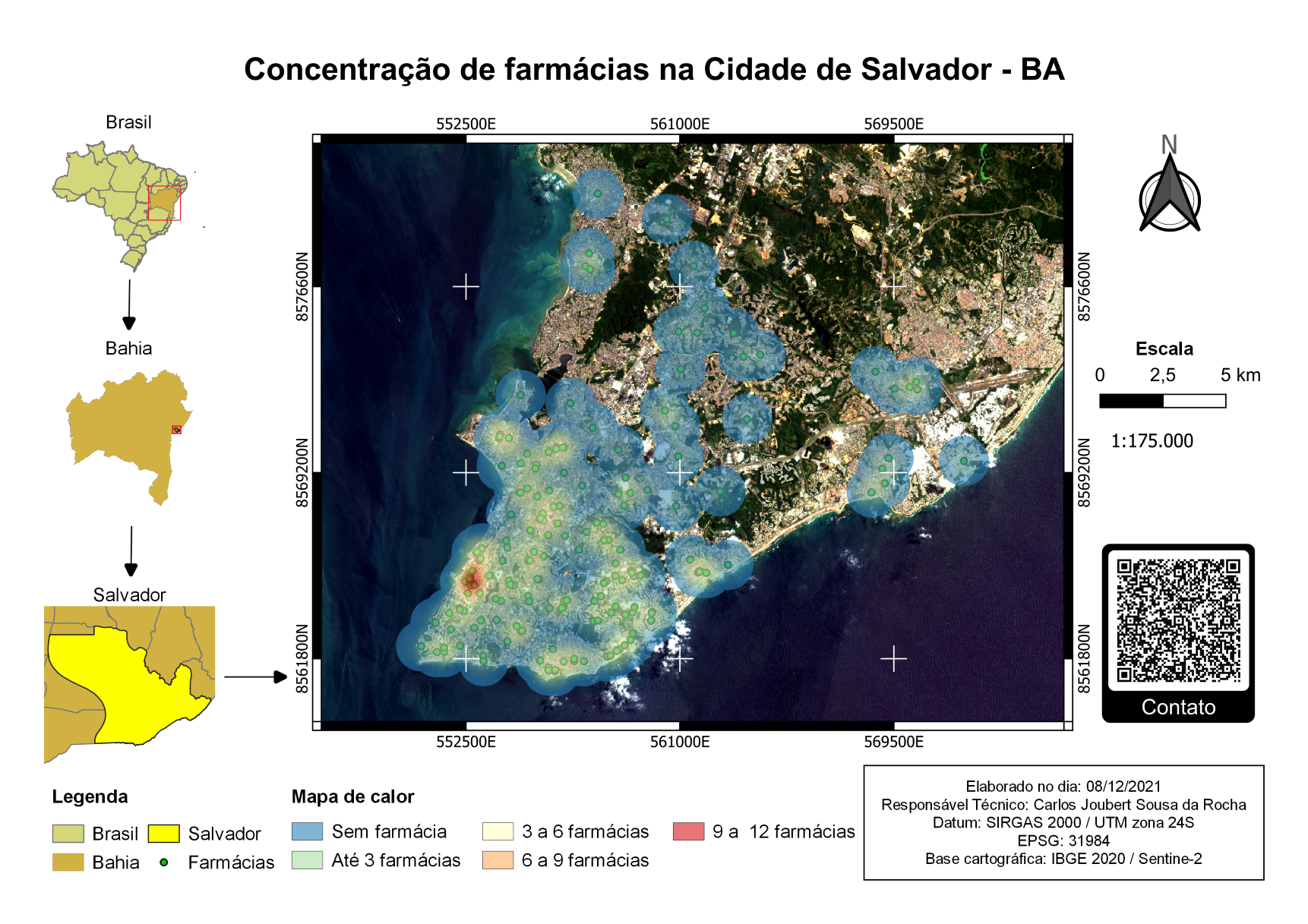
This heat map displays where the most car collisions occurred in Los Angeles, CA.


Tools used

ArcGIS OnlineArcGIS Pro

tags

collisionslos angeles

More by Harrison Hyatt

A Visitor's Guide to Miracle Mile, LA
26
Boundaries of Waters of the US
22
Saving Kauai's Seabirds
16
City of Redding
City of Redding
24
Pordenton School District
36
New York City Open Data
81

You might also like

AGOL - BCS Data Viewer
Jeffrey Erwin
AGOL - BCS Data Viewer
Jeffrey Erwin
12
Mapa Hipsométrico
Amanda Ellen da Silva Conceição
Mapa Hipsométrico
Amanda Ellen...
94
GEO For Good 2021 - WildFire Animation
Noel Png
GEO For Good 2021 - WildFire Animation
Noel Png
491
Pearl River, Louisiana
Hugo Pereira Lima
Pearl River, Louisiana
Hugo Pereira Lima
12
Map of North East Region in Ghana
Annan Kingsford Kobina
Map of North East Region in Ghana
Annan Kingsford Kobina
17
Mapa Precipitação
Marco Zero Geologia
Mapa Precipitação
Marco Zero Geologia
89
Temperature Heat Map - Argentina
Martin Nuñez Igarzabal
Temperature Heat Map - Argentina
Martin Nuñez Igarzabal
41
Mapa de população
Jardel Estevam Barbosa dos Santos
Mapa de população
Jardel Estevam...
5
Liberty Ibadan Street Map
Emeka Ude
Liberty Ibadan Street Map
Emeka Ude
36
Land Use and Occupation of Três Corações
Kauê Santos Lima
Land Use and Occupation of Três Corações
Kauê Santos Lima
30
TTC Subway
Marcelo Aguilera
TTC Subway
Marcelo Aguilera
239
Geospatial Data for Corsan Sanitation
Kaio Serrano Galvão
Geospatial Data for Corsan Sanitation
Kaio Serrano Galvão
23

Join the community!

We're a place where geospatial professionals showcase their works and discover opportunities.

Sign Up for free