Sign up or log in to your Spatialnode account.

Takes less than a few seconds.

New York City Open Data

Harrison Hyatt
Harrison Hyatt•

May 24, 2022

New York City Open Data

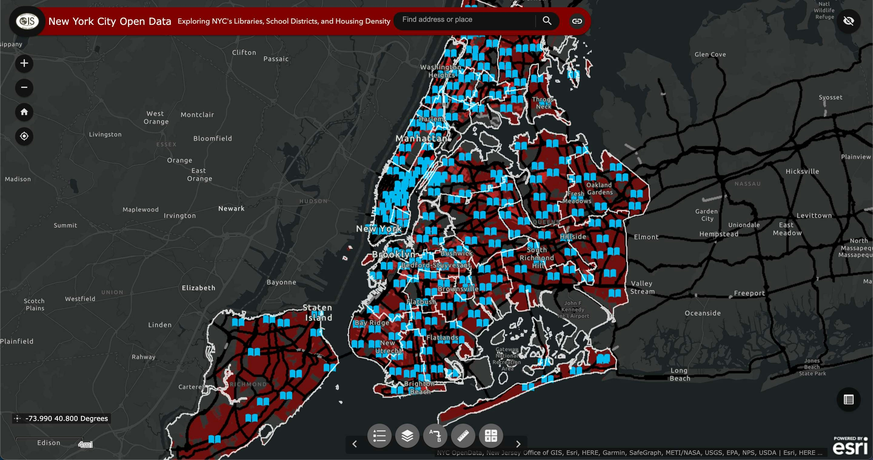
This dashboard explores NYC's libraries, school districts, and housing density.

Demo

Tools used

ArcGIS Dashboards

tags

nyc

More by Harrison Hyatt

Boundaries of Waters of the US
22
City of Redding
City of Redding
22
A Visitor's Guide to Miracle Mile, LA
23
Pordenton School District
36
Car Collisions in Los Angeles 2014-2019
79
Saving Kauai's Seabirds
16

You might also like

Digital Elevation Model of Oyo State.
Olawuyi Abolade Pelumi
Digital Elevation Model of Oyo State.
Olawuyi Abolade Pelumi
32
Youtube as Remote Sensing
Andrew Middleton
Youtube as Remote Sensing
Andrew Middleton
771
Mapa NDVI
Luiz Gustavo De Góes Sterle
Mapa NDVI
Luiz Gustavo...
57
RMNA People In Need Map
George Cabrera
RMNA People In Need Map
George Cabrera
6
Education Level of Marion County
Jason Boatjri
Education Level of Marion County
Jason Boatjri
10
NHL Team Locations by Division
Nick Linell
NHL Team Locations by Division
Nick LinellPro
4
Hipsometria de Araponga - MG
Henrique Cesar Bitencourt
Hipsometria de Araponga - MG
Henrique Cesar Bitencourt
39
Unioncorn Companies Analytics
Adedoyin Ajeyomi
Unioncorn Companies Analytics
Adedoyin Ajeyomi
75
Mapa de Hierarquia fluvial
Thátila de Jesus Assis
Mapa de Hierarquia fluvial
Thátila de...
8
Contexto geológico local
Jailane de Sousa Gomes
Contexto geológico local
Jailane de...
157
Mapa Comparativo sobre o método (DOS)
Breno Nunes
Mapa Comparativo sobre o método (DOS)
Breno Nunes
15
Rondonia land use classifcation
Millie Brand
Rondonia land use classifcation
Millie Brand
47

Join the community!

We're a place where geospatial professionals showcase their works and discover opportunities.

Sign Up for free