Sign up or log in to your Spatialnode account.

Takes less than a few seconds.

Oceans Map

Marica di Girolamo
Marica di Girolamo•

March 30, 2023

Oceans Map

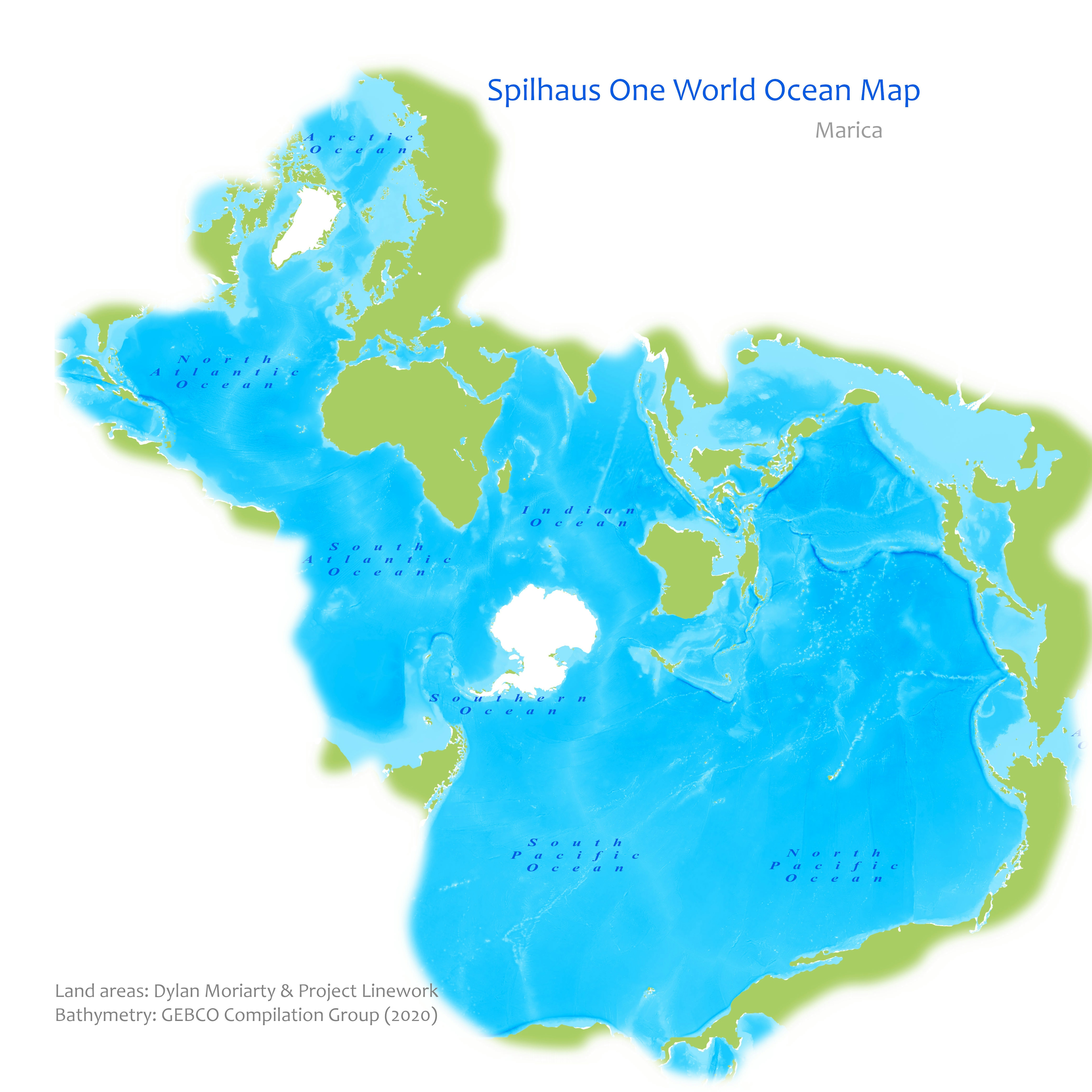
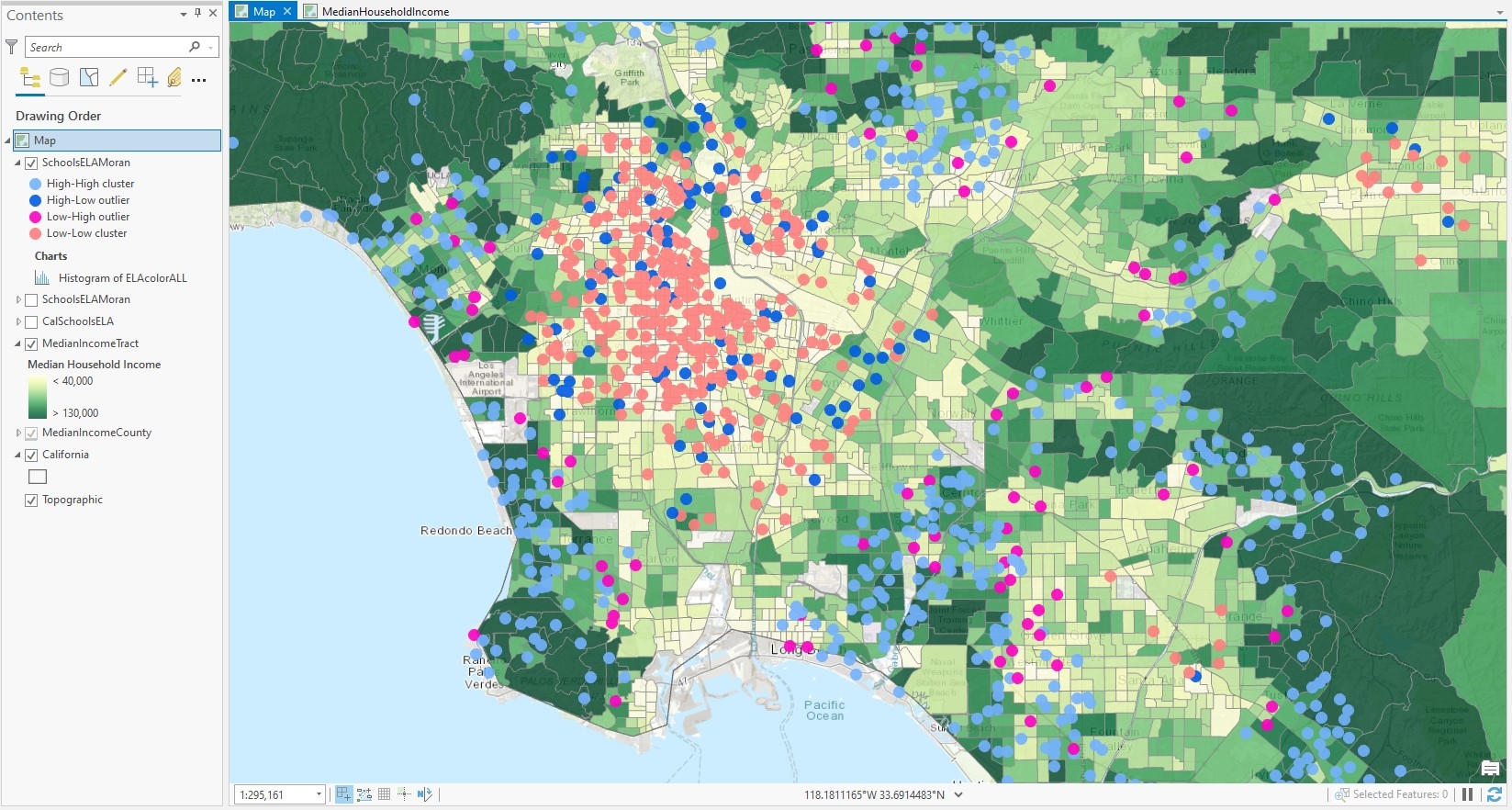
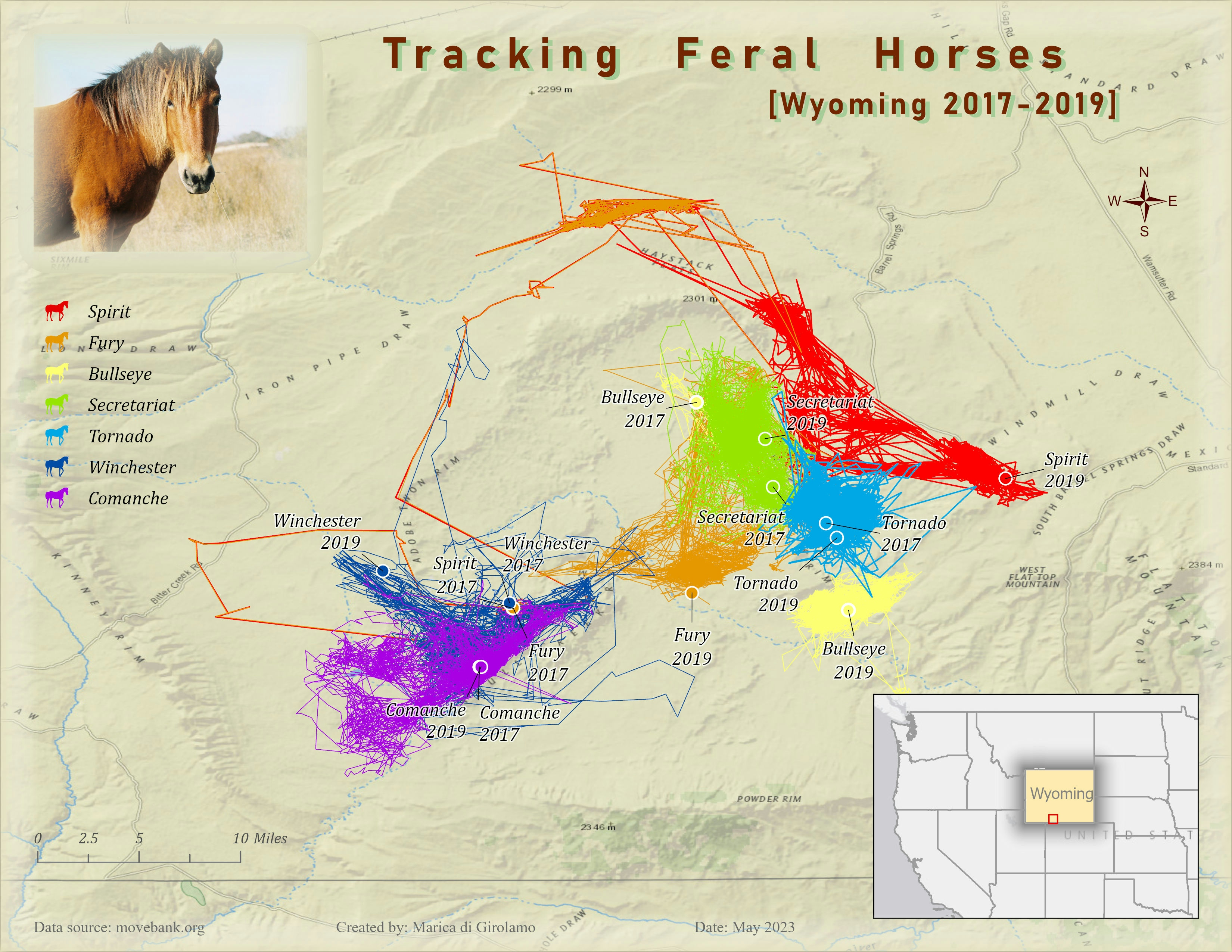
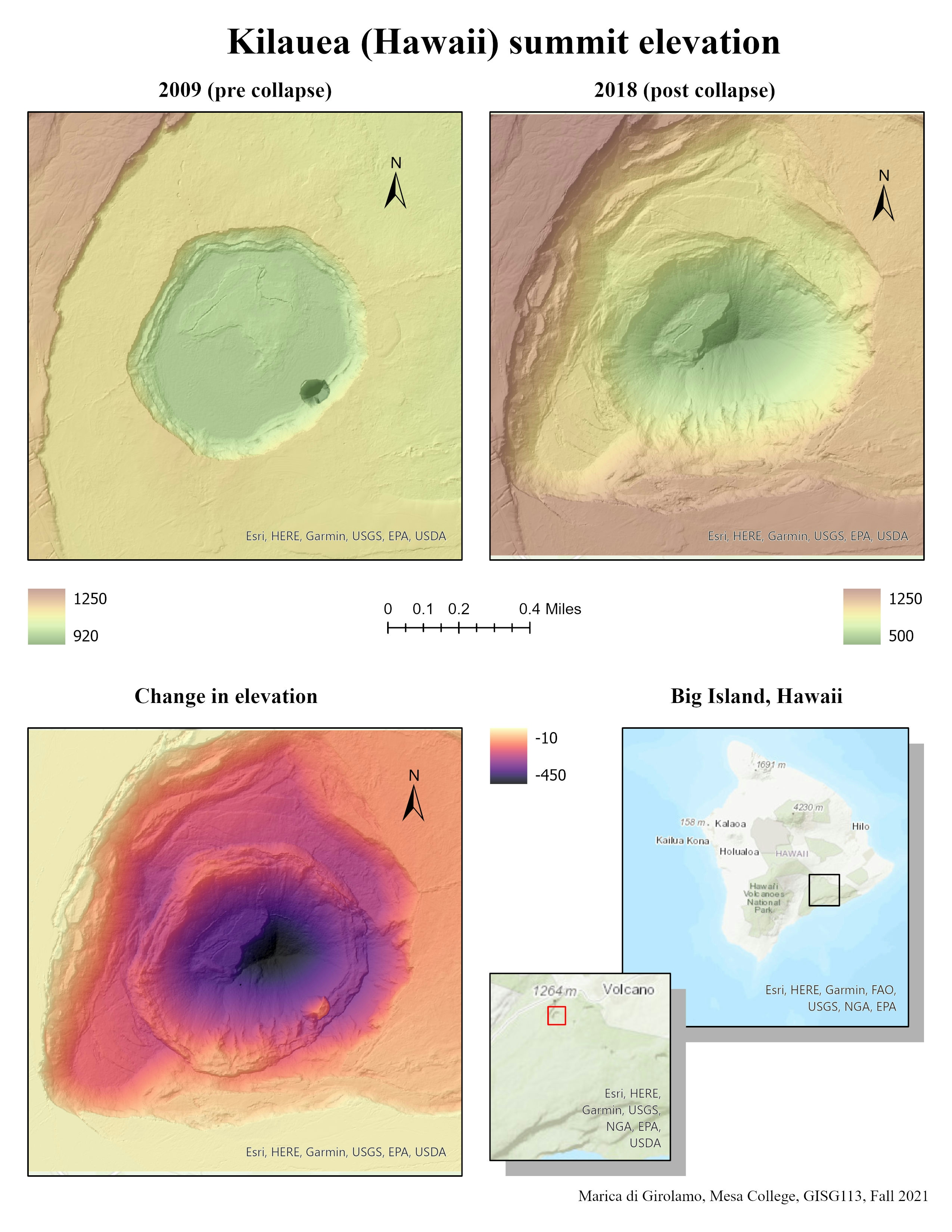
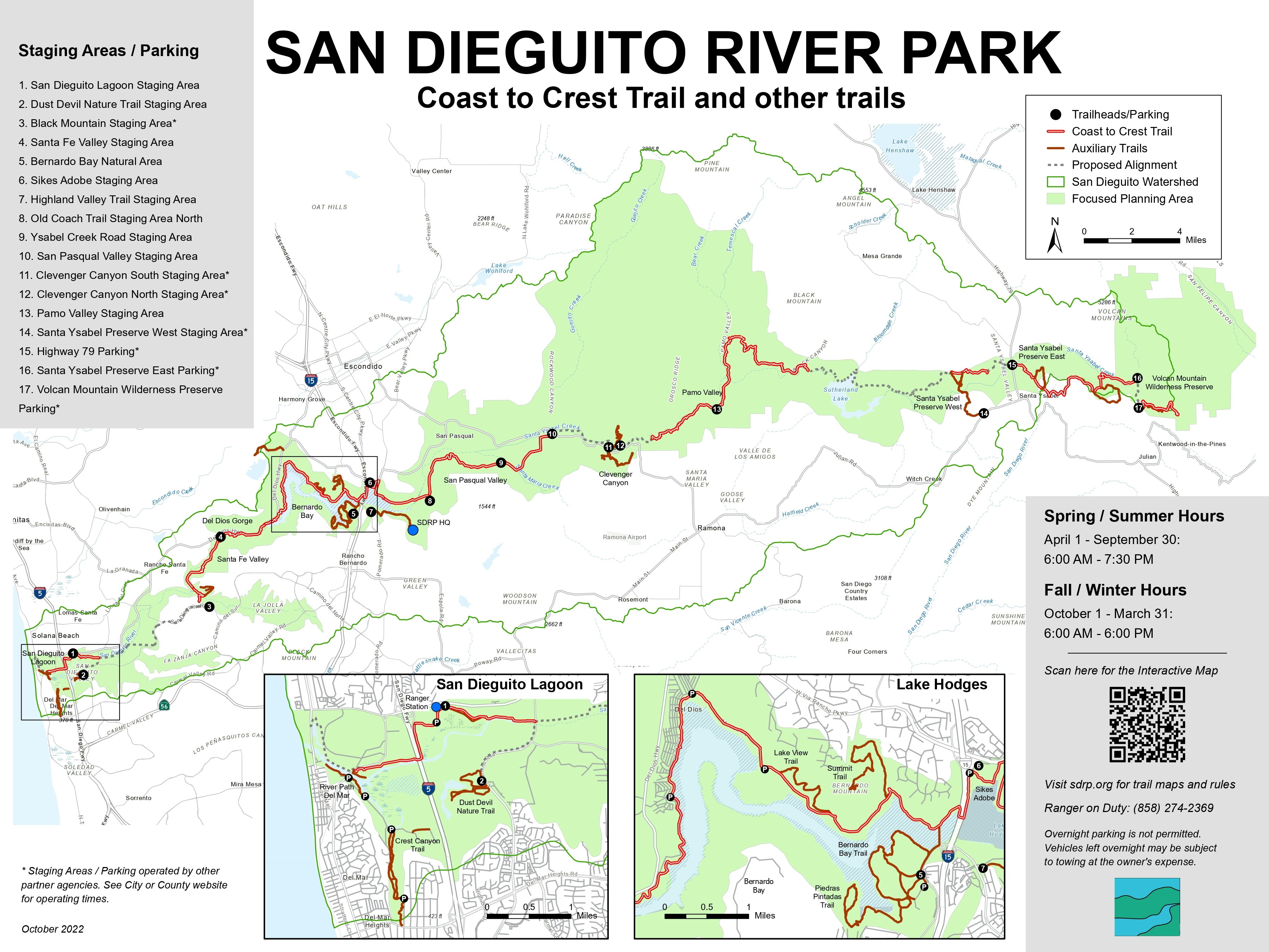
Map realized during the Esri Mooc Cartography class. 


Tools used

Projections

Plug-ins used

ArcGIS Pro

tags

ocean

More by Marica di Girolamo

Tracking Feral Horses
15
Wildlife Sightings
Wildlife Sightings
21
Earthquakes 1898 - 2017
18
San Dieguito River Park - Map
16
Schools rating and Household Income
14
San Dieguito River Watershed
28
Kilauea Summit Elevation
26

You might also like

City of Bend, OR: Wildfire Exposure Map
Tate Ewing
City of Bend, OR: Wildfire Exposure Map
Tate Ewing
41
Mapping 2021 Dixie wildfire.
Kolawole Arowoogun
Mapping 2021 Dixie wildfire.
Kolawole Arowoogun
291
Cláudio D´Assunção Ferreira
Perícia em condomínio
Cláudio D´Assunção Ferreira
5
Georeferencing antique geological map.
Miriela Ulloa Santana
Georeferencing antique geological map.
Miriela Ulloa Santana
70
Cadeia produtiva da soja no Mato Grosso
Tainá Nogueira de Almeida
Cadeia produtiva da soja no Mato Grosso
Tainá Nogueira...
44
Canopy Cover and Heat Severity
Sean Willis
Canopy Cover and Heat Severity
Sean Willis
76
How can you create your own Django Applications leveraging on data from Google Earth Engine?
Joseph Thuha
How can you create your own Django Applications leveraging on...
Joseph Thuha
806
Mapa Topográfico
José Geraldo Ribeiro Junior
Mapa Topográfico
José Geraldo...
11
Queimada na região de Poconé-MT
Rogério Gusmão Junior
Queimada na região de Poconé-MT
Rogério Gusmão Junior
16
Land Cover Types in Oregon Counties
Brittany Biro
Land Cover Types in Oregon Counties
Brittany Biro
17
Louisville Light Rail Proposal
Sean Willis
Louisville Light Rail Proposal
Sean Willis
88
Zoneamento Plano Diretor Recife
Renata Maciel
Zoneamento Plano Diretor Recife
Renata Maciel
23

Join the community!

We're a place where geospatial professionals showcase their works and discover opportunities.

Sign Up for free