
🌐 Introduction:
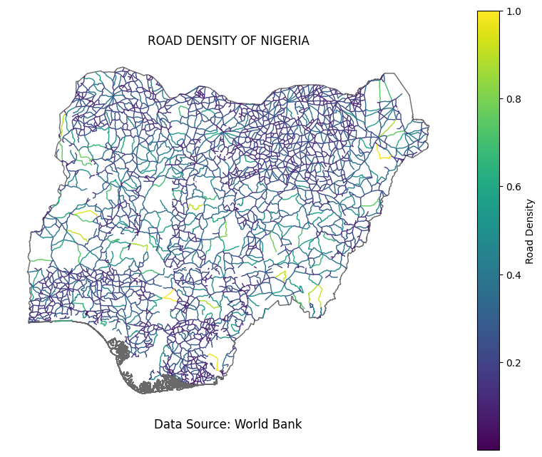
Roads are the lifelines of any nation, connecting people, businesses, and regions. In Nigeria, understanding road density is crucial for effective infrastructure planning and development. This map, powered by Geographic Information Systems (GIS) and utilizing open data from the World Bank, visually represents road density across Nigeria.
🛣️ The Map:
This map employs a gradient color scheme, ranging from light to dark, to depict road density. Darker areas signify higher road density, indicating better connectivity and accessibility. Analyzing this data provides valuable insights for policymakers, urban planners, and researchers.
📈 Why It Matters:
Facilitating Economic Growth: Improved road connectivity stimulates economic activities by easing the movement of goods and people.
Enhanced Urban Planning: Better understanding of road density helps plan efficient transportation systems and urban development.
Socio-Economic Development: Accessible roads lead to improved access to education, healthcare, and markets, contributing to overall development.
🔗 Data Sources and Tools:
Data Source: World Bank
Geographic Data Processing: GeoPandas
Visualization: Matplotlib
🌍 Conclusion:
This road density map of Nigeria offers a glimpse into the nation's infrastructure landscape. By harnessing the power of GIS and open data, we can make informed decisions for a more connected and prosperous Nigeria. Together, let's pave the way to a brighter future.
#GIS #Nigeria #RoadDensity #Infrastructure #Connectivity


.jpeg&w=3840&q=100)
