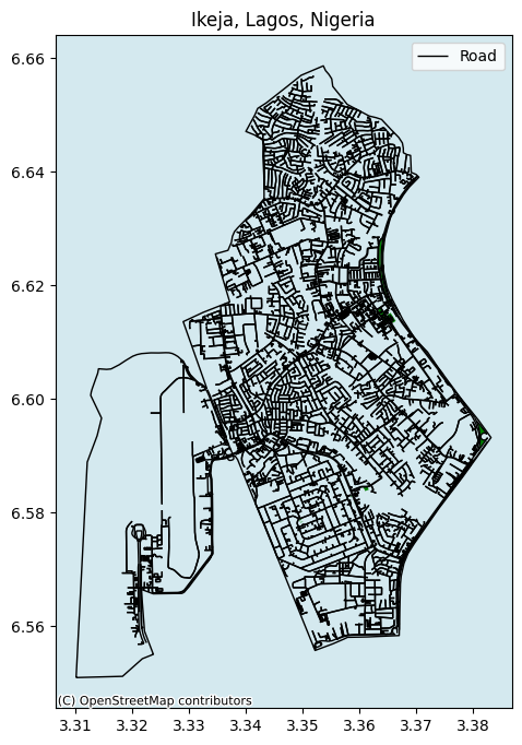
🌍 Exploring Ikeja, Lagos, Nigeria: A Geospatial Mapping Project 🗺️
In this captivating project, I delved into the heart of Ikeja, Lagos, Nigeria, using the power of geospatial data and technology to unravel the city's rich tapestry. Here's a glimpse into what went into this exploration:
📊 Geospatial Data Collection: The foundation of this project was the collection of geospatial data. Using the remarkable OSMnx library, I retrieved the intricate road network of Ikeja, enabling me to visualize the city's connectivity and infrastructure.
🏙️ Urban Mapping: Ikeja's streets tell the story of its urban life. With meticulous detail, I mapped the street edges, revealing the veins that pulse with the energy of the city's inhabitants.
🎨 Styling and Visualization: Careful attention was given to styling the map. Different layers, including parks, streets, and the area footprint, were styled and assigned z-orders to ensure visual clarity and hierarchy.
📷 Capture and Presentation: Finally, I captured the visualization as an image, ready to be shared with the world. This image encapsulates the essence of Ikeja, from its urban streets to its green sanctuaries.
This project is a testament to the power of geospatial analysis and mapping in understanding and appreciating our urban environments. Ikeja, Lagos, Nigeria, with its vibrant culture and dynamic urban landscape, served as both muse and canvas for this endeavor.