
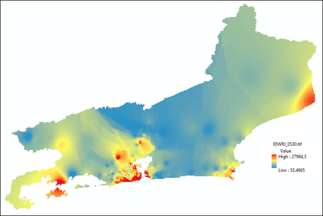
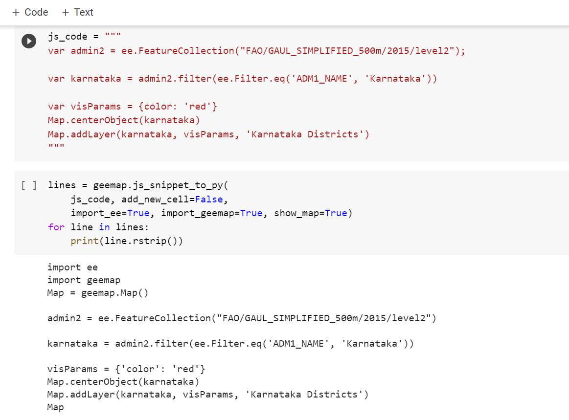
The Python script proposed in this study automatically performs routines that are normally costly and time-consuming, when performed by users on their workstations. For this specific work, given that the csv files made available by the real estate agency contain all properties advertised in Brazil in the period from six months to one year, it was agreed to work with the Brazilian States as study regions of interest.
Heat Map produced by Python ETL Script
Tools used
ArcMapPython
Plug-ins used
arcpyGDALIDWosgeo
tags
Heat MapIDWMapPython
More by Alexandre Dargains Auricchio de Oliveira
You might also like


Join the community!
We're a place where geospatial professionals showcase their works and discover opportunities.