
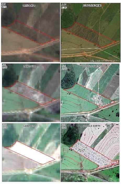
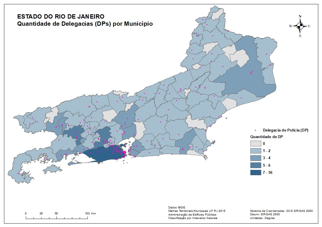
The Use of Remote Sensing in the Identification of Warehouses to Support Illicit Cross-Border Activities in Brazil
Image Intelligence for National Security
Tools used
ArcMap
tags
DefenseImageIntRemote SensingSecurity
More by Alexandre Dargains Auricchio de Oliveira
You might also like


Join the community!
We're a place where geospatial professionals showcase their works and discover opportunities.