
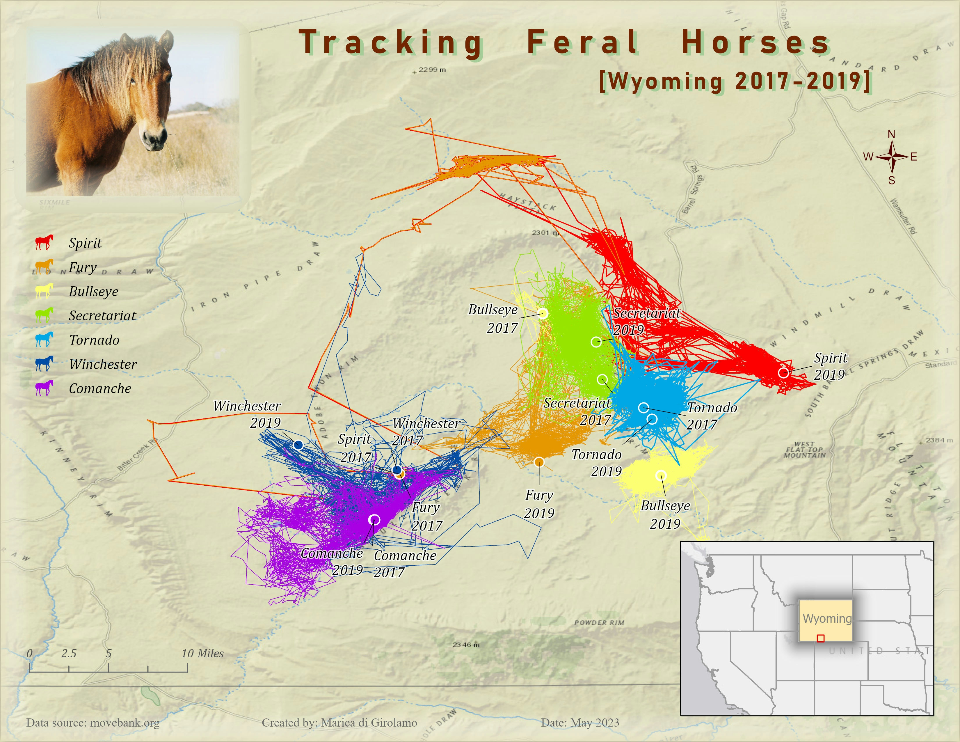
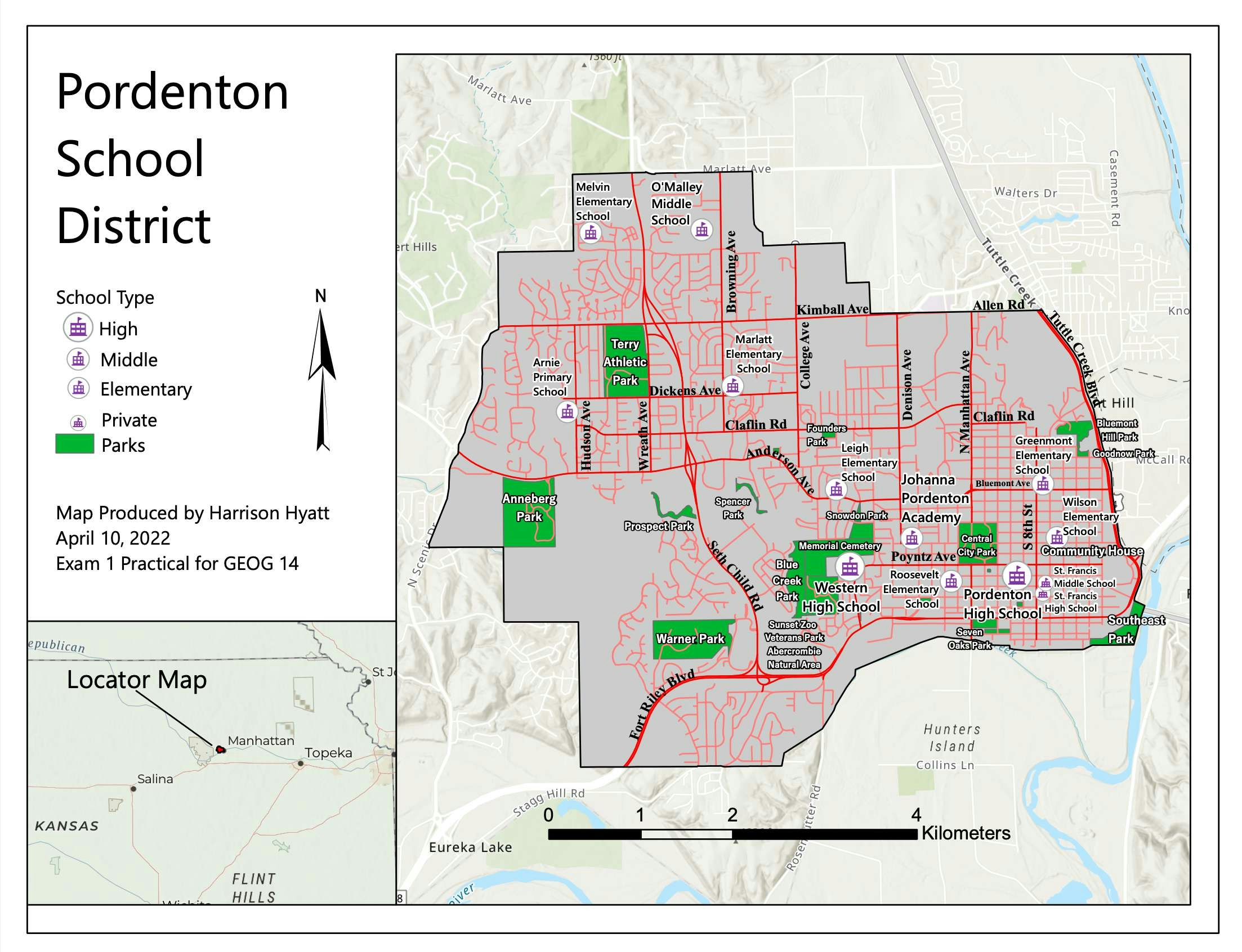
After downloading the dataset of feral horses roaming in Wyoming (and tracked with GPS technology between 2017 and 2019), I decided to work on a subset of only 7 horses.
In the original dataset the horses were identified by an ID number. However, following the reasoning on the book I'm reading, I decided to give them some proper names.
The first map I worked on answers the question: Who? and Where?
The map shows the first and last recorded locations for each horse, and their recorded tracks in between those events.
The sample is small, but it shows that some horses prefer to stay local while others seem to wander around more.
As a cartographer, my challenge was to effectively show where each horse has been during the recorded time.
[I tried to replicate the map shown in the book as closely as possible.]
Tracking Feral Horses
Tools used
labelingSymbology
Plug-ins used
ArcGIS Pro
tags
Wildlife
More by Marica di Girolamo
You might also like


.svg "Keran Nkongolo")


Join the community!
We're a place where geospatial professionals showcase their works and discover opportunities.