Sign up or log in to your Spatialnode account.

Takes less than a few seconds.

City of Redding

Harrison Hyatt
Harrison Hyatt•

May 17, 2022

City of Redding

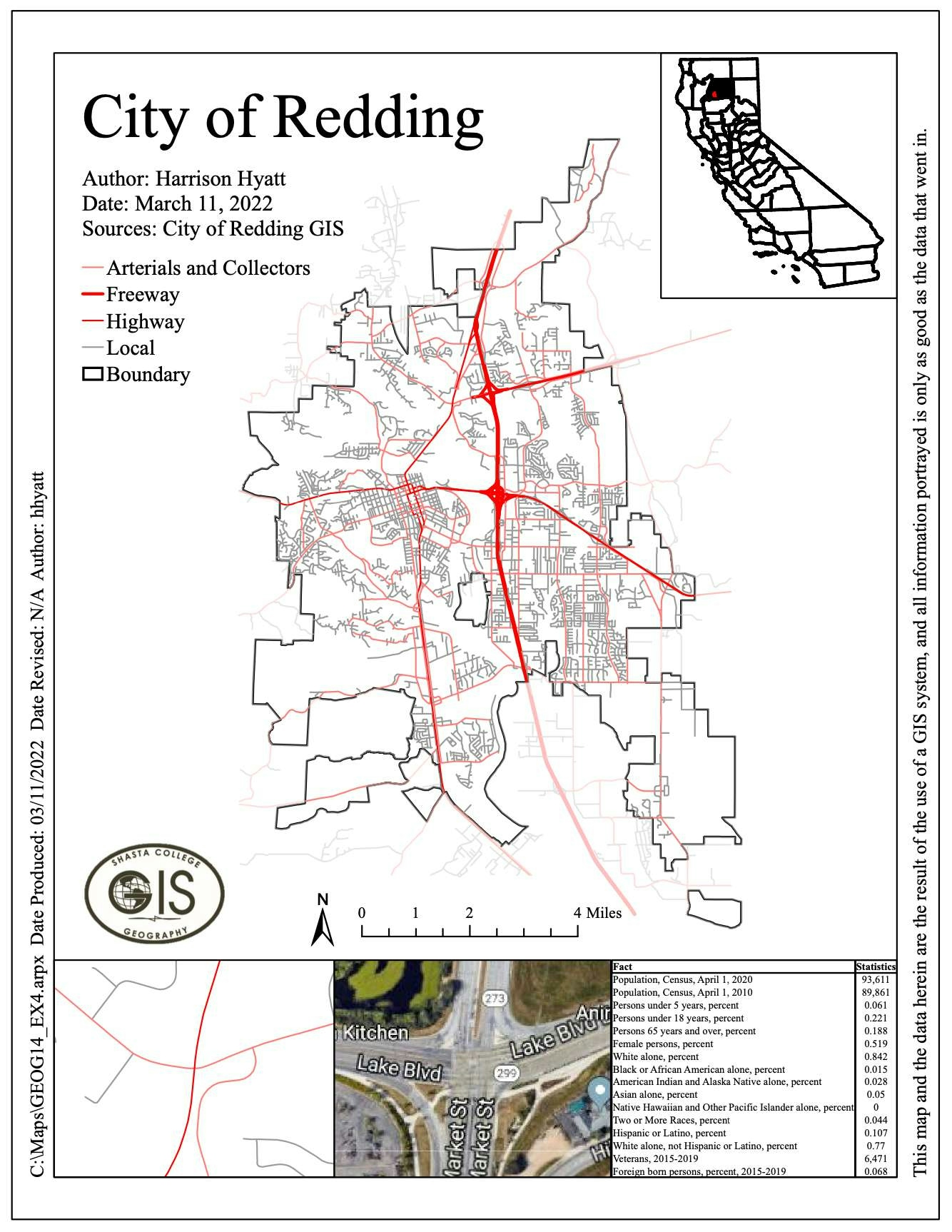
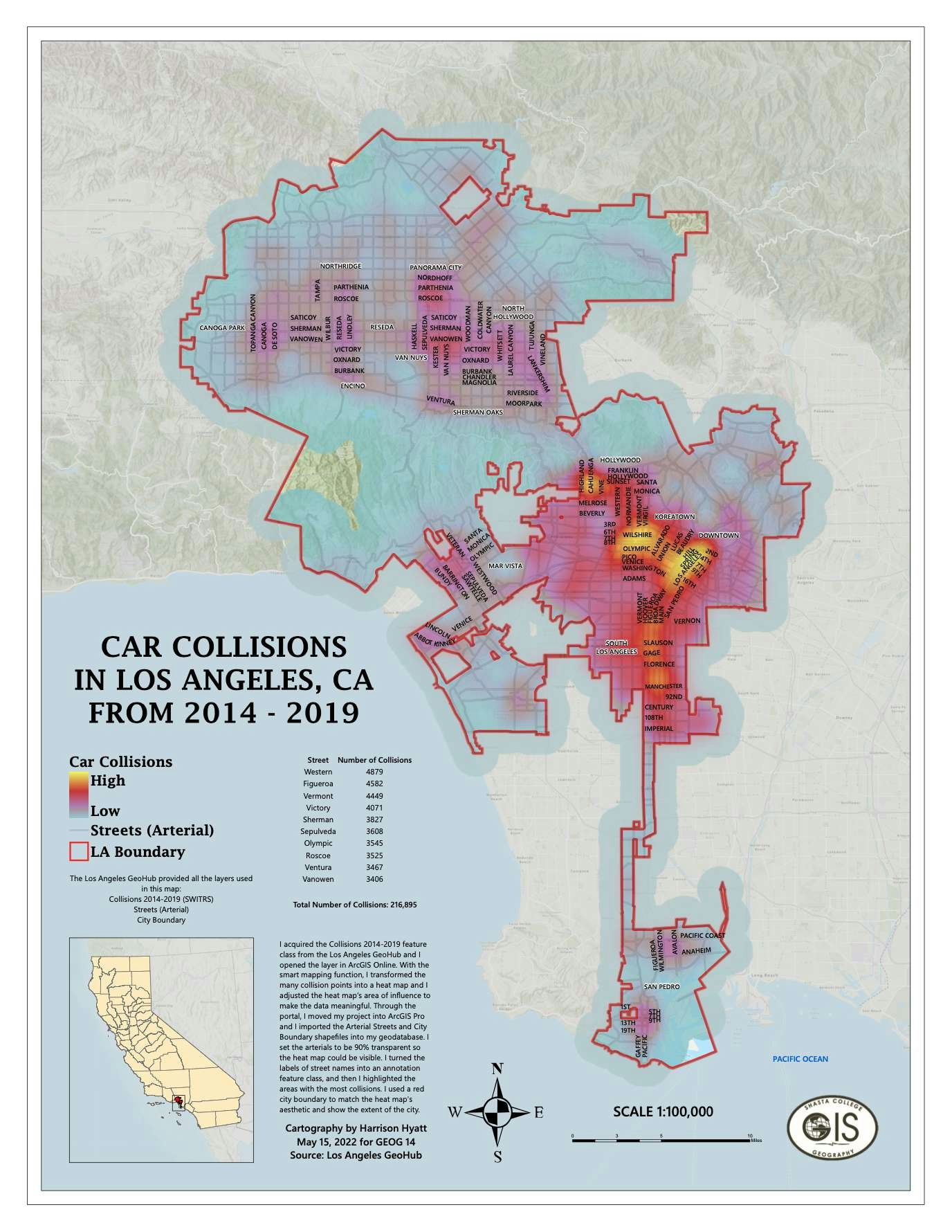
This map displays the different roads of Redding, CA, complete with an inset map and other graphic elements.


Tools used

ArcGIS Pro

tags

redding

More by Harrison Hyatt

Boundaries of Waters of the US
22
Saving Kauai's Seabirds
16
Car Collisions in Los Angeles 2014-2019
79
A Visitor's Guide to Miracle Mile, LA
23
Pordenton School District
36
New York City Open Data
80

You might also like

Deforestation rate out of CAR overlap
Rayane Pacheco
Deforestation rate out of CAR overlap
Rayane Pacheco
58
Central and Northern Italy
Jennifer Cresap
Central and Northern Italy
Jennifer Cresap
25
Map a Month: July
Cari Lynn Squibb
Map a Month: July
Cari Lynn Squibb
9
How to use the MarkerCluster plugin in LeafletJS
Joseph Thuha
How to use the MarkerCluster plugin in LeafletJS
Joseph Thuha
325
Black Brook CHM
Michael Burnett
Black Brook CHM
Michael Burnett
11
Mapa de localização
Vanessa Cristiane Santos
Mapa de localização
Vanessa Cristiane Santos
6
Marsa Matrouh
Ahmed Ashraf
Marsa Matrouh
Ahmed Ashraf
51
Map of the Niger-Delta area of Nigeria
Paul Ugbong
Map of the Niger-Delta area of Nigeria
Paul Ugbong
145
Mapa de Localização de Manicoré-AM
Luan Vinicius Mar Cavalcante
Mapa de Localização de Manicoré-AM
Luan Vinicius...
317
Área de Estudo
Sidney dos Santos
Área de Estudo
Sidney dos Santos
28
Air Pollution and Population Trends
erica chaif
Air Pollution and Population Trends
erica chaif
9
Mapa de Fitofisionomia Fazenda Fartura
RODRIGO DE ARAUJO BELOTE
Mapa de Fitofisionomia Fazenda Fartura
RODRIGO DE...
18

Join the community!

We're a place where geospatial professionals showcase their works and discover opportunities.

Sign Up for free