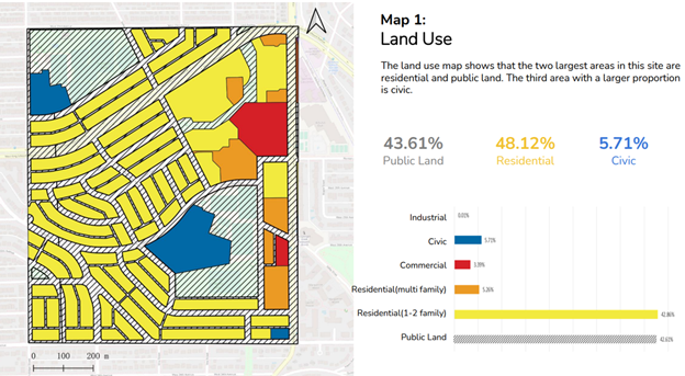
Sorted Metro Vancouver land use data into Public, residential, civic, commercial, industrial, and mixed-use. Symbolized categories according to industry standards. Edited and corrected missing data. Calculated each category area relative to the selected 100 Ha site (Land Use share).
Skills: Land Use/Land Cover Analysis, Spatial data visualisation, SQL scripting, MS Excel