Sign up or log in to your Spatialnode account.

Takes less than a few seconds.

Connecticut Foreclosures, 2005 - 2017

Ryan O'Neil
Ryan O'Neil•

April 14, 2022

Connecticut Foreclosures, 2005 - 2017

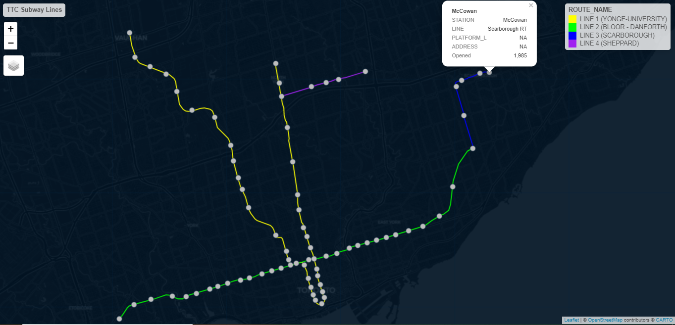
I geocoded all of the foreclosures in Connecticut from 2005 through 2017, which served as the basis for further analysis.


Tools used

ArcMapQGIS

tags

ArcMapQGIS

More by Ryan O'Neil

3D Greater Hartford, Connecticut, USA
159
Philadelphia Burglaries 1998-2009
25
Analysis of Foreclosures, Race, Income
17

You might also like

Spatial Distribution of Conductivity
Akor, Daniel Enechojo
Spatial Distribution of Conductivity
Akor, Daniel Enechojo
56
Estadios da copa do mundo 2022
Adriano jose de Barros
Estadios da copa do mundo 2022
Adriano jose...
7
PointCloud Web Platform
Efstathios Lymperis
PointCloud Web Platform
Efstathios Lymperis
68
Potencial de Mecanização
Ana Caroline Pereira da Silva
Potencial de Mecanização
Ana Caroline...
23
Land use
omoogun bankole
Land use
omoogun bankole
2
Localização de sítio arqueológico
Lucas Moreira
Localização de sítio arqueológico
Lucas Moreira
13
Pemba Ward wise population distributon
Hashimu Misanya
Pemba Ward wise population distributon
Hashimu Misanya
41
Interpolating Sulfer Dioxide Data
Emmet O Donnell
Interpolating Sulfer Dioxide Data
Emmet O Donnell
14
Tétouan Coastline
Hamza Bouarakia
Tétouan Coastline
Hamza Bouarakia
129
Oklahoma Drought & Wheat
Keran Nkongolo
Oklahoma Drought & Wheat
Keran NkongoloPro
15
Lagos in a Single Map
Adedoyin Ajeyomi
Lagos in a Single Map
Adedoyin Ajeyomi
446
NDVI Change detection 2000-2022
Comson Iyamisigh
NDVI Change detection 2000-2022
Comson Iyamisigh
35

Join the community!

We're a place where geospatial professionals showcase their works and discover opportunities.

Sign Up for free