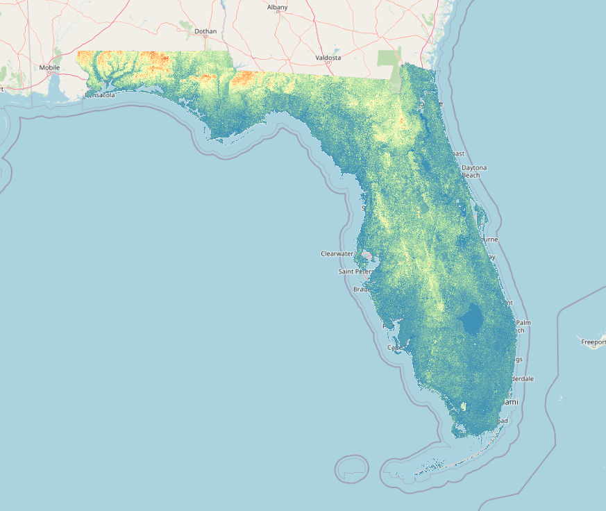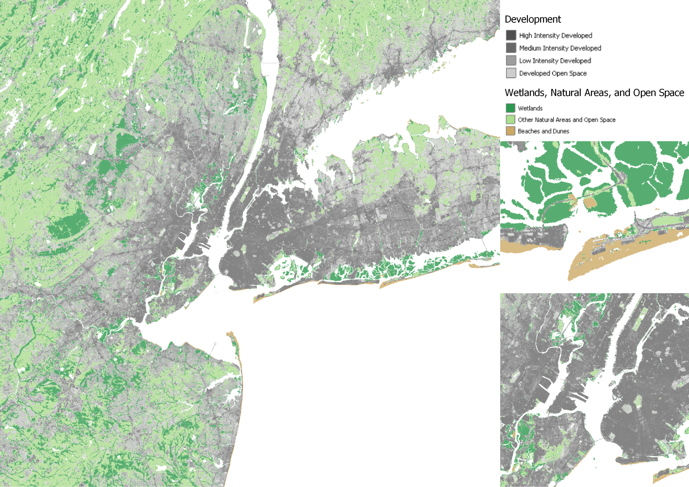
I quickly explored two different land cover classification layers from the Flood Exposure Mapper Service from NOAA. I connected to the service using QGIS and make a quick visualization of the layers in a few minutes using free and open source GIS technologies.
More visualizations and data links in my article on opensourcegisdata.com.