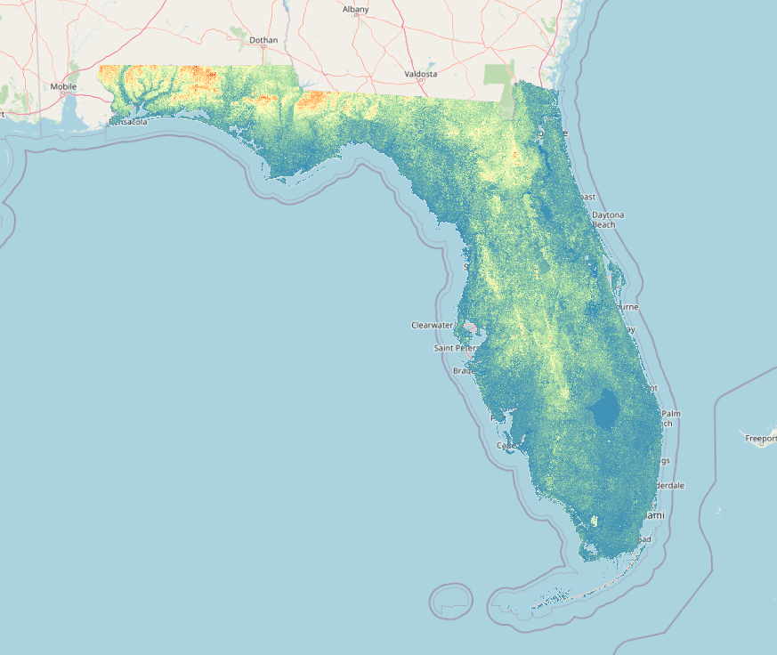
This dem was created using the ASTER Global Digital Elevation Model V003. The tiles were loaded into qgis where they were merged and clipped using the TIGER polygon for Florida. The final output you see above was then styled with a colorful gradient to see the terrain better.
If you are looking to find more gis data for the state of Florida then I would recommend a simple website I built that aggregates sources.