.svg "Keran Nkongolo")

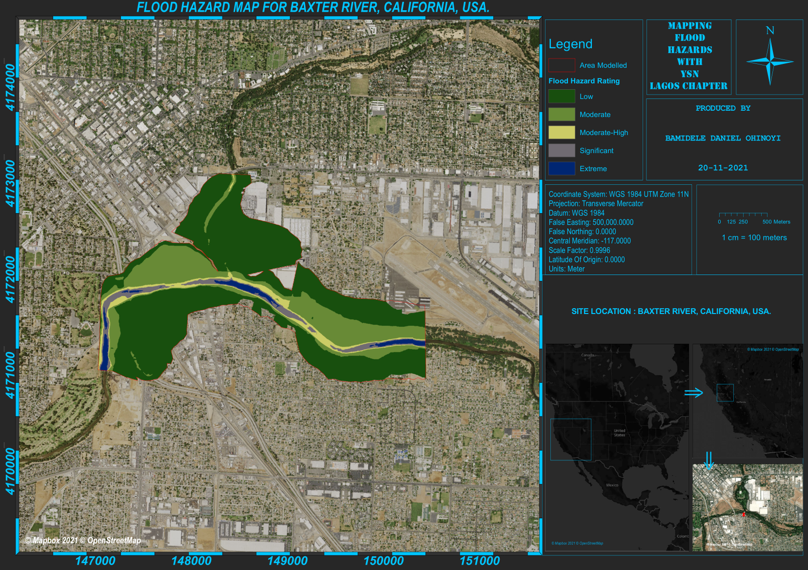
This map displays the relationship between the D2 and D3 drought intensity and wheat yield and production.
Oklahoma Drought & Wheat
Plug-ins used
ArcMap
tags
ArcMap
More by Keran Nkongolo


You might also like


Join the community!
We're a place where geospatial professionals showcase their works and discover opportunities.