.svg "Keran Nkongolo")
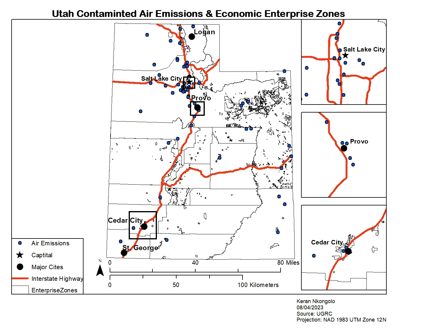
This project investigated the relationship between contaminated air emissions in Utah and Economic Enterprise Zones in the state. The data was retrieved from the Utah Geospatial Resource Center, and the results of this map reveal there seems to be a relationship between enterprise zones with the most populous cities in the state and contaminated air emissions.
Utah Air Emissions
Tools used
ArcMapSelect by atrbutes
Plug-ins used
ArcMap
tags
ArcMap
More by Keran Nkongolo


You might also like


Join the community!
We're a place where geospatial professionals showcase their works and discover opportunities.