
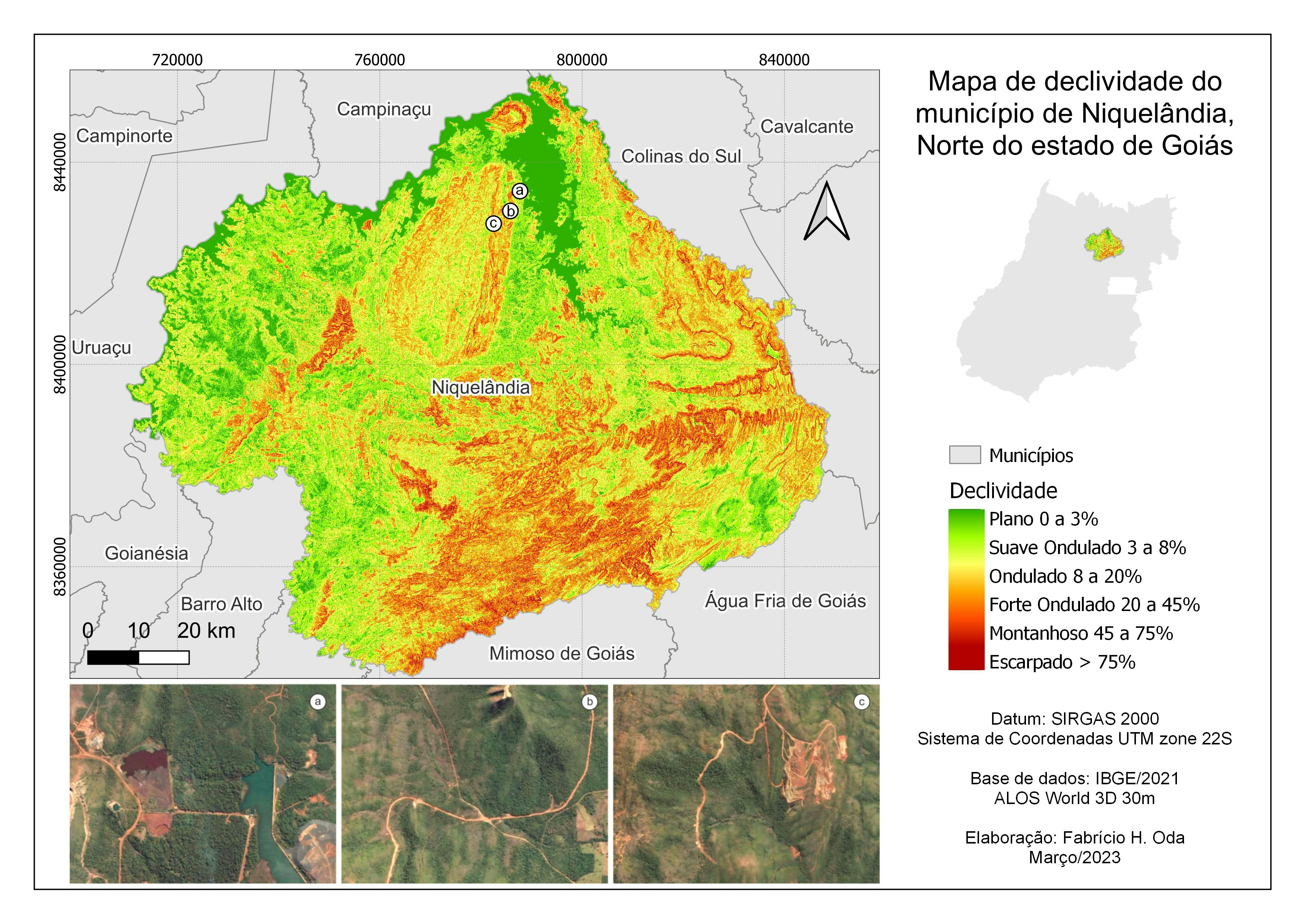
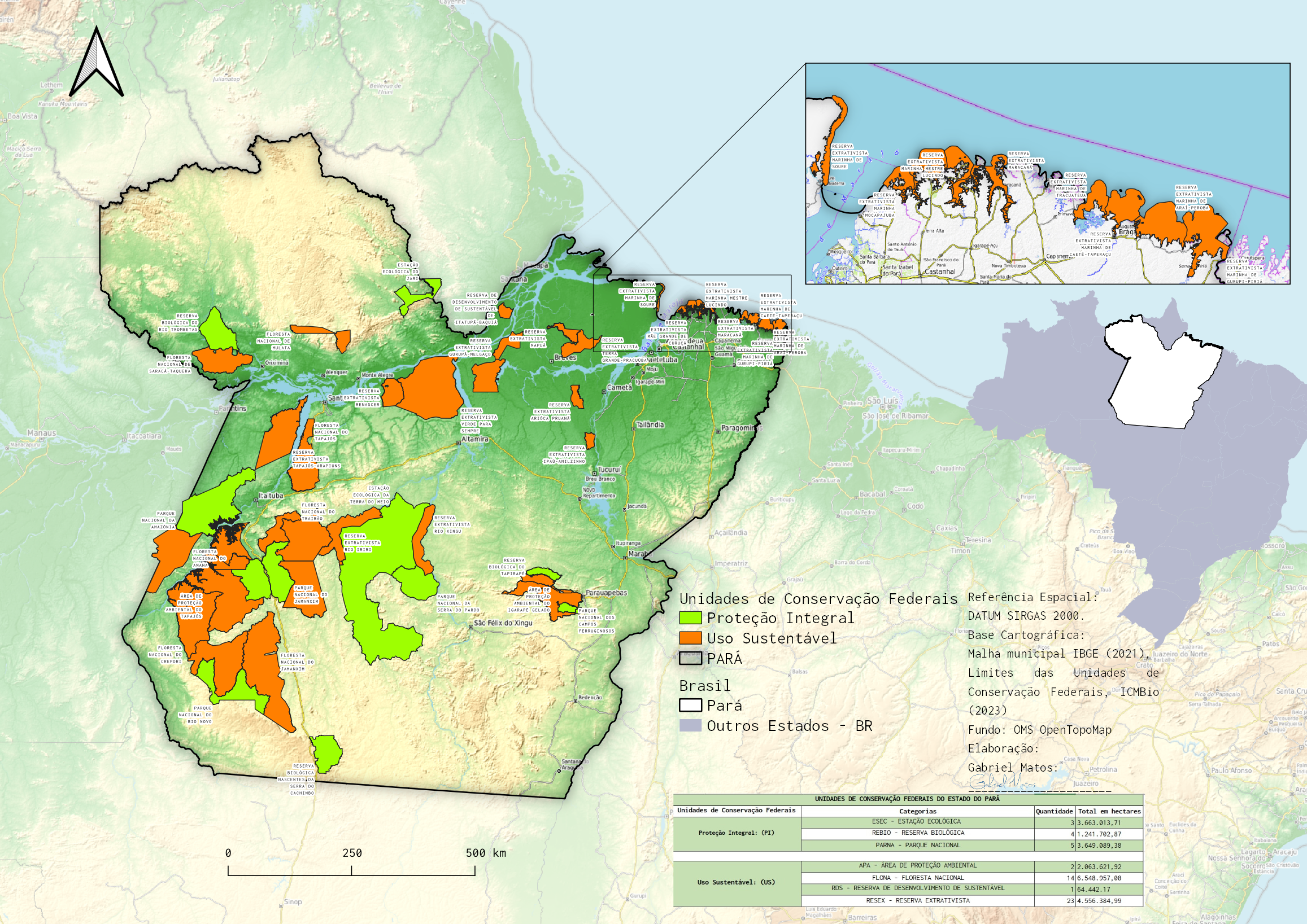
Slope map of te municipality of Niquelândia, Northern Goiás state, Central Brazil
Advanced map (analytical) - Slope
Tools used
QGIS
Plug-ins used
ALOS World 3D 30mIBGE Shapefile (Polygon) with municipal boundariesOpenTopographyDEMDownloader
tags
#analyticalmapbrasil#goias#niquelandia#slopemap
More by Fabrício H. Oda

You might also like


.svg "Alec Soltes")
Join the community!
We're a place where geospatial professionals showcase their works and discover opportunities.