
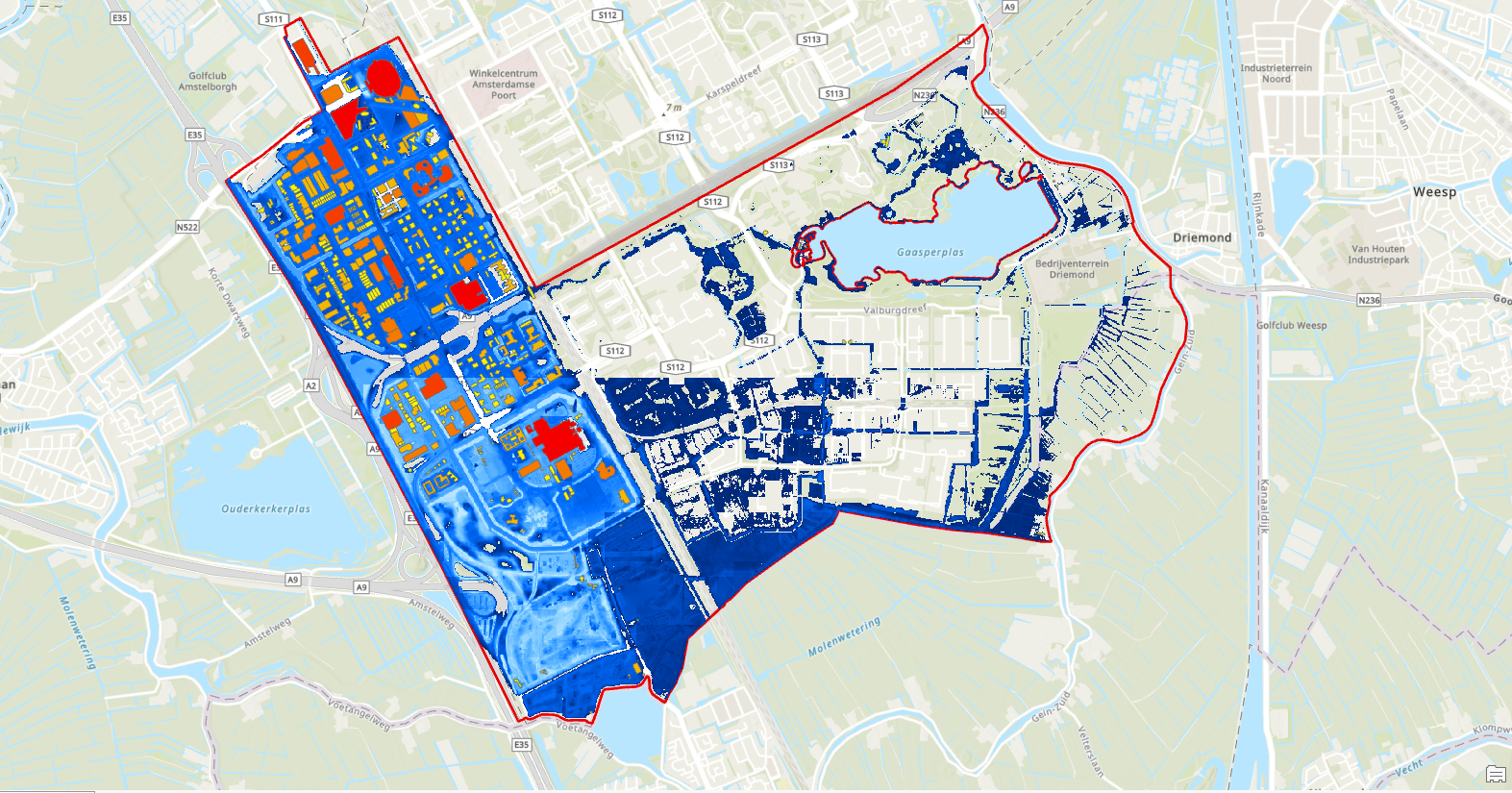
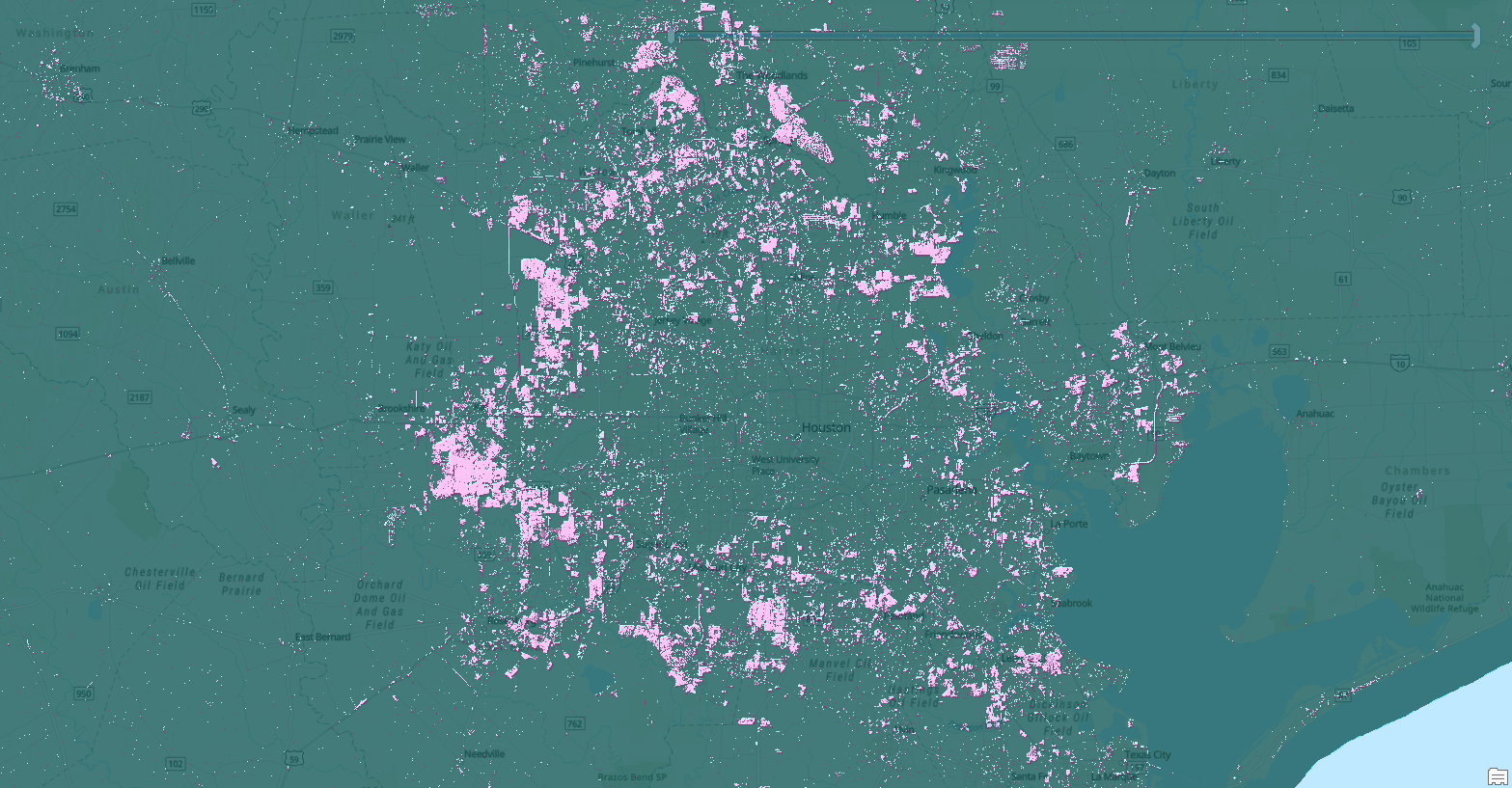
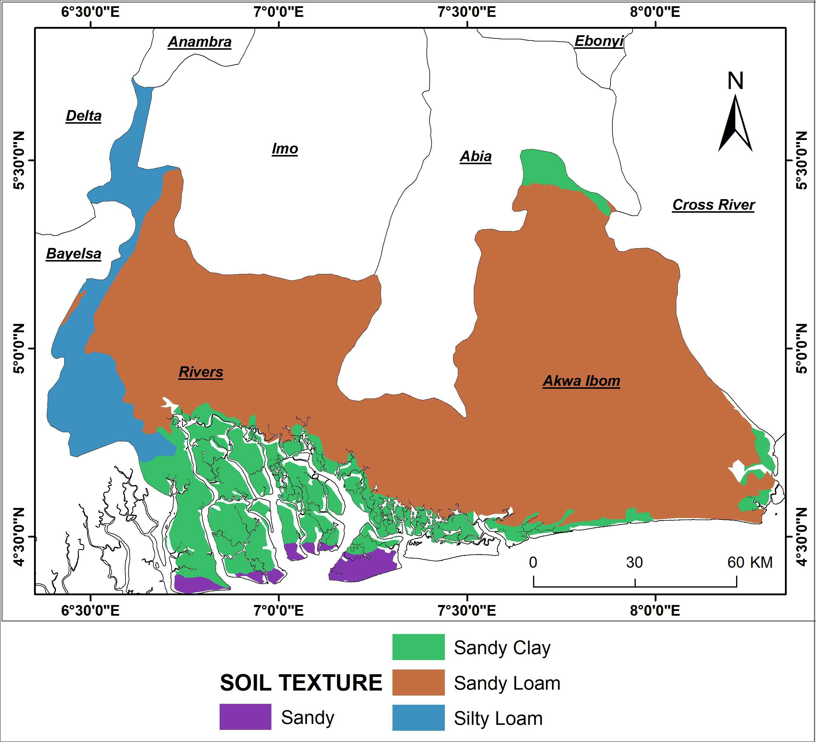
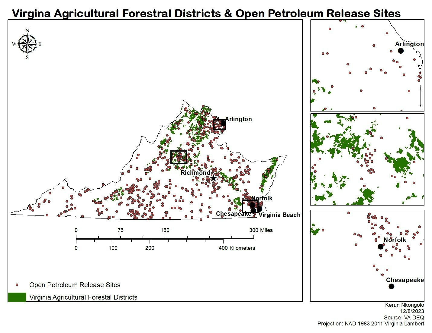
This project consisted of investigating how land subsidence can change the spatial and financial impacts of a flood. First, I used spatial analyst tools to preprocess the provided raster dataset. Then, I determined flood extents and estimated damage. Finally, I compared damages that would take place today and in 2050 based on projected land subsidence estimates.
This project was completed using the 'Model how land subsidence affects flooding' tutorial on Learn ArcGIS by authors Mathijs Andeweg and Tom Kuijpers.


.svg "Keran Nkongolo")


_2461995.png&w=48&q=40 "Carmem Lúcia Ribeiro da Costa Soares")