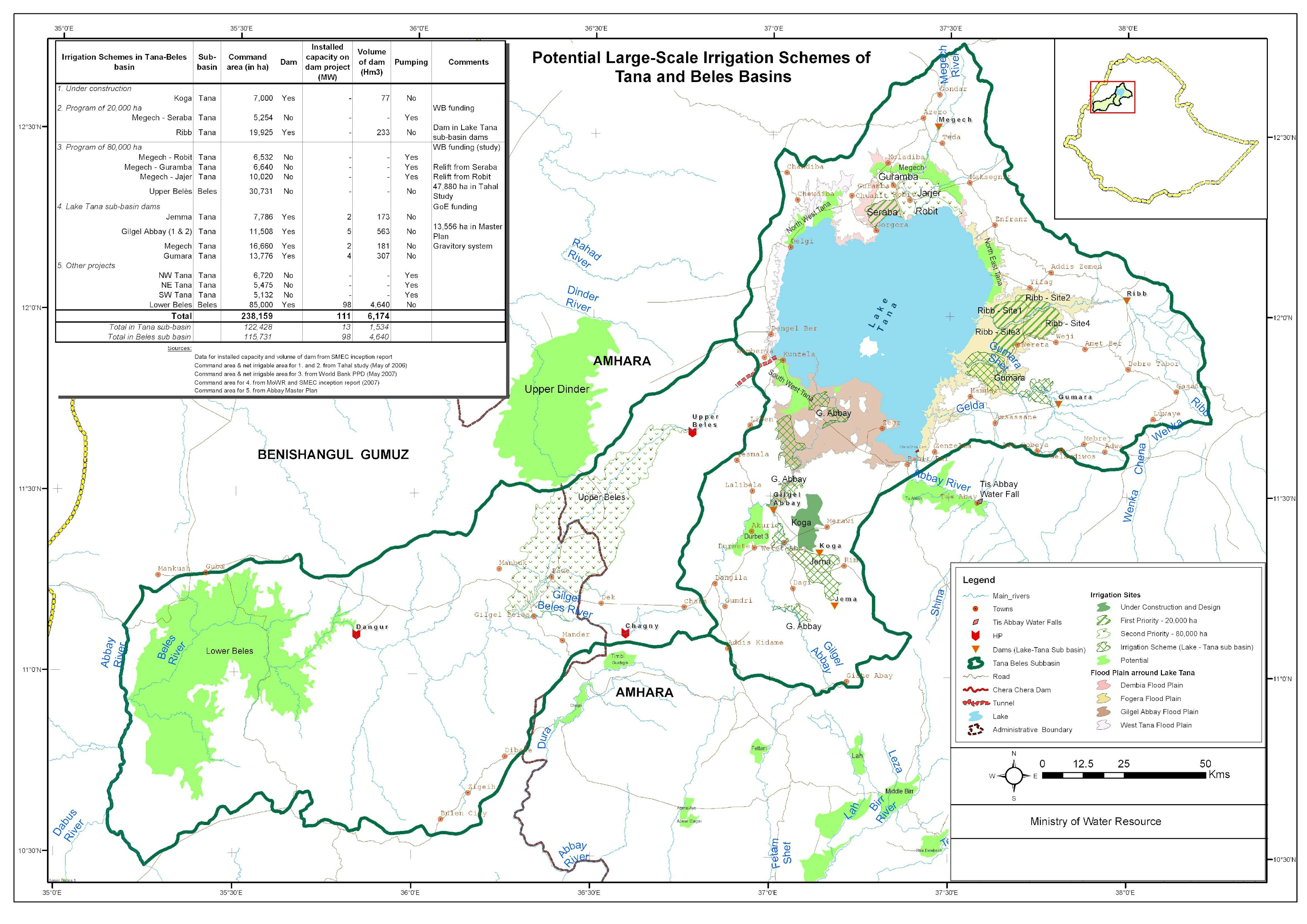
The primary objective of this study was to establish the current situation of vectors and trypanosomiasis in selected areas to facilitate the implementation of wider campaign activities.
The survey sites were selected based on the prior knowledge of the tsetse infested zone and recent reports collected from local Animal Health Officers in the regions. In order to conduct the survey systematically, 5km x 5km grid squares were prepared for both survey areas, Say and Gaya. Each grid was coded with site number and grid reference.
Images from Landsat 8 and MODIS were used to study seasonal vegetation distribution. Using QGIS, the survey team defined and marked estimated trap sites where the likelihood of the presence of tsetse flies can be high. The selection of the points on the satellite images considers the biotopes (Vegetation, river network system) and accessibility of the area. Finally selected points were converted to GIS point layers, uniquely named, and uploaded to GPS devices. Traps were deployed based on the estimated sites and collected after 48 hours.
The map above shows the survey result for a region called Say. I was involved as a GIS expert in the study and work closely with local and international Entomologists during the survey.