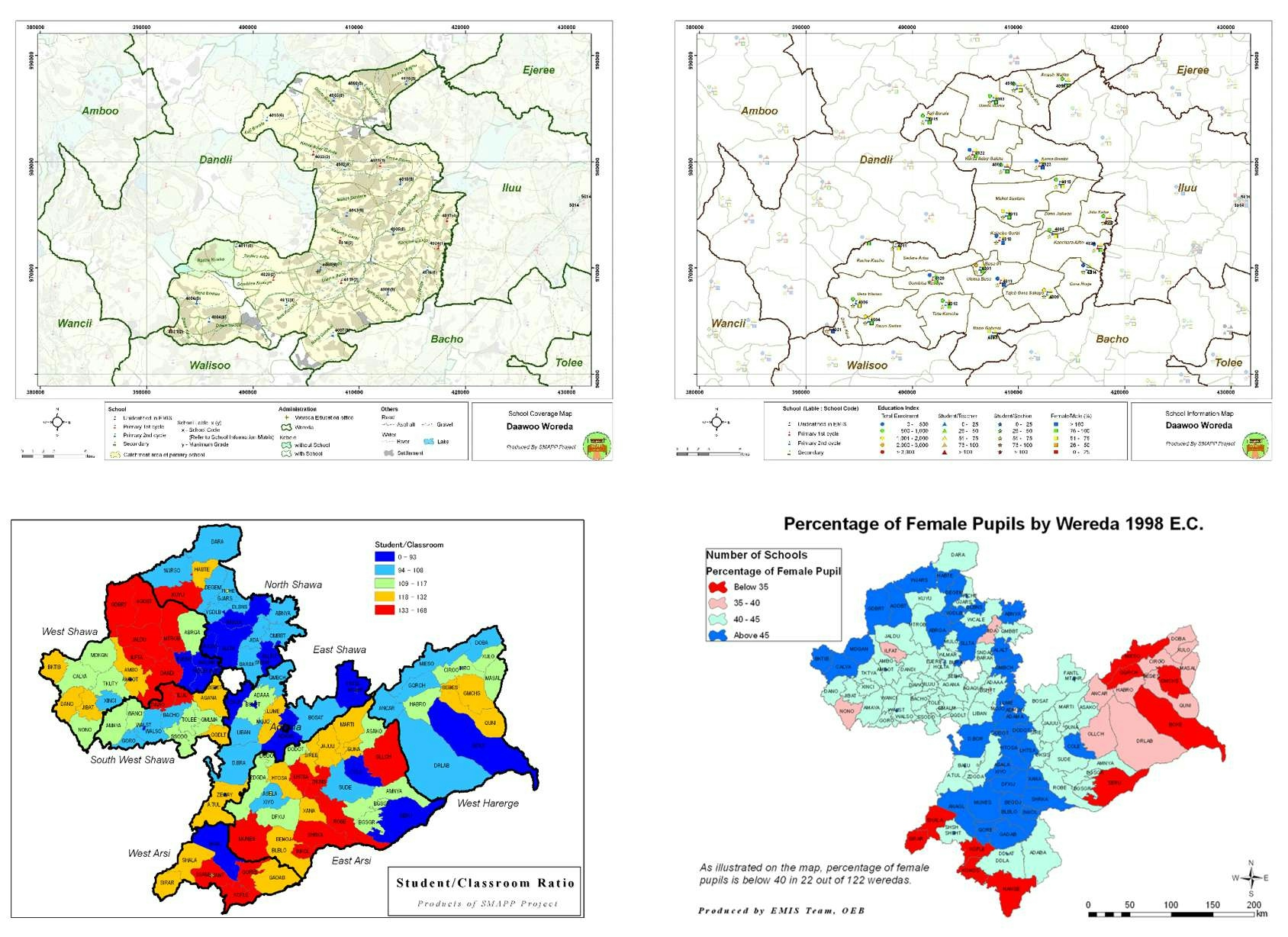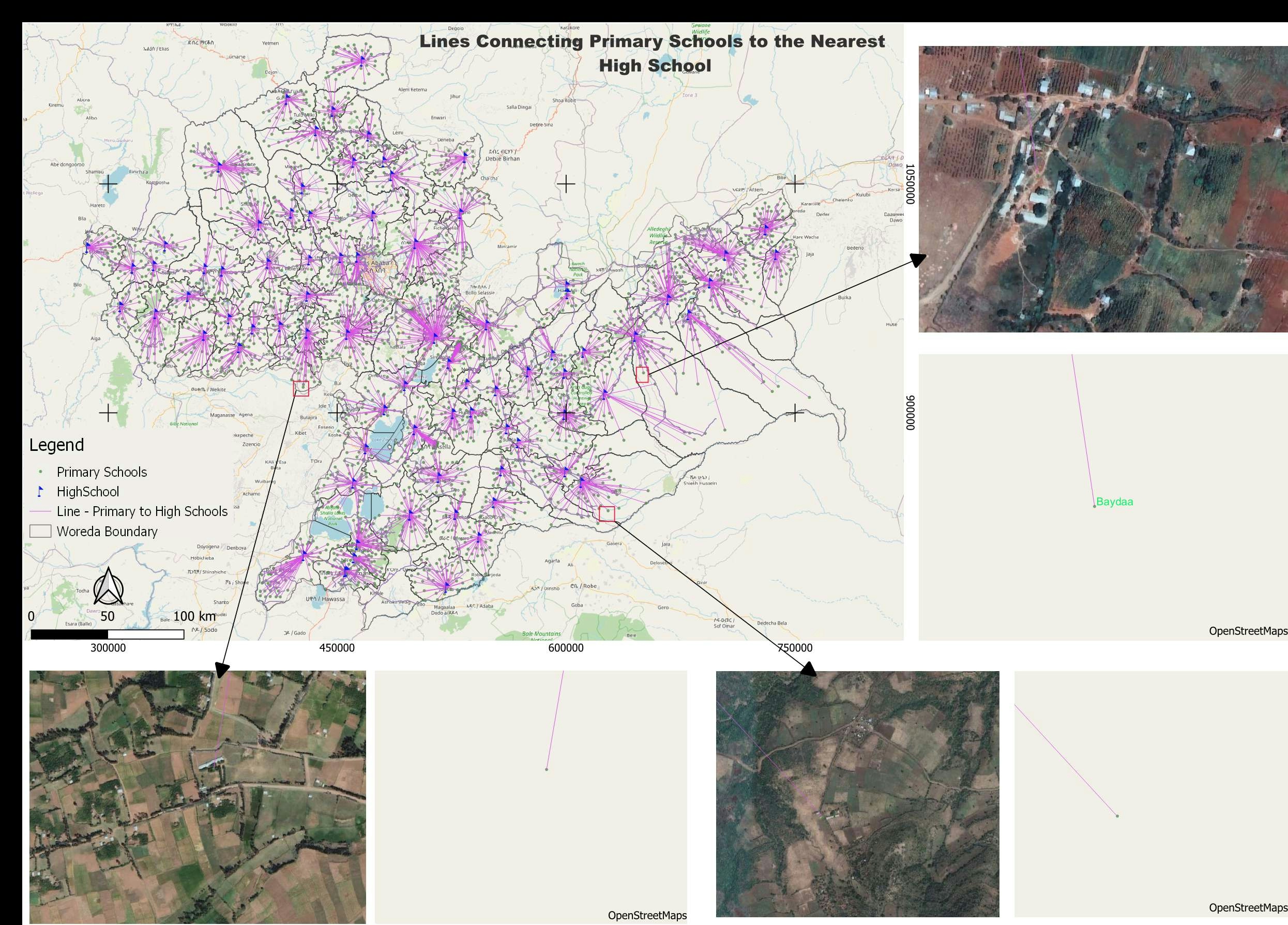
The map shows lines connecting primary schools to their nearest high schools. In the project, in most woredas (administrative units), when students finish their primary school, either they have to move to the nearest town or travel a long distance every day to continue to high school.
Although most parts of the project area are not far from the capital city, the OpenStreetMap coverage is very limited which indicates the need for OSM mapping intervention to capture infrastructure.