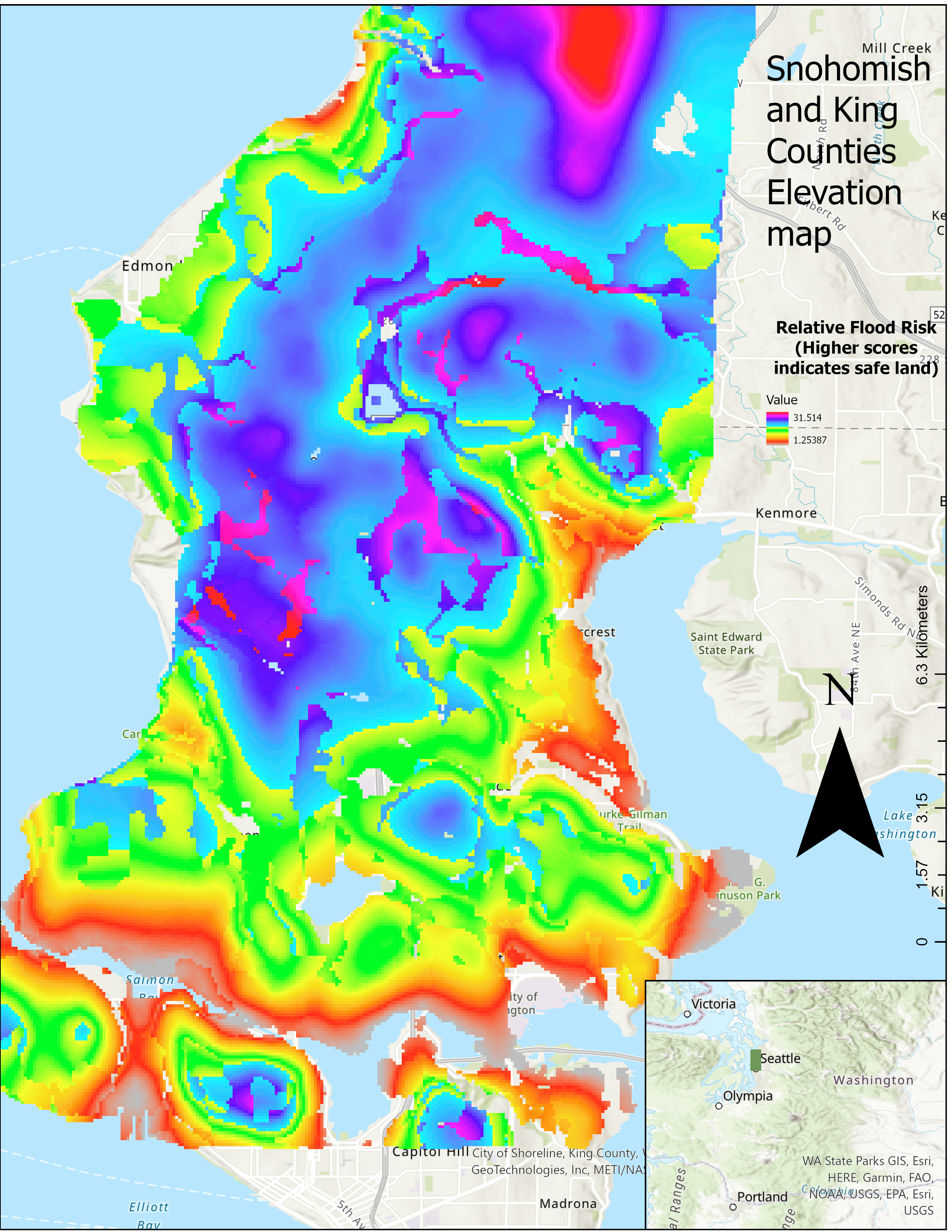
Description:
This is a map of the relative flood risk of various parts of west Snohomish and King County. I collected elevation data from Google Earth, and geologic data from the Washington information portal, and used the Kriging interpolation Spatial analysis tool, to compose the map above.
Skills:
ArcGis: Kriging, Rasters, Raster Calculator, Make feature Layer, Intersect, dissolve, Polygon to Raster, basic Map details (Title, Legend, compass, inset map)