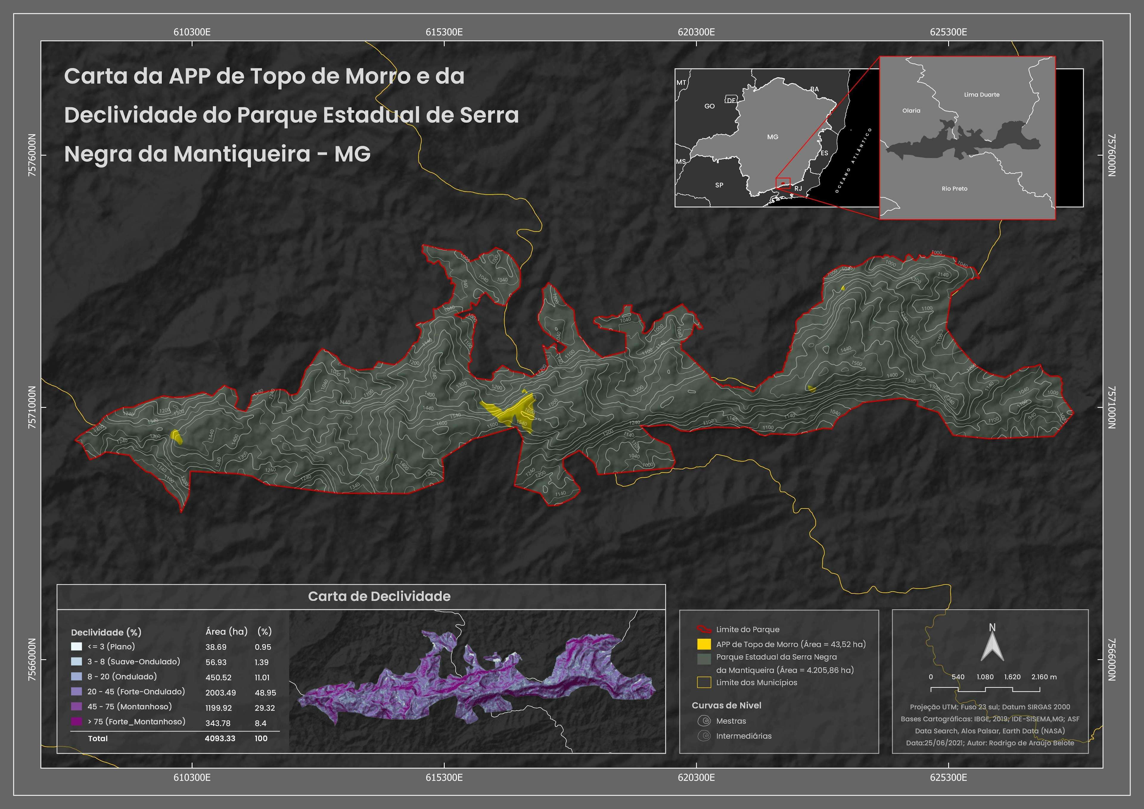
Description:
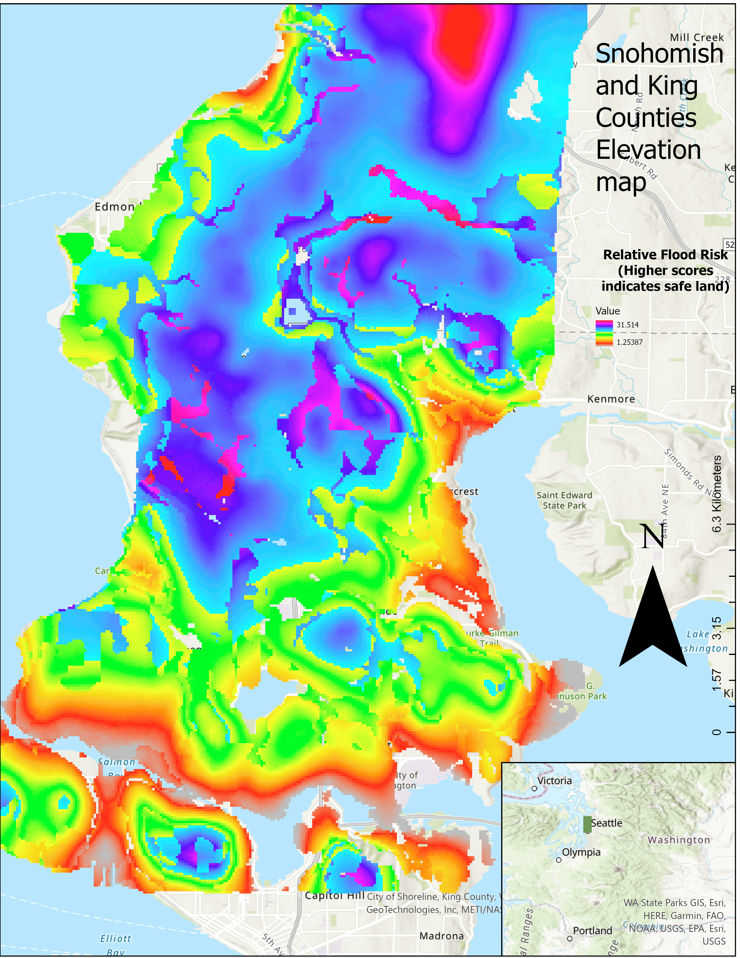
This is a map of the elevation of various parts of west Snohomish and King County. I collected elevation data from Google Earth and used the Kriging interpolation Spatial analysis tool to compose the map above.
Skills:
Google Earth: Created a path to create a KML file, Convert to GPX
ArcGis: GPX to Features, Contours, Kriging, basic Map details (Title, Legend, compass, inset map)


.jpg&w=3840&q=100)