
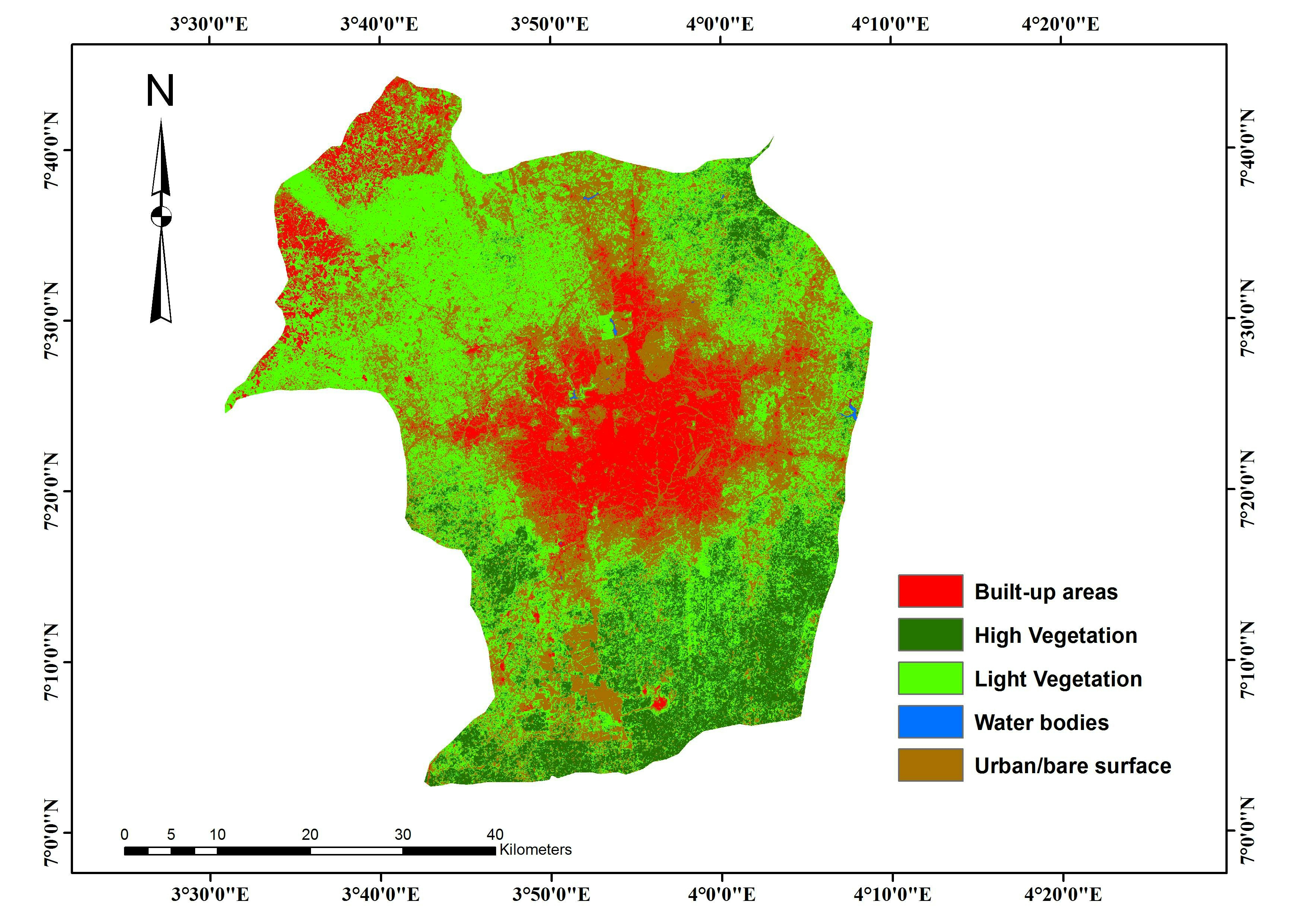
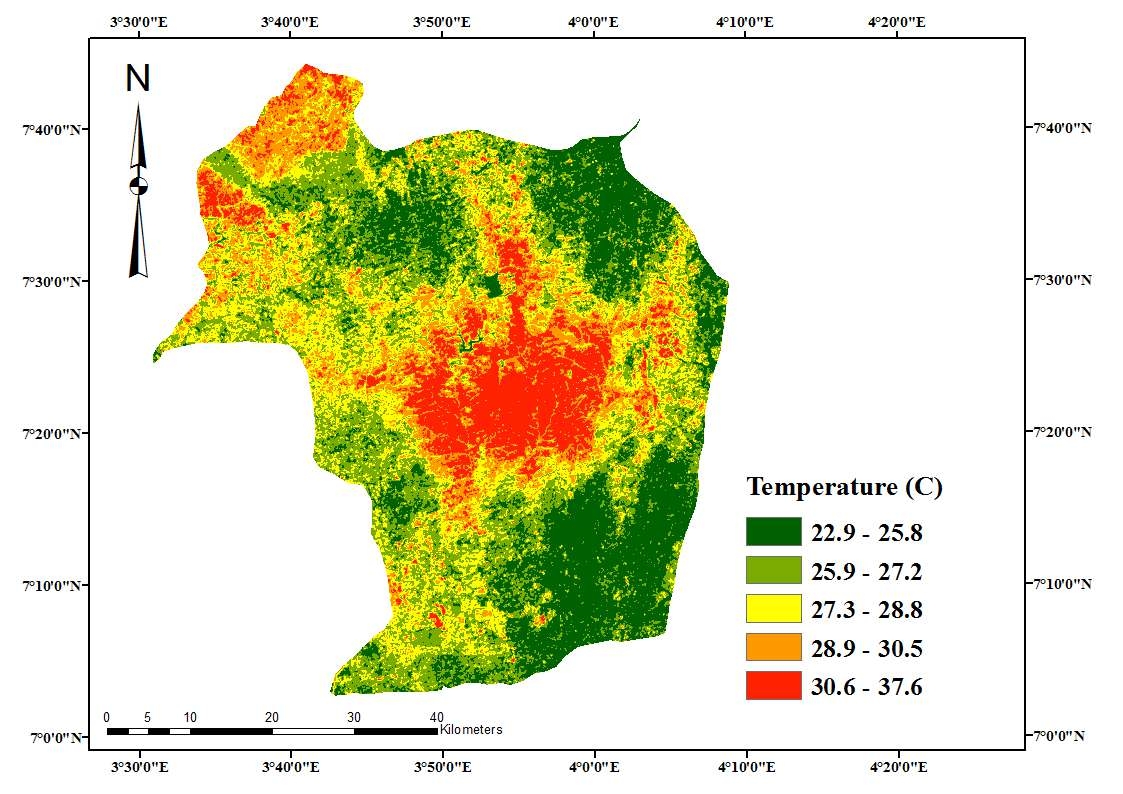
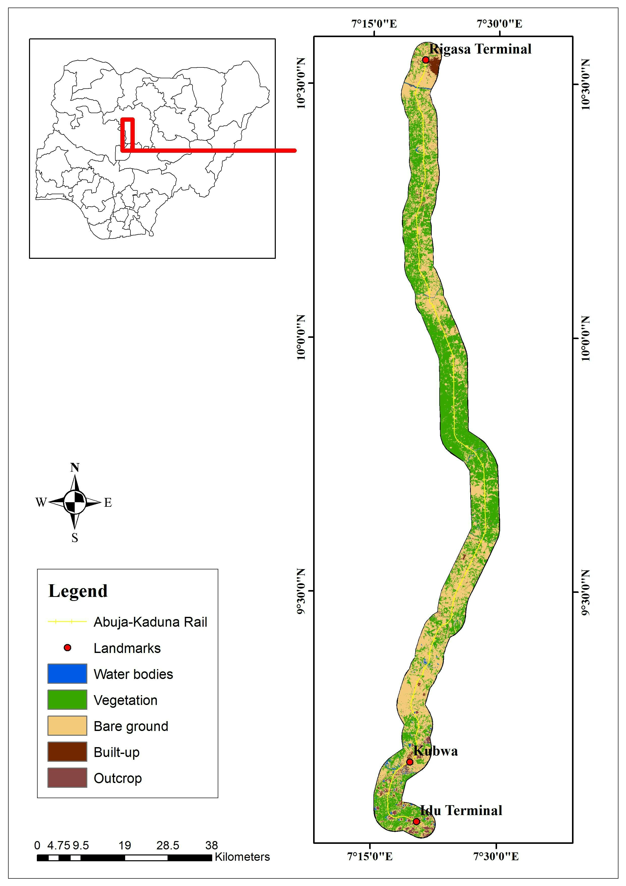
An analysis of land use land cover extent and changes over Ibadan region. The extent of each land-use type was quantified and compared across the region over a duration of ten (10) years. The result shows a continuously expanding city center with built-up areas and reducing vegetal cover.
Land Cover Change Analysis over Ibadan
Tools used
ArcMapRemote Sensing
Plug-ins used
ArcMapGeoserver
tags
land coverLandsatLULC
More by Lawrence Akpoterai
_7771518.jpg&w=3840&q=100)

You might also like


Join the community!
We're a place where geospatial professionals showcase their works and discover opportunities.