Sign up or log in to your Spatialnode account.

Takes less than a few seconds.

Road network analysis of Ibadan metro

Lawrence Akpoterai
Lawrence Akpoterai•

June 21, 2022

Road network analysis of Ibadan metro

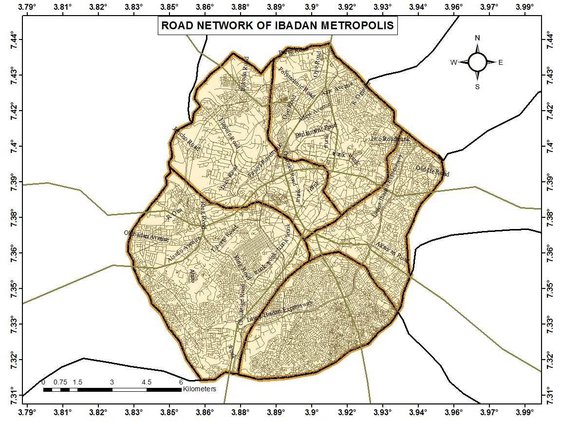
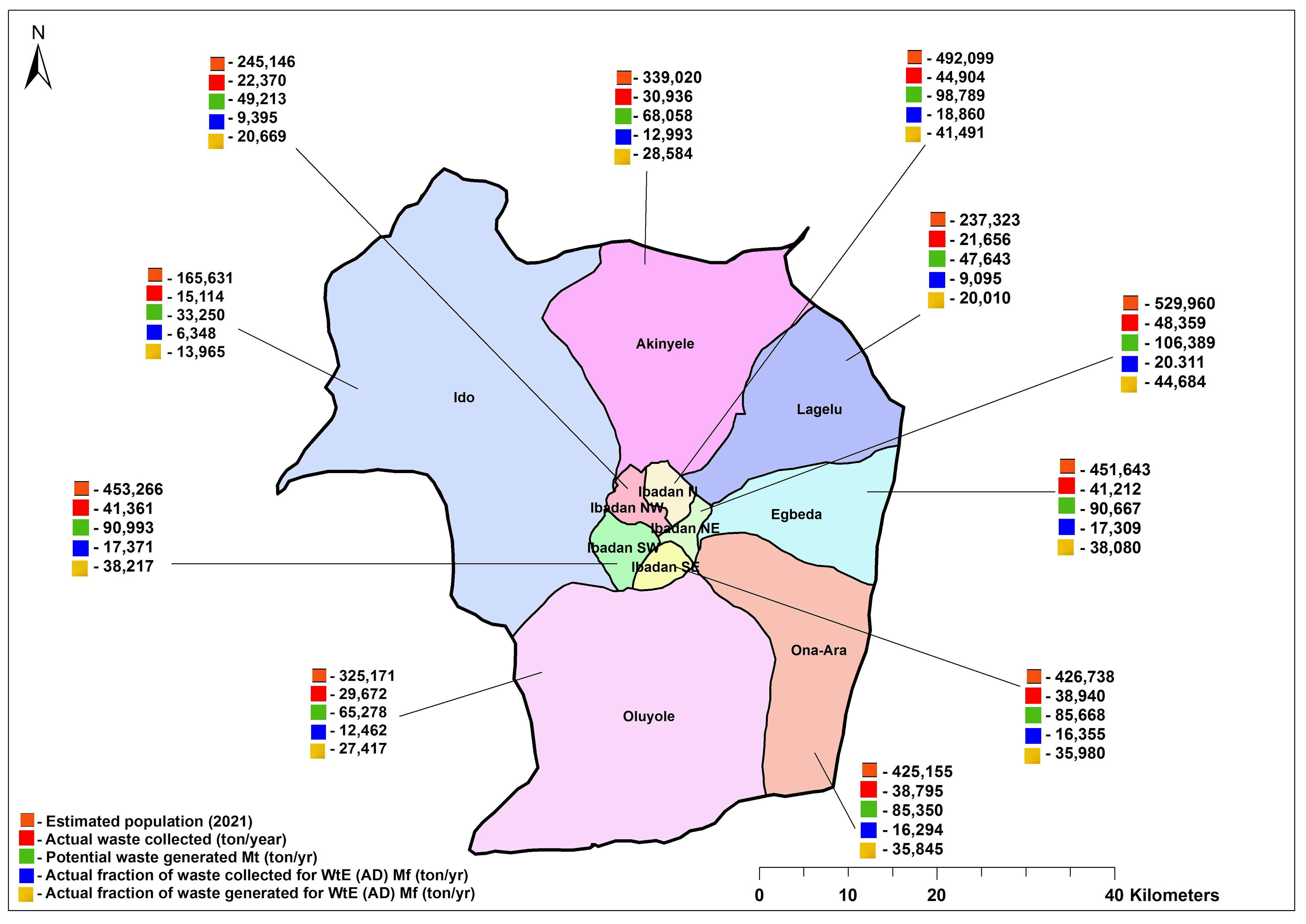
A network analysis of roads - major, minor, etc., across the Ibadan metropolis showing interconnectivity. This was used to determine the siting of undisclosed stations.


Tools used

ArcMap

Plug-ins used

ArcMap

tags

mapsnetwork

More by Lawrence Akpoterai

Malaria disease atlas for SW Nigeria
95
Analysis of LULC along ABJ-KAD Rail
82
CO2 Emissions across Africa, 2018
105
2020 Rainfall Dashboard, Nigeria
254
Land Cover Change Analysis over Ibadan
58
Data presentation on waste collection
28
Land Surface Temperature Analysis
127
Spatial visualization of applicants ??
13
COVID-19 morbidity cases in Nigeria
82

You might also like

Image Classification of Habitat Elements
Ali Mulla
Image Classification of Habitat Elements
Ali Mulla
22
Unioncorn Companies Analytics
Adedoyin Ajeyomi
Unioncorn Companies Analytics
Adedoyin Ajeyomi
75
Food & Pharmacy Flood Risk Mapper
Simone Chapman
Food & Pharmacy Flood Risk Mapper
Simone Chapman
317
Foz do rio Piranhas-Açu
Jardel Estevam Barbosa dos Santos
Foz do rio Piranhas-Açu
Jardel Estevam...
22
PATHIX - A GUIDE MAP
Ogungbemi Ezekiel Tobiloba
PATHIX - A GUIDE MAP
Ogungbemi Ezekiel Tobiloba
237
Hexagonal Digital Elevation Model
Adam O Dolce
Hexagonal Digital Elevation Model
Adam O Dolce
83
Mapa de localização
ana karla rodrigues lobato
Mapa de localização
ana karla...
5
Epidermic outbreak Mapping
Onyeakagbuna Amos
Epidermic outbreak Mapping
Onyeakagbuna Amos
5
GDAL: JPEGs Image Preview and Tile Index
Paola Prieto Botero
GDAL: JPEGs Image Preview and Tile Index
Paola Prieto Botero
35
Building Detection with Machine Learning
Kaio Serrano Galvão
Building Detection with Machine Learning
Kaio Serrano Galvão
28
Mapa coroplético
Jardel Estevam Barbosa dos Santos
Mapa coroplético
Jardel Estevam...
114
Telecommunication Data Processing
Sayed Farag
Telecommunication Data Processing
Sayed Farag
391

Join the community!

We're a place where geospatial professionals showcase their works and discover opportunities.

Sign Up for free