
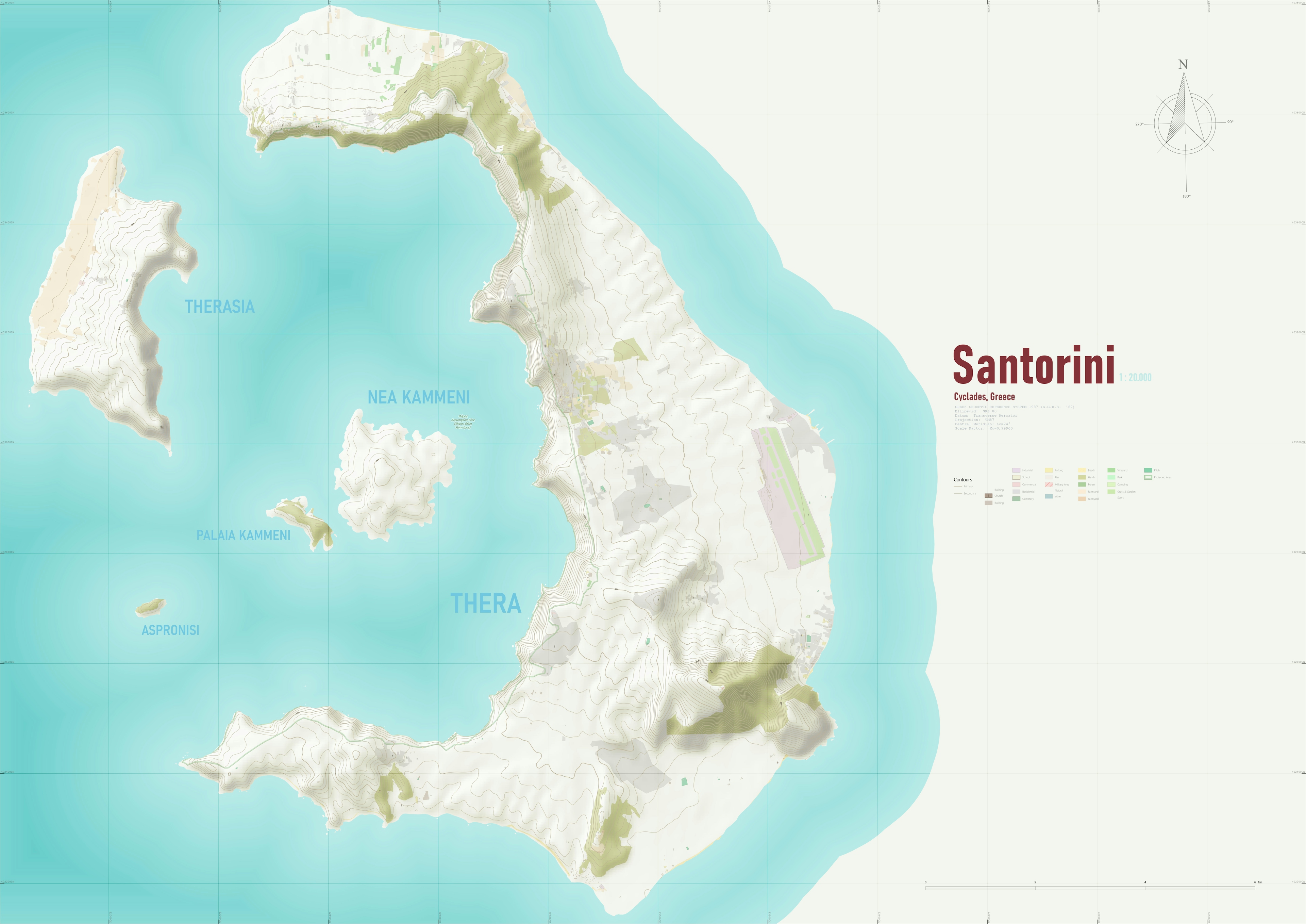
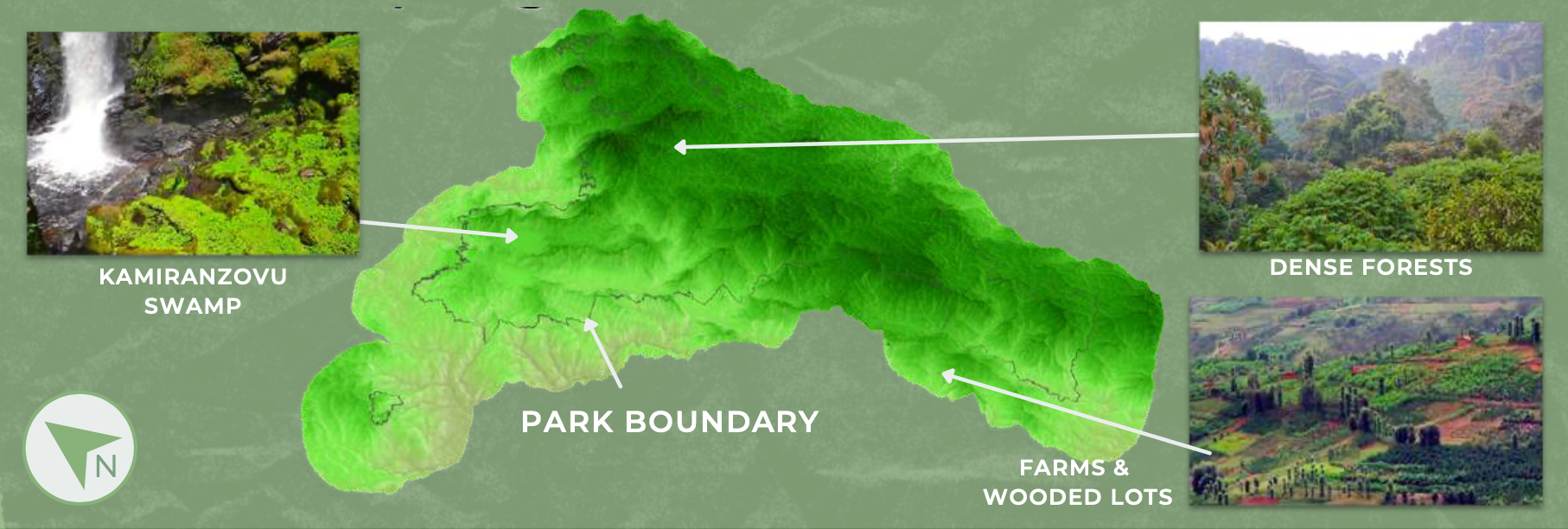
I came up with this little map while evaluating the OSM Downloader along with smooth DEM basemaps from SRTM data
Santorini Island
Tools used
QGIS
Plug-ins used
OpenTopographyDEMDownloaderOSMDownloader
tags
DEMOpenStreetMapSantorini
More by Efstathios Lymperis

You might also like


Join the community!
We're a place where geospatial professionals showcase their works and discover opportunities.