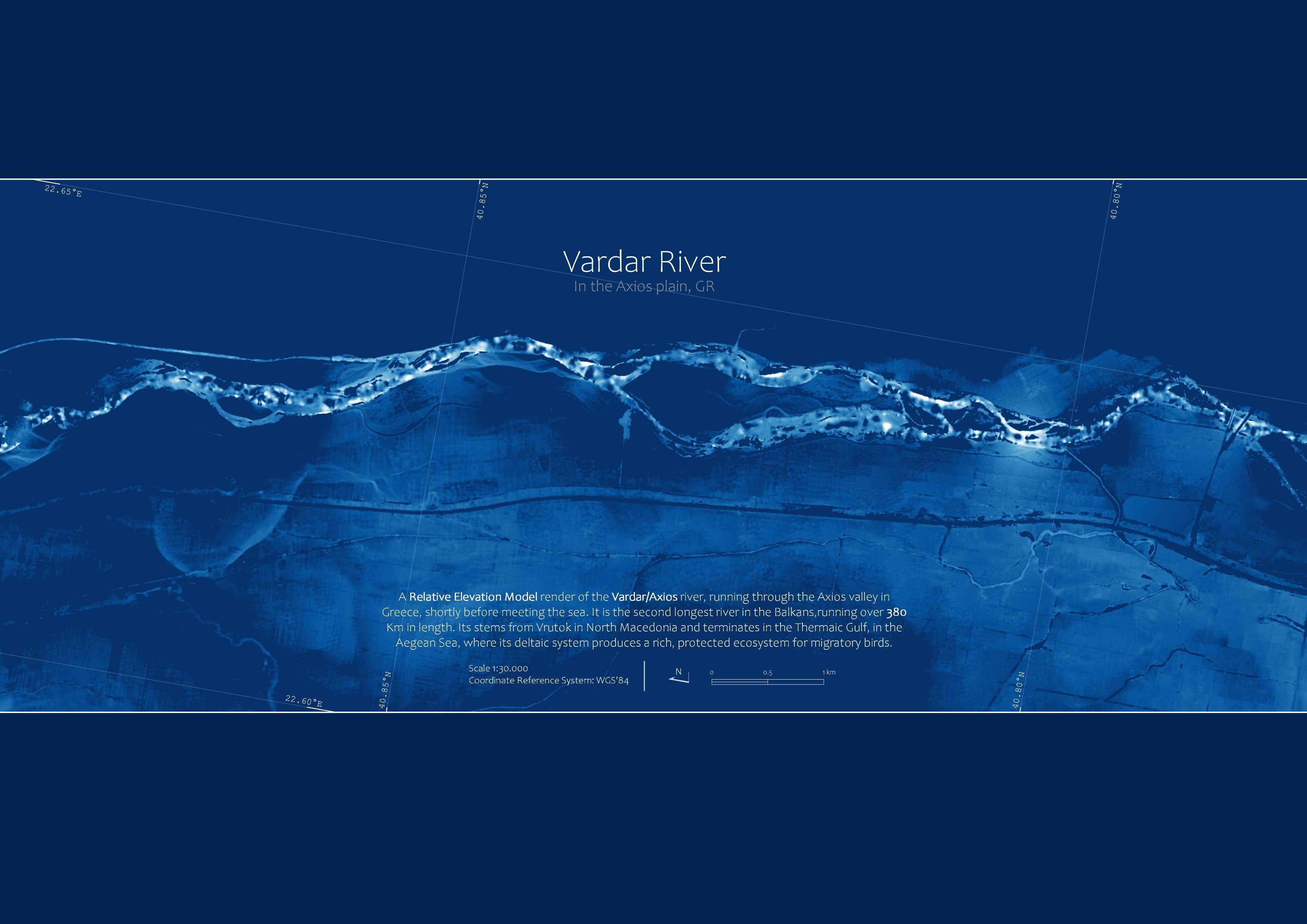
Anyone who's been in the mapping community for a while has probably come across Relative Elevation Models, probably one of the best looking earth data visualisation techniques ever (if not THE)
I just followed Dan Coe's method for producing REMs via the Inverse Distance Weighting interpolation method and had a first try (you should too!).
You can find the tutorial here
I am determined to get better at this...Well, enjoy


_645201.jpg&w=48&q=40 "Eguagie-suyi Precious")